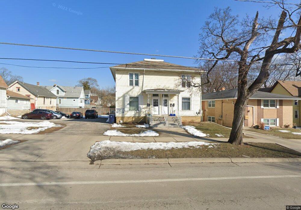
411 Raymond St Unit 13 Elgin, IL 60120
Elgin National Watch Historic District NeighborhoodEstimated Value: $308,000 - $461,000
--
Bed
--
Bath
2,926
Sq Ft
$132/Sq Ft
Est. Value
About This Home
This home is located at 411 Raymond St Unit 13, Elgin, IL 60120 and is currently estimated at $385,752, approximately $131 per square foot. 411 Raymond St Unit 13 is a home located in Kane County with nearby schools including Garfield Elementary School, Kenyon Woods Middle School, and South Elgin High School.
Ownership History
Date
Name
Owned For
Owner Type
Purchase Details
Closed on
Oct 24, 1997
Sold by
Idstein Bernard J and Idstein Judith Ann
Bought by
Luna Jose Luis and Luna Hilda
Current Estimated Value
Home Financials for this Owner
Home Financials are based on the most recent Mortgage that was taken out on this home.
Original Mortgage
$50,000
Interest Rate
7.65%
Create a Home Valuation Report for This Property
The Home Valuation Report is an in-depth analysis detailing your home's value as well as a comparison with similar homes in the area
Home Values in the Area
Average Home Value in this Area
Purchase History
| Date | Buyer | Sale Price | Title Company |
|---|---|---|---|
| Luna Jose Luis | -- | Chicago Title |
Source: Public Records
Mortgage History
| Date | Status | Borrower | Loan Amount |
|---|---|---|---|
| Closed | Luna Jose Luis | $50,000 |
Source: Public Records
Tax History Compared to Growth
Tax History
| Year | Tax Paid | Tax Assessment Tax Assessment Total Assessment is a certain percentage of the fair market value that is determined by local assessors to be the total taxable value of land and additions on the property. | Land | Improvement |
|---|---|---|---|---|
| 2024 | $8,653 | $108,127 | $15,001 | $93,126 |
| 2023 | $8,327 | $97,684 | $13,552 | $84,132 |
| 2022 | $7,119 | $82,097 | $12,357 | $69,740 |
| 2021 | $6,848 | $76,755 | $11,553 | $65,202 |
| 2020 | $6,683 | $73,274 | $11,029 | $62,245 |
| 2019 | $6,519 | $69,798 | $10,506 | $59,292 |
| 2018 | $6,501 | $65,754 | $9,897 | $55,857 |
| 2017 | $6,394 | $62,161 | $9,356 | $52,805 |
| 2016 | $6,150 | $57,669 | $8,680 | $48,989 |
| 2015 | -- | $52,859 | $7,956 | $44,903 |
| 2014 | -- | $52,207 | $7,858 | $44,349 |
| 2013 | -- | $53,584 | $8,065 | $45,519 |
Source: Public Records
Map
Nearby Homes
- 364 Bent St
- 262 Bartlett Place
- 518 Raymond St
- 270 Villa St
- 306 S Liberty St
- 277 Gifford Place
- 661 Wellington Ave
- 72 Harding St
- 422 Ryerson Ave
- 644 Lavoie Ave
- 645 Lavoie Ave
- 527 Ashland Ave
- 331 Griswold St
- 309 Griswold St
- 302 Griswold St
- 453 E Chicago St
- 50 S State St
- 327 Billings St
- 528 E Chicago St
- 414 Billings St
- 403 Raymond St
- 417 Raymond St
- 359 Yarwood St
- 363 Yarwood St Unit UPPER
- 363 Yarwood St
- 421 Raymond St
- 367 Yarwood St
- 425 Raymond St
- 371 Yarwood St
- 393 Raymond St Unit 395
- 408 Raymond St
- 412 Raymond St
- 375 Yarwood St
- 404 Raymond St
- 420 Raymond St
- 429 Raymond St
- 400 Raymond St
- 358 Yarwood St
- 424 Raymond St
- 377 Yarwood St