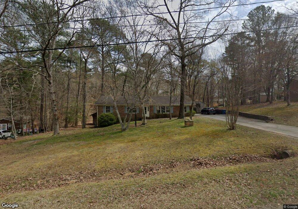
4110 Bartlett Dr Durham, NC 27705
North Durham NeighborhoodEstimated Value: $360,000 - $388,000
3
Beds
2
Baths
1,680
Sq Ft
$225/Sq Ft
Est. Value
About This Home
This home is located at 4110 Bartlett Dr, Durham, NC 27705 and is currently estimated at $377,483, approximately $224 per square foot. 4110 Bartlett Dr is a home located in Durham County with nearby schools including Easley Elementary, George L Carrington Middle, and Riverside High School.
Ownership History
Date
Name
Owned For
Owner Type
Purchase Details
Closed on
Feb 19, 2010
Sold by
Hoyme Steven J
Bought by
Hoyme Nancy
Current Estimated Value
Create a Home Valuation Report for This Property
The Home Valuation Report is an in-depth analysis detailing your home's value as well as a comparison with similar homes in the area
Home Values in the Area
Average Home Value in this Area
Purchase History
| Date | Buyer | Sale Price | Title Company |
|---|---|---|---|
| Hoyme Nancy | -- | None Available |
Source: Public Records
Tax History
| Year | Tax Paid | Tax Assessment Tax Assessment Total Assessment is a certain percentage of the fair market value that is determined by local assessors to be the total taxable value of land and additions on the property. | Land | Improvement |
|---|---|---|---|---|
| 2025 | $3,992 | $402,662 | $171,900 | $230,762 |
| 2024 | $2,840 | $203,589 | $47,625 | $155,964 |
| 2023 | $2,667 | $203,589 | $47,625 | $155,964 |
| 2022 | $2,606 | $203,589 | $47,625 | $155,964 |
| 2021 | $2,594 | $203,589 | $47,625 | $155,964 |
| 2020 | $2,532 | $203,589 | $47,625 | $155,964 |
| 2019 | $2,532 | $203,589 | $47,625 | $155,964 |
| 2018 | $2,064 | $152,162 | $33,337 | $118,825 |
| 2017 | $2,049 | $152,162 | $33,337 | $118,825 |
| 2016 | $1,980 | $152,162 | $33,337 | $118,825 |
| 2015 | $1,948 | $140,753 | $33,702 | $107,051 |
| 2014 | $1,948 | $140,753 | $33,702 | $107,051 |
Source: Public Records
Map
Nearby Homes
- 1016 Skyler Ln
- 3026 Rosebriar Dr
- 913 Woodside Park Ln
- 337 Latta Rd
- 1 Signet Dr Unit A17
- 405 Latta Rd
- 403 Bonhill Dr
- 411 Latta Cir
- 5005 Gatewood Dr
- 3775 Guess Rd Unit 43
- 1918 Peppertree St
- 805 Northwood Hills Ave
- 812 Sanderson Dr
- 5023 Pine Trail Dr
- 5018 Gatewood Dr
- 5022 Green Oak Dr
- 1427 Cherrycrest Dr
- 1425 Cherrycrest Dr
- 1421 Cherrycrest Dr
- 1419 Cherrycrest Dr
- 4114 Bartlett Dr
- 4106 Bartlett Dr
- 4118 Bartlett Dr
- 4105 Bartlett Dr
- 2510 Landis Dr
- 2514 Landis Dr
- 2506 Landis Dr
- 4012 Trevor Cir
- 2518 Landis Dr
- 4008 Trevor Cir
- 4122 Bartlett Dr
- 4108 Trevor Cir
- 2502 Landis Dr
- 2522 Landis Dr
- 4101 Bartlett Dr
- 4112 Trevor Cir
- 4126 Bartlett Dr
- 2526 Landis Dr
- 2420 Landis Dr
- 2509 Landis Dr
Your Personal Tour Guide
Ask me questions while you tour the home.