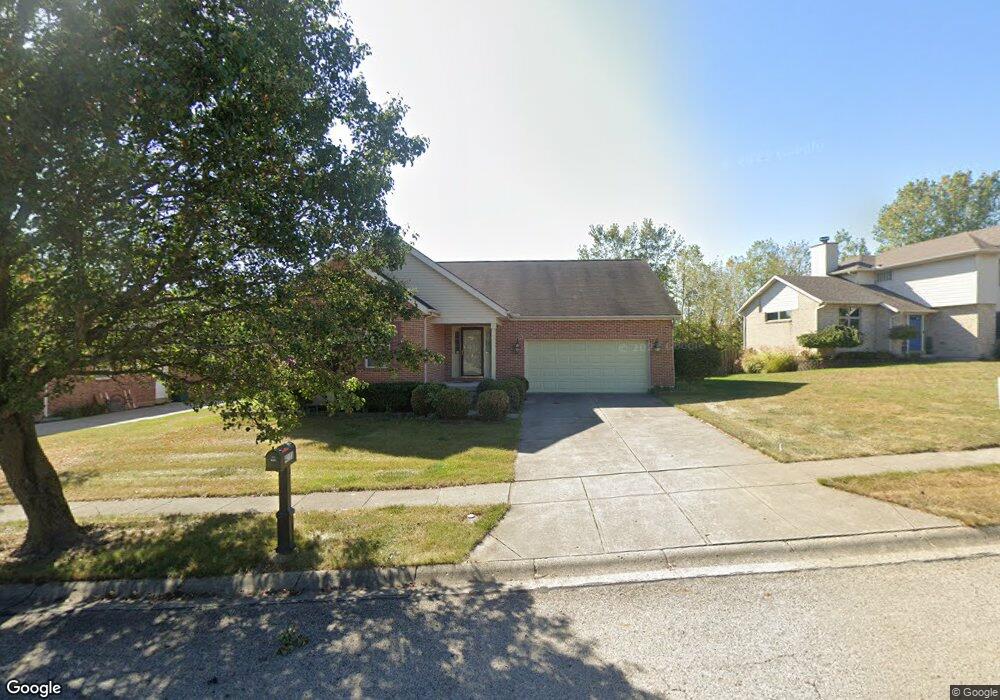
4111 Ashton Ln Springfield, OH 45503
Estimated Value: $311,303 - $333,000
3
Beds
2
Baths
1,807
Sq Ft
$177/Sq Ft
Est. Value
About This Home
This home is located at 4111 Ashton Ln, Springfield, OH 45503 and is currently estimated at $320,076, approximately $177 per square foot. 4111 Ashton Ln is a home located in Clark County with nearby schools including Northridge Elementary School, Kenton Ridge Middle & High School, and Emmanuel Christian Academy.
Ownership History
Date
Name
Owned For
Owner Type
Purchase Details
Closed on
Oct 27, 2025
Sold by
Kelley Delores and Kelley Roy J
Bought by
Rice Leah and Brown Cody
Current Estimated Value
Home Financials for this Owner
Home Financials are based on the most recent Mortgage that was taken out on this home.
Original Mortgage
$304,385
Outstanding Balance
$304,385
Interest Rate
6.3%
Mortgage Type
FHA
Estimated Equity
$15,691
Purchase Details
Closed on
Nov 27, 2002
Sold by
Hoppes Development Company The
Bought by
Kelley Delores
Home Financials for this Owner
Home Financials are based on the most recent Mortgage that was taken out on this home.
Original Mortgage
$106,900
Interest Rate
6.22%
Create a Home Valuation Report for This Property
The Home Valuation Report is an in-depth analysis detailing your home's value as well as a comparison with similar homes in the area
Home Values in the Area
Average Home Value in this Area
Purchase History
| Date | Buyer | Sale Price | Title Company |
|---|---|---|---|
| Rice Leah | $310,000 | First Ohio Title Insurance | |
| Kelley Delores | $157,900 | -- |
Source: Public Records
Mortgage History
| Date | Status | Borrower | Loan Amount |
|---|---|---|---|
| Open | Rice Leah | $304,385 | |
| Previous Owner | Kelley Delores | $106,900 |
Source: Public Records
Tax History
| Year | Tax Paid | Tax Assessment Tax Assessment Total Assessment is a certain percentage of the fair market value that is determined by local assessors to be the total taxable value of land and additions on the property. | Land | Improvement |
|---|---|---|---|---|
| 2025 | $3,335 | $108,670 | $19,760 | $88,910 |
| 2024 | $3,251 | $86,060 | $16,960 | $69,100 |
| 2023 | $3,251 | $86,060 | $16,960 | $69,100 |
| 2022 | $3,281 | $86,060 | $16,960 | $69,100 |
| 2021 | $2,557 | $59,810 | $13,570 | $46,240 |
| 2020 | $2,559 | $59,810 | $13,570 | $46,240 |
| 2019 | $2,608 | $59,810 | $13,570 | $46,240 |
| 2018 | $2,662 | $58,700 | $11,200 | $47,500 |
| 2017 | $2,282 | $55,658 | $11,197 | $44,461 |
| 2016 | $2,266 | $55,658 | $11,197 | $44,461 |
| 2015 | $2,006 | $55,122 | $10,661 | $44,461 |
| 2014 | $2,006 | $55,122 | $10,661 | $44,461 |
| 2013 | $2,160 | $55,122 | $10,661 | $44,461 |
Source: Public Records
Map
Nearby Homes
- 4256 Midfield St Unit 9
- 1341 Student Ave
- 4446 Ridgewood Rd E Unit 3
- 1500 Kingsgate Rd
- 1502 Kingsgate Rd
- 1500 Kingsgate Rd Unit 19430
- 1502 Kingsgate Rd Unit 19432
- 1509 Kingsgate Rd
- 1201 Kingsgate Rd
- 1503 Kingsgate Rd
- 3631 Kingsgate Ln
- 1505 Kingsgate Rd
- 4577 Reno Ln Unit 2
- 1162 Kingsgate Rd
- 4343 Burchill St
- 1711 Pinehurst Dr
- 1507 Kingsgate Rd
- 1831 Pinehurst Dr Unit 37
- 4652 Reno Ln Unit 15
- 3969 Covington Dr Unit 3969
- 4105 Ashton Ln
- 4117 Ashton Ln
- 1590 Montego Dr
- 4127 Ashton Ln
- 4110 Ashton Ln
- 4116 Ashton Ln
- 4102 Ashton Ln
- 1566 Montego Dr
- 4124 Ashton Ln
- 1509 Montego Dr
- 1595 Montego Dr
- 4135 Ashton Ln
- 1591 Montego Dr
- 4068 Harris Ln
- 4132 Ashton Ln
- 4107 Tacoma St
- 1558 Montego Dr
- 4115 Tacoma St
- 1624 Montego Dr
- 1575 Montego Dr
Your Personal Tour Guide
Ask me questions while you tour the home.