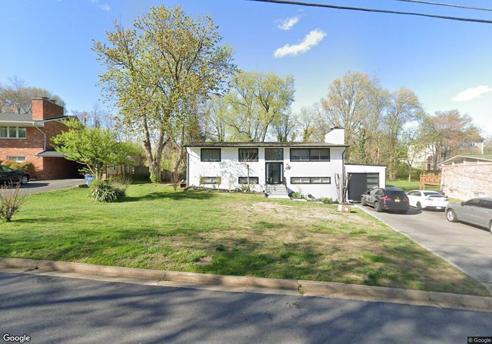
4111 Watkins Trail Annandale, VA 22003
Estimated Value: $865,000 - $913,561
6
Beds
3
Baths
1,564
Sq Ft
$570/Sq Ft
Est. Value
About This Home
This home is located at 4111 Watkins Trail, Annandale, VA 22003 and is currently estimated at $890,890, approximately $569 per square foot. 4111 Watkins Trail is a home located in Fairfax County with nearby schools including Columbia Elementary School, Holmes Middle School, and Annandale High School.
Ownership History
Date
Name
Owned For
Owner Type
Purchase Details
Closed on
Feb 16, 2006
Sold by
Thomas John Tobias Truste
Bought by
Kaur Jasdeep and Singh,Dalbir
Current Estimated Value
Home Financials for this Owner
Home Financials are based on the most recent Mortgage that was taken out on this home.
Original Mortgage
$417,000
Outstanding Balance
$235,171
Interest Rate
6.23%
Mortgage Type
New Conventional
Estimated Equity
$655,719
Purchase Details
Closed on
Feb 18, 1997
Sold by
Tobias Thomas J and Tobias Joyce M
Bought by
Thomas J Tobias Rev Trust
Create a Home Valuation Report for This Property
The Home Valuation Report is an in-depth analysis detailing your home's value as well as a comparison with similar homes in the area
Home Values in the Area
Average Home Value in this Area
Purchase History
| Date | Buyer | Sale Price | Title Company |
|---|---|---|---|
| Kaur Jasdeep | $620,000 | -- | |
| Thomas J Tobias Rev Trust | -- | -- |
Source: Public Records
Mortgage History
| Date | Status | Borrower | Loan Amount |
|---|---|---|---|
| Open | Kaur Jasdeep | $417,000 |
Source: Public Records
Tax History Compared to Growth
Tax History
| Year | Tax Paid | Tax Assessment Tax Assessment Total Assessment is a certain percentage of the fair market value that is determined by local assessors to be the total taxable value of land and additions on the property. | Land | Improvement |
|---|---|---|---|---|
| 2025 | $9,382 | $853,870 | $341,000 | $512,870 |
| 2024 | $9,382 | $809,840 | $326,000 | $483,840 |
| 2023 | $8,879 | $786,800 | $326,000 | $460,800 |
| 2022 | $7,893 | $690,210 | $286,000 | $404,210 |
| 2021 | $7,146 | $608,920 | $276,000 | $332,920 |
| 2020 | $6,733 | $568,890 | $252,000 | $316,890 |
| 2019 | $6,849 | $578,690 | $252,000 | $326,690 |
| 2018 | $6,574 | $571,690 | $245,000 | $326,690 |
| 2017 | $6,533 | $562,690 | $236,000 | $326,690 |
| 2016 | $6,519 | $562,690 | $236,000 | $326,690 |
| 2015 | $6,010 | $538,490 | $236,000 | $302,490 |
| 2014 | $5,331 | $478,790 | $224,000 | $254,790 |
Source: Public Records
Map
Nearby Homes
- 6515 Oakwood Dr
- 6436 Maplewood Dr
- 6416 Columbia Pike
- 6430 Maplewood Dr
- 4106 Breezewood Ln
- 6474 Oakwood Dr
- 4211 Downing St
- 4121 Sleepy Hollow Rd
- 6424 Recreation Ln
- 3857 Pinewood Terrace
- 3806 Bent Branch Rd
- 6436 Holyoke Dr
- 6381 Lakewood Dr
- 3823 Pinewood Terrace
- 3913 Victoria Oaks Trail
- 3706 Quaint Acres Cir
- 6360 Lakewood Dr
- 4214 Pine Ln
- 3717 Chanel Rd
- 6542 Cypress Point Rd
- 4113 Watkins Trail
- 4109 Watkins Trail
- 4020 Honey Ln
- 4107 Watkins Trail
- 4112 Watkins Trail
- 4101 Mason Ridge Dr
- 4116 Watkins Trail
- 4105 Watkins Trail
- 4103 Mason Ridge Dr
- 4118 Watkins Trail
- 4103 Watkins Trail
- 4105 Mason Ridge Dr
- 4023 Honey Ln
- 4029 Honey Ln
- 4025 Honey Ln
- 4021 Honey Ln
- 4027 Honey Ln
- 4120 Watkins Trail
- 4104 Watkins Trail
- 4102 Mason Ridge Dr