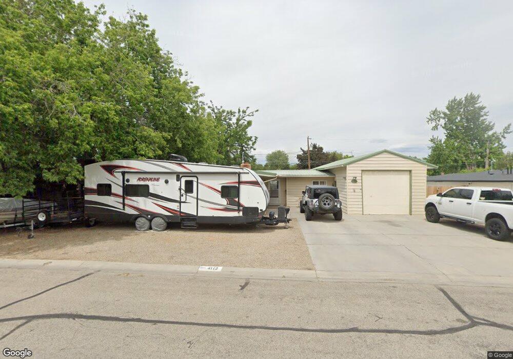
4112 Saint Andrews Dr Boise, ID 83705
Central Bench NeighborhoodEstimated Value: $384,000 - $430,000
3
Beds
1
Bath
1,344
Sq Ft
$304/Sq Ft
Est. Value
About This Home
This home is located at 4112 Saint Andrews Dr, Boise, ID 83705 and is currently estimated at $408,704, approximately $304 per square foot. 4112 Saint Andrews Dr is a home located in Ada County with nearby schools including Owyhee Elementary School, South Junior High School, and Borah Senior High School.
Ownership History
Date
Name
Owned For
Owner Type
Purchase Details
Closed on
Sep 12, 2019
Sold by
Marketplace Mortgage Inc
Bought by
Sanceri Caroline L and Nice Truli K
Current Estimated Value
Home Financials for this Owner
Home Financials are based on the most recent Mortgage that was taken out on this home.
Original Mortgage
$218,500
Outstanding Balance
$191,366
Interest Rate
3.7%
Mortgage Type
New Conventional
Estimated Equity
$217,338
Purchase Details
Closed on
Mar 27, 2019
Sold by
Hughes Diane
Bought by
Ten Bridges Llc
Create a Home Valuation Report for This Property
The Home Valuation Report is an in-depth analysis detailing your home's value as well as a comparison with similar homes in the area
Home Values in the Area
Average Home Value in this Area
Purchase History
| Date | Buyer | Sale Price | Title Company |
|---|---|---|---|
| Sanceri Caroline L | -- | Stewart Title Emerald Office | |
| Ten Bridges Llc | -- | None Available |
Source: Public Records
Mortgage History
| Date | Status | Borrower | Loan Amount |
|---|---|---|---|
| Open | Sanceri Caroline L | $218,500 |
Source: Public Records
Tax History Compared to Growth
Tax History
| Year | Tax Paid | Tax Assessment Tax Assessment Total Assessment is a certain percentage of the fair market value that is determined by local assessors to be the total taxable value of land and additions on the property. | Land | Improvement |
|---|---|---|---|---|
| 2025 | $1,458 | $322,000 | -- | -- |
| 2024 | $1,474 | $285,700 | -- | -- |
| 2023 | $1,474 | $279,400 | $0 | $0 |
| 2022 | $1,756 | $327,500 | $0 | $0 |
| 2021 | $1,346 | $246,300 | $0 | $0 |
| 2020 | $1,273 | $207,200 | $0 | $0 |
| 2019 | $2,531 | $186,500 | $0 | $0 |
| 2018 | $2,355 | $155,100 | $0 | $0 |
| 2017 | $2,228 | $139,400 | $0 | $0 |
| 2016 | $1,035 | $126,400 | $0 | $0 |
| 2015 | $488 | $125,500 | $0 | $0 |
| 2012 | -- | $96,300 | $0 | $0 |
Source: Public Records
Map
Nearby Homes
- 3001 S Roosevelt St Unit 16
- 4653 W Pasadena Ln
- 2701 S Gourley St
- 3166 W Hillcrest Ln
- 3810 W Targee St
- 3130 W Catalina Ln
- 2401 S Owyhee St
- 2612 -2614 S Hervey
- 2033 Jackson St
- TBD W Grover St
- 3249 W Cherry Ln Unit 2
- 3249 W Cherry Ln Unit 23
- 2108 S Pacific St
- 3201 W Cherry Ln
- 4431 W Hillcrest Dr
- 4704 Hillcrest View Dr
- 2022 S Latah St
- 2115 S Owyhee St
- 4950 W Hillcrest View Ct
- 4147 W Pinoak Ct
- 4106 Saint Andrews Dr
- 3210 S Roosevelt St
- 4111 Normandie Dr
- 4107 Normandie Dr
- 3200 S Roosevelt St
- 4100 Saint Andrews Dr
- 4115 Saint Andrews Dr
- 4115 W Saint Andrews Dr
- 4103 Normandie Dr
- 3214 S Roosevelt St
- 4100 W St Andrews Dr
- 4105 Saint Andrews Dr
- 4105 W Saint Andrews Dr
- 4017 Normandie Dr
- 4020 Saint Andrews Dr
- 3220 S Roosevelt St
- 4101 Saint Andrews Dr
- 4108 Normandie Dr
- 4114 Normandie Dr
- 3205 S Roosevelt St