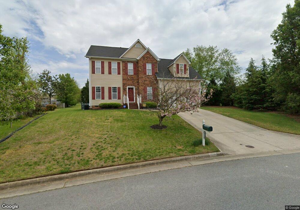
4116 Carroll Brook Rd High Point, NC 27265
Bent Tree NeighborhoodEstimated Value: $341,000 - $382,000
4
Beds
3
Baths
2,114
Sq Ft
$169/Sq Ft
Est. Value
About This Home
This home is located at 4116 Carroll Brook Rd, High Point, NC 27265 and is currently estimated at $357,806, approximately $169 per square foot. 4116 Carroll Brook Rd is a home located in Guilford County with nearby schools including Southwest Elementary School, Southwest Guilford Middle School, and Southwest Guilford High School.
Ownership History
Date
Name
Owned For
Owner Type
Purchase Details
Closed on
Mar 27, 2013
Sold by
Caldwell Enterprises Inc
Bought by
Brical Holdings Llc
Current Estimated Value
Purchase Details
Closed on
Jul 18, 2002
Sold by
Jessup Ronald K and Jessup Ginger F
Bought by
Caldwell Brian D and Caldwell Carolyn N
Home Financials for this Owner
Home Financials are based on the most recent Mortgage that was taken out on this home.
Original Mortgage
$155,800
Interest Rate
5.86%
Mortgage Type
Purchase Money Mortgage
Create a Home Valuation Report for This Property
The Home Valuation Report is an in-depth analysis detailing your home's value as well as a comparison with similar homes in the area
Home Values in the Area
Average Home Value in this Area
Purchase History
| Date | Buyer | Sale Price | Title Company |
|---|---|---|---|
| Brical Holdings Llc | -- | None Available | |
| Caldwell Brian D | $164,000 | -- |
Source: Public Records
Mortgage History
| Date | Status | Borrower | Loan Amount |
|---|---|---|---|
| Previous Owner | Caldwell Brian D | $155,800 |
Source: Public Records
Tax History Compared to Growth
Tax History
| Year | Tax Paid | Tax Assessment Tax Assessment Total Assessment is a certain percentage of the fair market value that is determined by local assessors to be the total taxable value of land and additions on the property. | Land | Improvement |
|---|---|---|---|---|
| 2025 | $3,251 | $235,900 | $44,000 | $191,900 |
| 2024 | $3,251 | $235,900 | $44,000 | $191,900 |
| 2023 | $3,251 | $235,900 | $44,000 | $191,900 |
| 2022 | $3,180 | $235,900 | $44,000 | $191,900 |
| 2021 | $2,468 | $179,100 | $35,000 | $144,100 |
| 2020 | $2,468 | $179,100 | $35,000 | $144,100 |
| 2019 | $2,468 | $179,100 | $0 | $0 |
| 2018 | $2,456 | $179,100 | $0 | $0 |
| 2017 | $2,456 | $179,100 | $0 | $0 |
| 2016 | $2,390 | $170,400 | $0 | $0 |
| 2015 | $2,403 | $170,400 | $0 | $0 |
| 2014 | $2,444 | $170,400 | $0 | $0 |
Source: Public Records
Map
Nearby Homes
- 3650 Single Leaf Ct
- 1515 Skeet Club Rd
- 3924 Braddock Rd
- 3525 Covent Oak Ct
- 4126 Birchgarden Dr
- 3007 Maple Branch Dr
- 3838 Galloway Ct
- 3905 Wynne Brook Ct
- 3301 Alyssa Way
- 4323 Holstein Dr
- Richmond Plan at Williard Place
- 3296 Alyssa Way
- Cameron Plan at Williard Place
- Southport Plan at Williard Place
- Columbia Plan at Williard Place
- Bailey Plan at Williard Place
- 3273 Alyssa Way
- 4485 Alderny Cir
- 3855 Thistleberry Rd
- 3199 Riley Ford Trail
- 4110 Carroll Brook Rd
- 3618 Single Leaf Ct
- 3620 Single Leaf Ct
- 4113 Carroll Brook Rd
- 3614 Single Leaf Ct
- 4119 Ballard Pond Dr
- 4117 Ballard Pond Dr
- 3622 Single Leaf Ct
- 3612 Single Leaf Ct
- 4111 Carroll Brook Rd
- 3624 Single Leaf Ct
- 3617 Single Leaf Ct
- 3610 Single Leaf Ct
- 3619 Single Leaf Ct
- 3615 Single Leaf Ct
- 3613 Single Leaf Ct
- 3621 Single Leaf Ct
- 3608 Single Leaf Ct
- 3628 Single Leaf Ct
- 3611 Single Leaf Ct