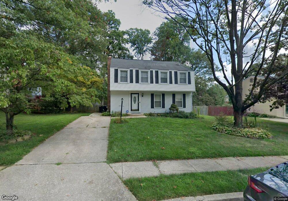
4117 Hanwell Rd Randallstown, MD 21133
Estimated Value: $393,719 - $426,000
--
Bed
3
Baths
1,792
Sq Ft
$232/Sq Ft
Est. Value
About This Home
This home is located at 4117 Hanwell Rd, Randallstown, MD 21133 and is currently estimated at $416,180, approximately $232 per square foot. 4117 Hanwell Rd is a home located in Baltimore County with nearby schools including Deer Park Elementary School, Deer Park Middle Magnet School, and New Town High.
Ownership History
Date
Name
Owned For
Owner Type
Purchase Details
Closed on
Mar 31, 2022
Sold by
Jones Neville A
Bought by
Jones Neville Anthony and Jones Kyundra Renee
Current Estimated Value
Home Financials for this Owner
Home Financials are based on the most recent Mortgage that was taken out on this home.
Original Mortgage
$343,660
Interest Rate
3.76%
Mortgage Type
Construction
Purchase Details
Closed on
Dec 23, 1992
Sold by
Mock H Robert
Bought by
Jones Neville A and Jones Mauxine R
Purchase Details
Closed on
Oct 23, 1974
Sold by
Ryland Group Inc Orporated
Bought by
Mock H Robert
Create a Home Valuation Report for This Property
The Home Valuation Report is an in-depth analysis detailing your home's value as well as a comparison with similar homes in the area
Home Values in the Area
Average Home Value in this Area
Purchase History
| Date | Buyer | Sale Price | Title Company |
|---|---|---|---|
| Jones Neville Anthony | $350,000 | New Title Company Name | |
| Jones Neville A | $115,000 | -- | |
| Mock H Robert | $48,500 | -- |
Source: Public Records
Mortgage History
| Date | Status | Borrower | Loan Amount |
|---|---|---|---|
| Previous Owner | Jones Neville Anthony | $343,660 |
Source: Public Records
Tax History Compared to Growth
Tax History
| Year | Tax Paid | Tax Assessment Tax Assessment Total Assessment is a certain percentage of the fair market value that is determined by local assessors to be the total taxable value of land and additions on the property. | Land | Improvement |
|---|---|---|---|---|
| 2025 | $4,285 | $274,567 | -- | -- |
| 2024 | $4,285 | $246,000 | $80,000 | $166,000 |
| 2023 | $2,017 | $240,667 | $0 | $0 |
| 2022 | $3,730 | $235,333 | $0 | $0 |
| 2021 | $3,421 | $230,000 | $80,000 | $150,000 |
| 2020 | $3,421 | $220,333 | $0 | $0 |
| 2019 | $3,246 | $210,667 | $0 | $0 |
| 2018 | $2,998 | $201,000 | $63,400 | $137,600 |
| 2017 | $2,874 | $191,967 | $0 | $0 |
| 2016 | $2,519 | $182,933 | $0 | $0 |
| 2015 | $2,519 | $173,900 | $0 | $0 |
| 2014 | $2,519 | $173,900 | $0 | $0 |
Source: Public Records
Map
Nearby Homes
- 4105 Hanwell Rd
- 9519 Branchleigh Rd
- 4108 Brown Bark Cir
- 9530 John Locke Way
- 3903 Red Deer Cir
- 3903 Innerdale Ct
- 9500 Georgian Way
- 4313 Plinlimmon Dr
- 17 Bannock Ct
- 9931 Tuscarora Rd
- 9 Bannock Ct
- 3827 Rayton Rd
- 9406 Painted Tree Dr
- 9435 James MacGowan Ln Unit 439
- 9436 Davy Ln Unit 475
- 4550 Chaucer Way Unit 406
- 9112 Meadow Heights Rd
- 4264 Cayuga Rd
- 4500 Chaucer Way Unit 202
- 4500 Chaucer Way Unit 403
- 4115 Hanwell Rd
- 4119 Hanwell Rd
- 9613 Winands Rd
- 4113 Hanwell Rd
- 4118 Hanwell Rd
- 4116 Hanwell Rd
- 4111 Hanwell Rd
- 4120 Hanwell Rd
- 0 Winands Rd Unit BC7549545
- 81 Winands Rd
- 0 Winands Rd Unit 1009335838
- 4114 Hanwell Rd
- 9600 Wesland Cir
- 9548 Wesland Cir
- 4201 Hanwell Rd
- 9546 Wesland Cir
- 4109 Hanwell Rd
- 9619 Winands Rd
- 4112 Hanwell Rd
- 9602 Wesland Cir