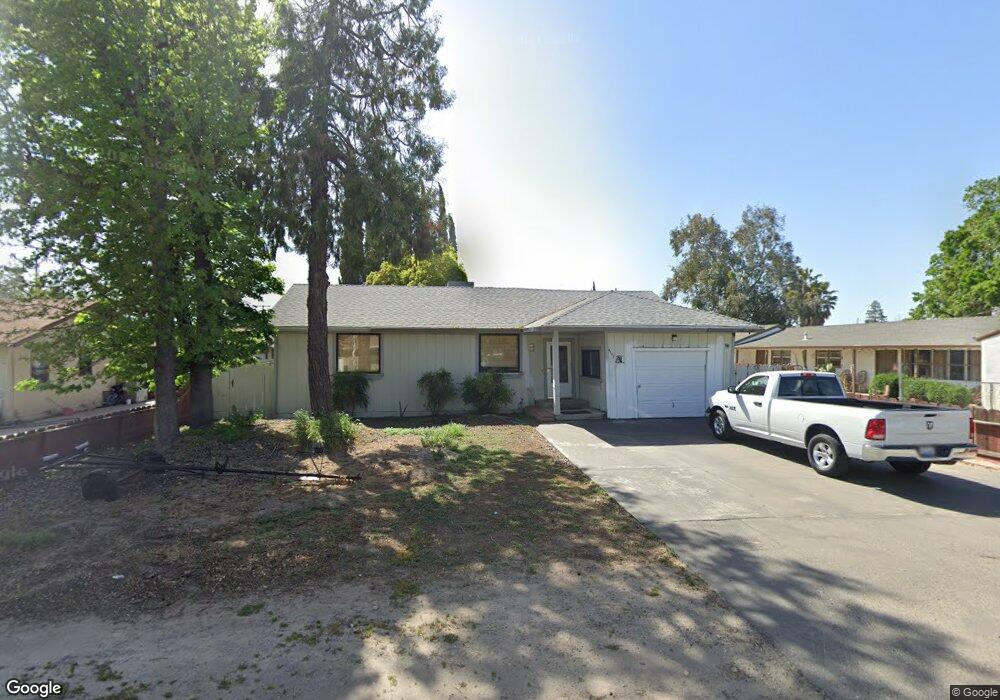
4117 N Sperry Rd Denair, CA 95316
Estimated Value: $337,000 - $619,000
2
Beds
2
Baths
1,574
Sq Ft
$295/Sq Ft
Est. Value
About This Home
This home is located at 4117 N Sperry Rd, Denair, CA 95316 and is currently estimated at $464,331, approximately $295 per square foot. 4117 N Sperry Rd is a home located in Stanislaus County with nearby schools including Denair Elementary School, Denair Middle School, and Denair High School.
Ownership History
Date
Name
Owned For
Owner Type
Purchase Details
Closed on
Sep 18, 1998
Sold by
Wright Brian A and Bibeau Nancy Bibeau
Bought by
Mendoza Tom M and Mendoza Denice L
Current Estimated Value
Home Financials for this Owner
Home Financials are based on the most recent Mortgage that was taken out on this home.
Original Mortgage
$103,283
Outstanding Balance
$22,024
Interest Rate
6.88%
Mortgage Type
FHA
Estimated Equity
$442,307
Create a Home Valuation Report for This Property
The Home Valuation Report is an in-depth analysis detailing your home's value as well as a comparison with similar homes in the area
Home Values in the Area
Average Home Value in this Area
Purchase History
| Date | Buyer | Sale Price | Title Company |
|---|---|---|---|
| Mendoza Tom M | $105,000 | Fidelity National Title Co |
Source: Public Records
Mortgage History
| Date | Status | Borrower | Loan Amount |
|---|---|---|---|
| Open | Mendoza Tom M | $103,283 |
Source: Public Records
Tax History Compared to Growth
Tax History
| Year | Tax Paid | Tax Assessment Tax Assessment Total Assessment is a certain percentage of the fair market value that is determined by local assessors to be the total taxable value of land and additions on the property. | Land | Improvement |
|---|---|---|---|---|
| 2025 | $1,917 | $164,592 | $54,860 | $109,732 |
| 2024 | $1,872 | $161,366 | $53,785 | $107,581 |
| 2023 | $1,819 | $158,203 | $52,731 | $105,472 |
| 2022 | $1,780 | $155,102 | $51,698 | $103,404 |
| 2021 | $1,772 | $152,062 | $50,685 | $101,377 |
| 2020 | $1,755 | $150,504 | $50,166 | $100,338 |
| 2019 | $1,665 | $147,554 | $49,183 | $98,371 |
| 2018 | $1,673 | $144,662 | $48,219 | $96,443 |
| 2017 | $1,624 | $141,826 | $47,274 | $94,552 |
| 2016 | $1,613 | $139,047 | $46,348 | $92,699 |
| 2015 | $1,538 | $136,959 | $45,652 | $91,307 |
| 2014 | $1,532 | $134,277 | $44,758 | $89,519 |
Source: Public Records
Map
Nearby Homes
- 3749 San Joaquin Ave
- 4910 E Zeering Rd
- 3541 Fresno St
- 3209 Berg Ave
- 4625 E Monte Vista Ave
- 3306 Story Rd
- 2912 Marazan St
- 3100 Liquid Amber Dr
- 3620 E Monte Vista Ave
- 3418 N Waring Rd Unit 71
- 4423 E Tuolumne Rd
- 4513 E Tuolumne Rd
- 2880 N Quincy Rd
- 2791 E Tuolumne Rd
- 2127 Bristol Park Cir
- 3703 Brookstone Dr
- 3600 E Hawkeye Ave
- 3200 Brookstone Dr
- 4227 Ivory Ln
- 2575 Kensington Ct
- 4133 N Sperry Rd
- 4101 N Sperry Rd
- 4201 S Sperry Rd
- 4141 N Sperry Rd
- 4132 N Sperry Rd
- 4108 N Sperry Rd
- 4100 N Sperry Rd
- 4109 N Sperry Rd
- 4217 N Sperry Rd
- 4200 Wilder Way
- 4041 N Sperry Rd
- 4225 N Sperry Rd
- 4231 S Sperry Rd
- 4201 Wilder Way Unit 102
- 4201 Wilder Way
- 4300 Greenview Dr
- 4080 Santa fe Ave
- 4317 E Zeering Rd
- 4205 Wilder Way
- 4333 E Zeering Rd