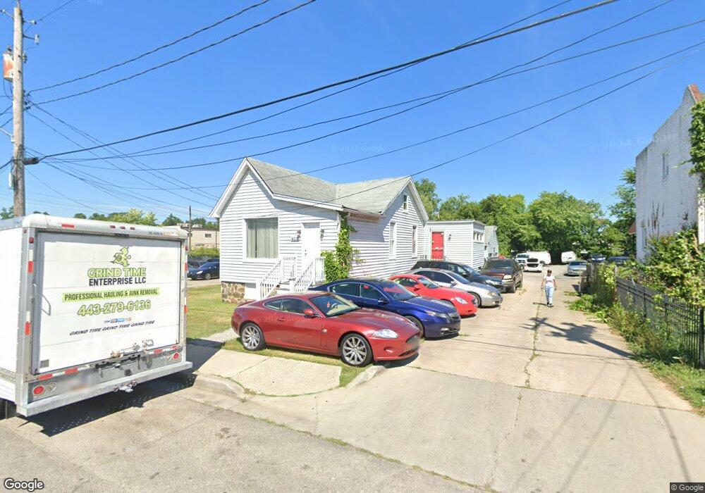
4118 Amos Ave Baltimore, MD 21215
Reisterstown Station NeighborhoodEstimated Value: $509,574
--
Bed
--
Bath
2,806
Sq Ft
$182/Sq Ft
Est. Value
About This Home
This home is located at 4118 Amos Ave, Baltimore, MD 21215 and is currently estimated at $509,574, approximately $181 per square foot. 4118 Amos Ave is a home located in Baltimore City with nearby schools including Cross Country Elementary School, Booker T. Washington Middle School, and Forest Park High School.
Ownership History
Date
Name
Owned For
Owner Type
Purchase Details
Closed on
Sep 14, 2015
Sold by
Lidston Robert and Estate Of Richard M Hoover
Bought by
Hoover Ryan and Hoover Denise
Current Estimated Value
Purchase Details
Closed on
Oct 2, 1998
Sold by
Hoover Richard M
Bought by
Hoover Richard M
Purchase Details
Closed on
Dec 5, 1994
Sold by
Lawson Joseph G
Bought by
Hoover Richard M
Home Financials for this Owner
Home Financials are based on the most recent Mortgage that was taken out on this home.
Original Mortgage
$125,000
Interest Rate
8.81%
Mortgage Type
Commercial
Create a Home Valuation Report for This Property
The Home Valuation Report is an in-depth analysis detailing your home's value as well as a comparison with similar homes in the area
Home Values in the Area
Average Home Value in this Area
Purchase History
| Date | Buyer | Sale Price | Title Company |
|---|---|---|---|
| Hoover Ryan | -- | None Available | |
| Hoover Richard M | -- | -- | |
| Hoover Richard M | $125,000 | -- |
Source: Public Records
Mortgage History
| Date | Status | Borrower | Loan Amount |
|---|---|---|---|
| Previous Owner | Hoover Richard M | $125,000 |
Source: Public Records
Tax History Compared to Growth
Tax History
| Year | Tax Paid | Tax Assessment Tax Assessment Total Assessment is a certain percentage of the fair market value that is determined by local assessors to be the total taxable value of land and additions on the property. | Land | Improvement |
|---|---|---|---|---|
| 2025 | $4,975 | $214,167 | -- | -- |
| 2024 | $4,975 | $211,800 | $102,500 | $109,300 |
| 2023 | $4,975 | $211,800 | $102,500 | $109,300 |
| 2022 | $4,998 | $211,800 | $102,500 | $109,300 |
| 2021 | $5,683 | $240,800 | $102,500 | $138,300 |
| 2020 | $5,065 | $214,600 | $0 | $0 |
| 2019 | $4,425 | $188,400 | $0 | $0 |
| 2018 | $3,828 | $162,200 | $102,500 | $59,700 |
| 2017 | $3,670 | $155,500 | $0 | $0 |
| 2016 | $3,669 | $148,800 | $0 | $0 |
| 2015 | $3,669 | $142,100 | $0 | $0 |
| 2014 | $3,669 | $142,100 | $0 | $0 |
Source: Public Records
Map
Nearby Homes
- 4108 Fords Ln
- 6203 Hopeton Ave
- 3720 Bartwood Rd
- 3803 Menlo Dr
- 3737 Clarks Ln
- 6210 Park Heights Ave Unit 700
- 6509 Parr Ave
- 3601 Clarks Ln Unit 424
- 3601 Clarks Ln Unit 506
- 3601 Clarks Ln
- 3601 Clarks Ln
- 3601 Clarks Ln
- 3601 Clarks Ln
- 6606 Park Heights Ave Unit 305
- 6606 Park Heights Ave Unit 905
- 6606 Park Heights Ave Unit 615
- 3922 Mortimer Ave
- 4011 Mortimer Ave
- 6317 Park Heights Ave Unit T9
- 6317 Park Heights Ave Unit 404
- 4116 Amos Ave
- 4122 Amos Ave
- 4114 Amos Ave
- 4112 Amos Ave
- 4124 Amos Ave
- 4110 Amos Ave
- 4108 Amos Ave
- 4106 Amos Ave
- 4109 Fordleigh Rd
- 4104 Amos Ave
- 4107 Fordleigh Rd
- 6210 Reisterstown Rd
- 4126 Amos Ave
- 4113 Fordleigh Rd
- 4103 Fordleigh Rd
- 6144 Reisterstown Rd
- 4105 Amos Ave
- 6200 Reisterstown Rd
- 4115 Fordleigh Rd
- 4109 Amos Ave