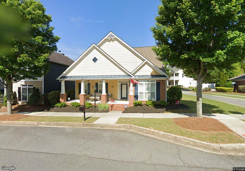
4118 Stonecypher Rd Unit 2 Suwanee, GA 30024
Estimated Value: $500,000 - $521,000
3
Beds
4
Baths
2,019
Sq Ft
$252/Sq Ft
Est. Value
About This Home
This home is located at 4118 Stonecypher Rd Unit 2, Suwanee, GA 30024 and is currently estimated at $509,474, approximately $252 per square foot. 4118 Stonecypher Rd Unit 2 is a home located in Gwinnett County with nearby schools including Roberts Elementary School, North Gwinnett Middle School, and North Gwinnett High School.
Ownership History
Date
Name
Owned For
Owner Type
Purchase Details
Closed on
Jun 28, 2022
Sold by
Woody Ernest Randall
Bought by
Stierwalt Michael J
Current Estimated Value
Home Financials for this Owner
Home Financials are based on the most recent Mortgage that was taken out on this home.
Original Mortgage
$275,500
Outstanding Balance
$261,340
Interest Rate
5.09%
Mortgage Type
New Conventional
Estimated Equity
$248,134
Purchase Details
Closed on
Jan 6, 2015
Sold by
Bank Of America Na
Bought by
Woody Ernest Randall
Purchase Details
Closed on
Nov 4, 2014
Sold by
Dispain Sara S
Bought by
Bank Of America Na
Purchase Details
Closed on
Mar 2, 2007
Sold by
Richport Properties Inc
Bought by
Dispain Sara S
Home Financials for this Owner
Home Financials are based on the most recent Mortgage that was taken out on this home.
Original Mortgage
$246,797
Interest Rate
6.19%
Mortgage Type
FHA
Create a Home Valuation Report for This Property
The Home Valuation Report is an in-depth analysis detailing your home's value as well as a comparison with similar homes in the area
Home Values in the Area
Average Home Value in this Area
Purchase History
| Date | Buyer | Sale Price | Title Company |
|---|---|---|---|
| Stierwalt Michael J | $475,000 | -- | |
| Woody Ernest Randall | $185,069 | -- | |
| Bank Of America Na | -- | -- | |
| Dispain Sara S | $248,800 | -- |
Source: Public Records
Mortgage History
| Date | Status | Borrower | Loan Amount |
|---|---|---|---|
| Open | Stierwalt Michael J | $275,500 | |
| Previous Owner | Dispain Sara S | $246,797 |
Source: Public Records
Tax History
| Year | Tax Paid | Tax Assessment Tax Assessment Total Assessment is a certain percentage of the fair market value that is determined by local assessors to be the total taxable value of land and additions on the property. | Land | Improvement |
|---|---|---|---|---|
| 2025 | -- | $214,520 | $38,000 | $176,520 |
| 2024 | -- | $194,200 | $38,400 | $155,800 |
| 2023 | $1,718 | $190,000 | $38,400 | $151,600 |
| 2022 | $5,219 | $172,320 | $36,000 | $136,320 |
| 2021 | $4,014 | $125,320 | $25,880 | $99,440 |
| 2020 | $4,045 | $125,320 | $25,880 | $99,440 |
| 2019 | $3,123 | $111,520 | $22,680 | $88,840 |
| 2018 | $3,139 | $111,520 | $22,680 | $88,840 |
| 2016 | $2,261 | $74,000 | $28,000 | $46,000 |
| 2015 | $2,638 | $86,960 | $22,000 | $64,960 |
| 2014 | -- | $79,520 | $18,800 | $60,720 |
Source: Public Records
Map
Nearby Homes
- 557 Cypher Dr
- 792 Village Field Ct
- 4434 Lassen Ct
- 0 Mary Lou St Unit 7445497
- 0 Mary Lou St Unit 10365827
- 793 Village Field Ct
- 4422 Grove Field Park
- 4358 Grove Field Ct
- 3656 Chicago St
- 3930 Charleston Market St Unit 221
- 4271 Baverton Dr
- 3941 Savannah Square St
- 3971 Savannah Square St
- 4321 Baverton Dr
- 4460 Suwanee Dam Rd
- 405 Causeway Ct
- 4469 Tacoma Trace
- 4520 Sims Park Overlook
- 821 Scales Rd
- 4485 Tench Rd Unit 1420
- 4114 Stonecypher Rd Unit 2
- 4122 Stonecypher Rd
- 4110 Stonecypher Rd
- 4124 Stonecypher Rd
- 4126 Stonecypher Rd Unit 8
- 4126 Stonecypher Rd
- 4126 Stonecypher Rd Unit 4126
- 547 Pringle Dr
- 4106 Stonecypher Rd
- 4128 Stonecypher Rd
- 566 Pringle Dr
- 4123 Stonecypher Rd Unit 102F
- 4102 Stonecypher Rd
- 4125 Stonecypher Rd
- 4125 Stonecypher Rd Unit 103F
- 4125 Stonecypher Rd Unit 3
- 4127 Stonecypher Rd
- 4127 Stonecypher Rd Unit 104F
- 567 Pringle Dr
- 4129 Stonecypher Rd Unit 105F
Your Personal Tour Guide
Ask me questions while you tour the home.