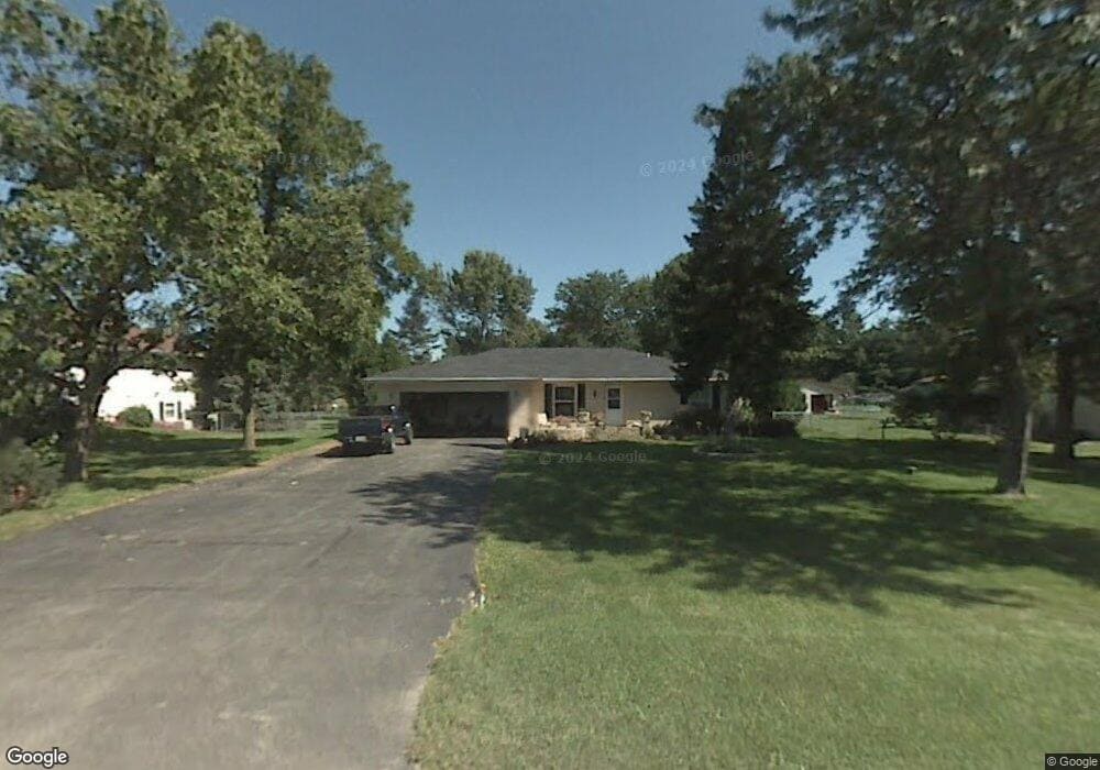
4118 Valerie Rd Roscoe, IL 61073
Estimated Value: $196,000 - $284,000
3
Beds
2
Baths
1,430
Sq Ft
$178/Sq Ft
Est. Value
About This Home
This home is located at 4118 Valerie Rd, Roscoe, IL 61073 and is currently estimated at $254,091, approximately $177 per square foot. 4118 Valerie Rd is a home located in Winnebago County with nearby schools including Ledgewood Elementary School, Kinnikinnick School, and Stone Creek School.
Ownership History
Date
Name
Owned For
Owner Type
Purchase Details
Closed on
Jun 26, 2017
Sold by
Gaudette Darren M and Gaudette Shelly
Bought by
Schrader David L and Manning Schrader K
Current Estimated Value
Home Financials for this Owner
Home Financials are based on the most recent Mortgage that was taken out on this home.
Original Mortgage
$113,810
Outstanding Balance
$94,738
Interest Rate
3.96%
Estimated Equity
$159,353
Purchase Details
Closed on
May 21, 2007
Bought by
Schrader David L and Manning Kathy A
Create a Home Valuation Report for This Property
The Home Valuation Report is an in-depth analysis detailing your home's value as well as a comparison with similar homes in the area
Home Values in the Area
Average Home Value in this Area
Purchase History
| Date | Buyer | Sale Price | Title Company |
|---|---|---|---|
| Schrader David L | -- | Security Title Co | |
| Schrader David L | $150,000 | -- |
Source: Public Records
Mortgage History
| Date | Status | Borrower | Loan Amount |
|---|---|---|---|
| Open | Schrader David L | $113,810 | |
| Closed | Schrader David L | $135,000 | |
| Closed | Schrader David L | $127,783 |
Source: Public Records
Tax History
| Year | Tax Paid | Tax Assessment Tax Assessment Total Assessment is a certain percentage of the fair market value that is determined by local assessors to be the total taxable value of land and additions on the property. | Land | Improvement |
|---|---|---|---|---|
| 2024 | $5,782 | $76,104 | $12,654 | $63,450 |
| 2022 | $5,092 | $62,435 | $10,381 | $52,054 |
| 2021 | $4,853 | $58,652 | $9,752 | $48,900 |
| 2020 | $4,755 | $56,521 | $9,398 | $47,123 |
| 2019 | $4,620 | $53,989 | $8,977 | $45,012 |
| 2018 | $4,341 | $51,878 | $8,626 | $43,252 |
| 2017 | $4,467 | $50,037 | $8,320 | $41,717 |
| 2016 | $4,282 | $49,235 | $8,187 | $41,048 |
| 2015 | $4,097 | $47,829 | $7,953 | $39,876 |
| 2014 | $3,774 | $47,224 | $7,852 | $39,372 |
Source: Public Records
Map
Nearby Homes
- 4338 Honey Locust Ln
- 11818 Balsa Ln
- 4593 Woodcrest Ln
- 4361 Pfister Ln
- 9.41 Acres Bluestem Rd
- 1245 Aldrin Rd
- 11578 Edgemere Terrace
- 11870 River Hills Pkwy Unit 29
- 4753 Edenberry Ln
- 11062 Chicory Ridge Way
- 11392 Edgemere Terrace
- 10458 Main St
- 4564 E Rockton Rd
- 10853 Lemon Grass Ln
- 549 Bayfield Rd
- 614 Bayfield Rd
- 13699 Chevron Dr
- 10662 Chicory Ridge Way
- 5683 Oak Village Dr Unit 5683
- 617 Queens Ct Unit 7617
- 4104 Valerie Rd
- 4134 Valerie Rd
- 4082 Valerie Rd
- 4127 Valerie Rd
- 4158 Valerie Rd
- 4225 Tresemer Cir
- 4093 Valerie Rd
- 4241 Tresemer Cir
- 4064 Valerie Rd
- 12260 Rae Ann Rd
- 4176 Valerie Rd
- 4163 Valerie Rd
- 4075 Valerie Rd
- 12248 Rae Ann Rd
- 12236 Tresemer Rd
- 4048 Valerie Rd
- 4231 Hononegah Rd
- 4037 Valerie Rd
- 3767 Doreen Dr
- 4248 Tresemer Cir
Your Personal Tour Guide
Ask me questions while you tour the home.