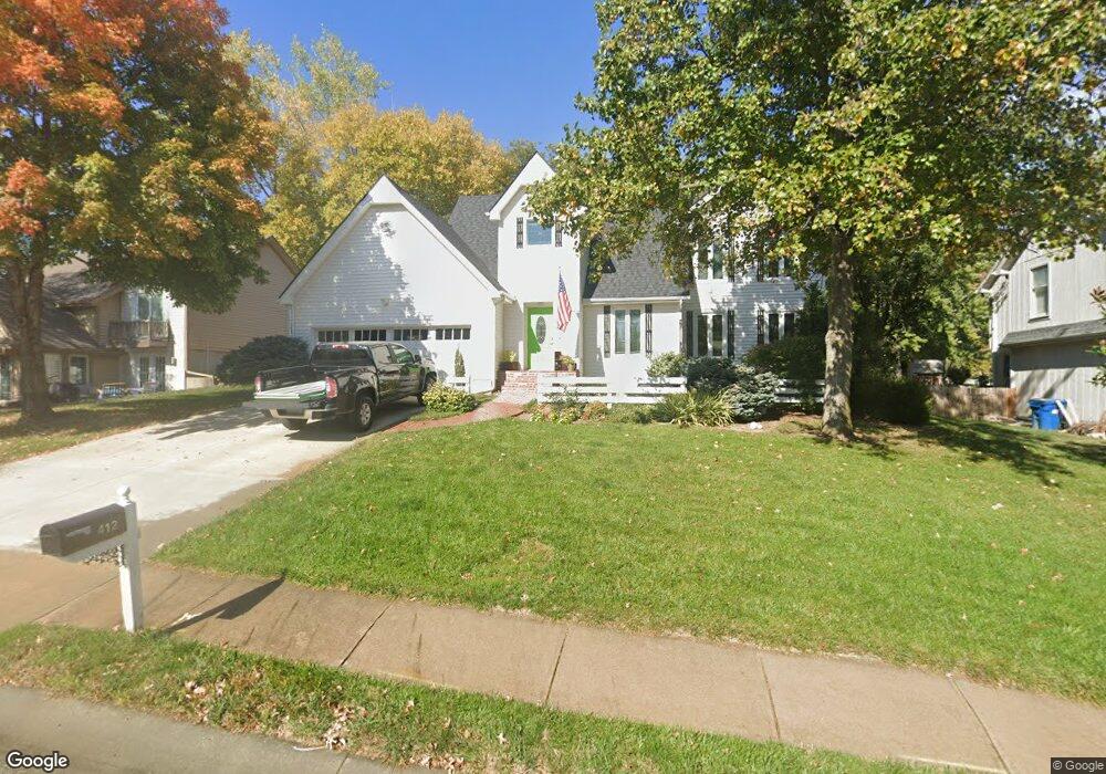
412 Brookside Ave Liberty, MO 64068
Estimated Value: $250,000 - $293,000
3
Beds
3
Baths
832
Sq Ft
$328/Sq Ft
Est. Value
About This Home
This home is located at 412 Brookside Ave, Liberty, MO 64068 and is currently estimated at $272,524, approximately $327 per square foot. 412 Brookside Ave is a home located in Clay County with nearby schools including Ridgeview Elementary School, Heritage Middle School, and Liberty North High School.
Ownership History
Date
Name
Owned For
Owner Type
Purchase Details
Closed on
May 22, 2001
Sold by
Edison Jerry Dale and Edison Linda
Bought by
Richardson Kevin D and Richardson Karla J
Current Estimated Value
Home Financials for this Owner
Home Financials are based on the most recent Mortgage that was taken out on this home.
Original Mortgage
$85,000
Interest Rate
7.07%
Create a Home Valuation Report for This Property
The Home Valuation Report is an in-depth analysis detailing your home's value as well as a comparison with similar homes in the area
Home Values in the Area
Average Home Value in this Area
Purchase History
| Date | Buyer | Sale Price | Title Company |
|---|---|---|---|
| Richardson Kevin D | -- | Stewart Title |
Source: Public Records
Mortgage History
| Date | Status | Borrower | Loan Amount |
|---|---|---|---|
| Closed | Richardson Kevin D | $85,000 |
Source: Public Records
Tax History
| Year | Tax Paid | Tax Assessment Tax Assessment Total Assessment is a certain percentage of the fair market value that is determined by local assessors to be the total taxable value of land and additions on the property. | Land | Improvement |
|---|---|---|---|---|
| 2025 | $3,150 | $46,360 | -- | -- |
| 2024 | $3,150 | $40,960 | -- | -- |
| 2023 | $3,204 | $40,960 | $0 | $0 |
| 2022 | $2,940 | $37,110 | $0 | $0 |
| 2021 | $2,917 | $37,107 | $5,700 | $31,407 |
| 2020 | $2,728 | $32,590 | $0 | $0 |
| 2019 | $2,727 | $32,585 | $5,700 | $26,885 |
Source: Public Records
Map
Nearby Homes
- 427 N Fairview Ave
- 425 Maple St
- 1303 Telford Dr
- 619 N Gallatin St
- 440 N Grover St
- 320 N Fairview Ave
- 439 Grover St
- 330 Lakeside Dr
- 318 Lakeside Dr
- 130 N Morse Ave
- 730 W College St
- 316 E Doniphan St
- 506 Kings Ridge
- 317 Camelot Dr
- 402 N Leonard St
- 304 Lancelot Dr
- 36 N Ridge Ave
- 527 Lancelot Dr
- 519 Lancelot Dr
- 907 N Forest Ln
- 418 Brookside Ave
- 406 Brookside Ave
- 424 Brookside Ave
- 405 Laurel Ct
- 824 Laurel Ave
- 1000 Craig Dr
- 500 Brookside Ave
- 401 Brookside Ave
- 419 Brookside Ave
- 900 Laurel Ave
- 409 Laurel Ct
- 506 Brookside Ave
- 425 Brookside Ave
- 407 Brookside Ave
- 413 Brookside Ave
- 807 Laurel Ave
- 404 Laurel Ct
- 512 Brookside Ave
- 819 Laurel Ave
- 825 Laurel Ave
Your Personal Tour Guide
Ask me questions while you tour the home.