Estimated Value: $211,831 - $236,000
3
Beds
3
Baths
1,595
Sq Ft
$140/Sq Ft
Est. Value
About This Home
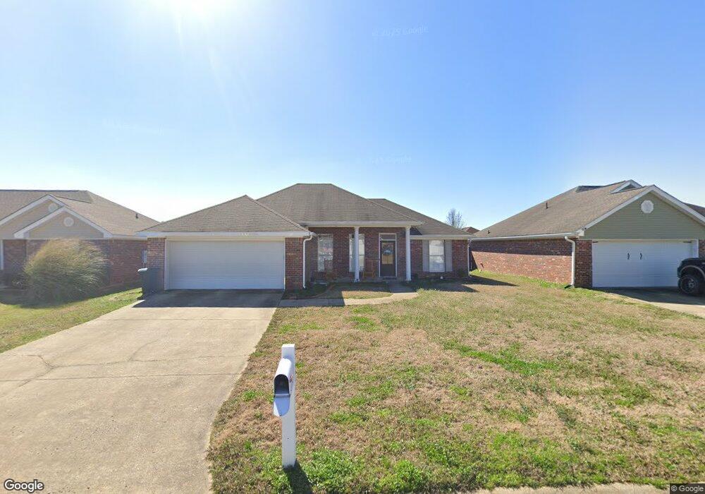
This home is located at 412 Cedar Trace Unit (lot23), Pearl, MS 39208 and is currently estimated at $222,958, approximately $139 per square foot. 412 Cedar Trace Unit (lot23) is a home located in Rankin County with nearby schools including McLaurin Elementary School.
Ownership History
Date
Name
Owned For
Owner Type
Purchase Details
Closed on
Sep 9, 2021
Sold by
Luvene Tymeshia D
Bought by
Gilbert Jaquia
Current Estimated Value
Home Financials for this Owner
Home Financials are based on the most recent Mortgage that was taken out on this home.
Original Mortgage
$177,000
Interest Rate
2.8%
Mortgage Type
Stand Alone Refi Refinance Of Original Loan
Purchase Details
Closed on
May 7, 2019
Sold by
Davis Tina R and Bennett Billy G
Bought by
Luvene Tymeshia D
Home Financials for this Owner
Home Financials are based on the most recent Mortgage that was taken out on this home.
Original Mortgage
$135,815
Interest Rate
4.5%
Mortgage Type
FHA
Purchase Details
Closed on
Aug 21, 2013
Sold by
Rees
Bought by
Davis
Purchase Details
Closed on
Jun 3, 2009
Bought by
Rees Charlene S
Home Financials for this Owner
Home Financials are based on the most recent Mortgage that was taken out on this home.
Original Mortgage
$129,731
Interest Rate
4.77%
Mortgage Type
New Conventional
Purchase Details
Closed on
Sep 26, 2007
Sold by
Massey J Gary
Bought by
Deutsche Bank National Trust Company
Create a Home Valuation Report for This Property
The Home Valuation Report is an in-depth analysis detailing your home's value as well as a comparison with similar homes in the area
Home Values in the Area
Average Home Value in this Area
Purchase History
| Date | Buyer | Sale Price | Title Company |
|---|---|---|---|
| Gilbert Jaquia | -- | None Available | |
| Luvene Tymeshia D | -- | -- | |
| Davis | -- | -- | |
| Rees Charlene S | -- | -- | |
| Deutsche Bank National Trust Company | $106,123 | -- |
Source: Public Records
Mortgage History
| Date | Status | Borrower | Loan Amount |
|---|---|---|---|
| Previous Owner | Gilbert Jaquia | $177,000 | |
| Previous Owner | Luvene Tymeshia D | $135,815 | |
| Previous Owner | Rees Charlene S | $129,731 |
Source: Public Records
Tax History Compared to Growth
Tax History
| Year | Tax Paid | Tax Assessment Tax Assessment Total Assessment is a certain percentage of the fair market value that is determined by local assessors to be the total taxable value of land and additions on the property. | Land | Improvement |
|---|---|---|---|---|
| 2024 | $1,770 | $17,934 | $0 | $0 |
| 2023 | $1,760 | $17,822 | $0 | $0 |
| 2022 | $1,733 | $17,822 | $0 | $0 |
| 2021 | $855 | $11,881 | $0 | $0 |
| 2020 | $855 | $11,881 | $0 | $0 |
| 2019 | $767 | $10,672 | $0 | $0 |
| 2018 | $1,569 | $16,008 | $0 | $0 |
| 2017 | $1,569 | $16,008 | $0 | $0 |
| 2016 | $663 | $10,353 | $0 | $0 |
| 2015 | $663 | $10,353 | $0 | $0 |
| 2014 | $641 | $10,353 | $0 | $0 |
| 2013 | -- | $10,353 | $0 | $0 |
Source: Public Records
Map
Nearby Homes
- 406 Cedar Way
- 407 Cedar Trace
- 503 Cedar Ct
- 505 Cedar Ct
- 504 Cedar Ct
- 506 Cedar Ct
- 505 Cedar Hill Dr
- 503 Cedar Hill Dr
- ALDRIDGE Plan at Cedar Lane
- FREEPORT Plan at Cedar Lane
- 506 Cedar Hill Dr
- 504 Cedar Hill Dr
- 406 Cedar Hill Dr
- 127 Cedar Ridge Blvd
- 103 Cedar Ridge Blvd
- 0 Jamison Ct Unit 4108269
- 313 Cedar Crest Dr
- 508 Ridgecrest Dr
- 315 Cedar Crest Dr
- 00 Whitfield Rd
- 412 Cedar Trace None
- 412 Cedar Trace None Unit (lot23)
- 412 Cedar Trace
- 410 Cedar Trace
- 414 Cedar Trace None
- 410 Cedar Trace None
- 410 Cedar Trace None Unit (Lot 22)
- 414 Cedar Trace
- 313 Cedar Grove Ln
- 313 Cedar Grove Ln
- 408 Cedar Trace
- 408 Cedar Trace Unit (LOT 21)
- 315 Cedar Grove Ln
- 311 Cedar Grove Ln
- 416 Cedar Trace
- 409 Cedar Trace
- 309 Cedar Grove Ln
- 309 Cedar Grove Ln Unit ( Lot 100 )
- 309 Cedar Grove Ln
- 317 Cedar Grove Ln