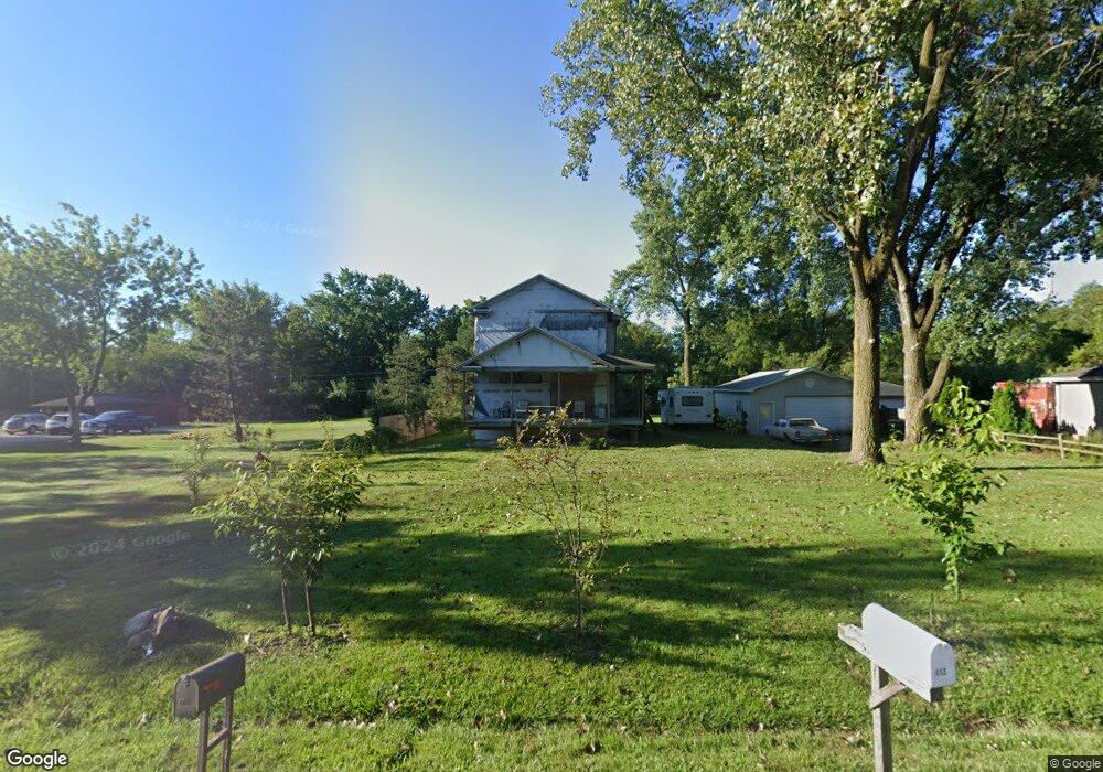
412 Connor Ave Lockport, IL 60441
South Lockport NeighborhoodEstimated Value: $211,918 - $243,000
Studio
--
Bath
738
Sq Ft
$300/Sq Ft
Est. Value
About This Home
This home is located at 412 Connor Ave, Lockport, IL 60441 and is currently estimated at $221,730, approximately $300 per square foot. 412 Connor Ave is a home located in Will County with nearby schools including Fairmont School, Lockport Township High School East, and Saint Dennis School.
Ownership History
Date
Name
Owned For
Owner Type
Purchase Details
Closed on
Jun 8, 2021
Sold by
Adelman Keith
Bought by
Sanchez Abraham and Costilla Maria
Current Estimated Value
Purchase Details
Closed on
Dec 27, 1995
Sold by
Hoendervoogt Jay and Latka Zygmunt
Bought by
Adelman Keith
Purchase Details
Closed on
Dec 19, 1995
Sold by
First National Bank Of Lockport
Bought by
Latka Hoendervoogt and Latka Zygmunt
Create a Home Valuation Report for This Property
The Home Valuation Report is an in-depth analysis detailing your home's value as well as a comparison with similar homes in the area
Home Values in the Area
Average Home Value in this Area
Purchase History
| Date | Buyer | Sale Price | Title Company |
|---|---|---|---|
| Sanchez Abraham | $45,000 | Boetto Paul V | |
| Adelman Keith | $45,000 | -- | |
| Latka Hoendervoogt | -- | -- |
Source: Public Records
Tax History
| Year | Tax Paid | Tax Assessment Tax Assessment Total Assessment is a certain percentage of the fair market value that is determined by local assessors to be the total taxable value of land and additions on the property. | Land | Improvement |
|---|---|---|---|---|
| 2024 | $4,424 | $52,522 | $31,493 | $21,029 |
| 2023 | $4,424 | $47,152 | $28,273 | $18,879 |
| 2022 | $3,714 | $41,036 | $24,607 | $16,429 |
| 2021 | $3,041 | $38,564 | $23,125 | $15,439 |
| 2020 | $2,987 | $37,296 | $22,365 | $14,931 |
| 2019 | $2,831 | $35,352 | $21,199 | $14,153 |
| 2018 | $2,549 | $32,088 | $19,242 | $12,846 |
| 2017 | $2,329 | $29,127 | $17,466 | $11,661 |
| 2016 | $2,054 | $25,851 | $15,501 | $10,350 |
| 2015 | $1,820 | $22,566 | $13,531 | $9,035 |
| 2014 | $1,820 | $21,289 | $12,765 | $8,524 |
| 2013 | $1,820 | $23,140 | $13,875 | $9,265 |
Source: Public Records
Map
Nearby Homes
- 418 Connor Ave
- 304 Dell Park Ave
- 302 Hughes Ave
- 403 North Ave
- 407 North Ave
- 2209-11 S State St
- 2021 Princess Ct
- 2009 Princess Ct
- 2005 Princess Ct
- 308 Dellwood Ave
- 101 Dellwood Ave
- 216 Dellwood Ave
- 217 Riley Ave
- 136 W 18th St
- 1709 S State St
- 2141 California Ave
- 17558 W Windemere Cir
- 2215 Fairview Ave
- 1505 East St
- 219 Reverend Walton Dr
- 410 Connor Ave
- 414 Connor Ave
- 416 Connor Ave
- 408 Connor Ave
- 413 Connor Ave
- 415 Connor Ave Unit 1
- 411 Connor Ave
- 406 Connor Ave
- 417 Connor Ave
- 429 Bruce Rd
- 404 Connor Ave Unit 1
- 407 Connor Ave
- 420 Connor Ave
- 420 Connor Ave
- 2660 Brown St
- 425 Bruce Rd
- 425 Bruce Rd
- 421 Bruce Rd
- 405 Connor Ave
- 422 Connor Ave
Your Personal Tour Guide
Ask me questions while you tour the home.