Estimated Value: $166,000 - $173,000
3
Beds
2
Baths
1,174
Sq Ft
$144/Sq Ft
Est. Value
About This Home
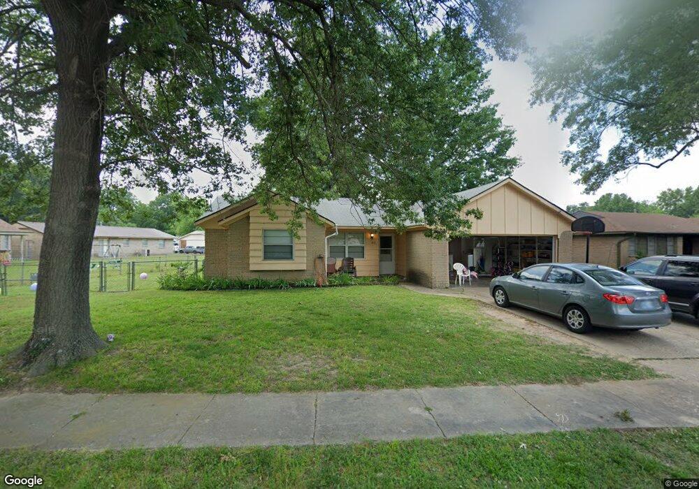
This home is located at 412 Lanternwick Ln, Pryor, OK 74361 and is currently estimated at $169,105, approximately $144 per square foot. 412 Lanternwick Ln is a home located in Mayes County with nearby schools including Pryor Middle School, Pryor High School, and William Bradford Christian School.
Ownership History
Date
Name
Owned For
Owner Type
Purchase Details
Closed on
Mar 16, 2004
Sold by
Washington Mutual
Bought by
Ingram Cw
Current Estimated Value
Purchase Details
Closed on
Oct 2, 2003
Sold by
Butler Mark and Butler Tammy
Bought by
Secretary Of Veterans Aff
Purchase Details
Closed on
Apr 13, 2000
Sold by
Shearer James J
Bought by
Butler Mark and Butler Tammy
Purchase Details
Closed on
Aug 19, 1998
Sold by
Ables Bobbie J and Ables Tari
Bought by
Shearer James J
Purchase Details
Closed on
Apr 10, 1992
Sold by
Whitson Johnny T
Bought by
Ables Bobbie T
Purchase Details
Closed on
Aug 21, 1991
Sold by
Miller James
Bought by
Whitson Johnny
Create a Home Valuation Report for This Property
The Home Valuation Report is an in-depth analysis detailing your home's value as well as a comparison with similar homes in the area
Home Values in the Area
Average Home Value in this Area
Purchase History
| Date | Buyer | Sale Price | Title Company |
|---|---|---|---|
| Ingram Cw | $48,000 | -- | |
| Washington Mutual Home | -- | -- | |
| Secretary Of Veterans Aff | -- | -- | |
| Butler Mark | $77,000 | -- | |
| Shearer James J | $67,500 | -- | |
| Ables Bobbie T | $41,000 | -- | |
| Whitson Johnny | $40,600 | -- |
Source: Public Records
Tax History Compared to Growth
Tax History
| Year | Tax Paid | Tax Assessment Tax Assessment Total Assessment is a certain percentage of the fair market value that is determined by local assessors to be the total taxable value of land and additions on the property. | Land | Improvement |
|---|---|---|---|---|
| 2025 | $1,139 | $13,486 | $2,992 | $10,494 |
| 2023 | $1,085 | $12,233 | $2,740 | $9,493 |
| 2022 | $974 | $11,651 | $2,632 | $9,019 |
| 2021 | $937 | $11,096 | $2,485 | $8,611 |
| 2020 | $875 | $10,567 | $2,239 | $8,328 |
| 2019 | $859 | $10,064 | $1,959 | $8,105 |
| 2018 | $814 | $9,585 | $1,859 | $7,726 |
| 2017 | $721 | $9,129 | $1,705 | $7,424 |
| 2016 | $693 | $8,694 | $1,512 | $7,182 |
| 2015 | $705 | $8,694 | $1,512 | $7,182 |
| 2014 | $705 | $8,694 | $1,512 | $7,182 |
Source: Public Records
Map
Nearby Homes
- 520 Ridgewood Dr
- 617 Ridgewood Dr
- 625 Grove Crest Rd
- 245 SE 17th St
- 321 SE 14th St
- 225 SE 15th Ct
- 0 SE 13th St
- 1300 Veyda St
- 1012 Colonial Dr
- 1208 Thurman St
- 412 Cobblestone Ct
- 101 Honeysuckle Ln
- 1200 SE 15th St
- 315 Savannah Park
- 1133 SE 14th St
- 0 N Highway 69 Unit 2537534
- 1220 SE 14th St
- 1496 S 4275
- 1516 Merlin Cir
- 600 S Adair St
- 408 Lanternwick Ln
- 1800 Surrey Dr
- 1804 Surrey Dr
- 404 Lanternwick Ln
- 1808 Surrey Dr
- 404 Lanterwick
- 1733 Bedford Dr
- 1728 Surrey Dr
- 1736 Bedford Dr
- 1812 Surrey Dr
- 0 Surrey Dr
- 1729 Bedford Dr
- 1801 Southridge Dr
- 1805 Southridge Dr
- 1724 Surrey Dr
- 1732 Bedford Dr
- 1805 Surrey Dr
- 1801 Surrey Dr
- 1805 SE Surrey
- 1809 Southridge Dr