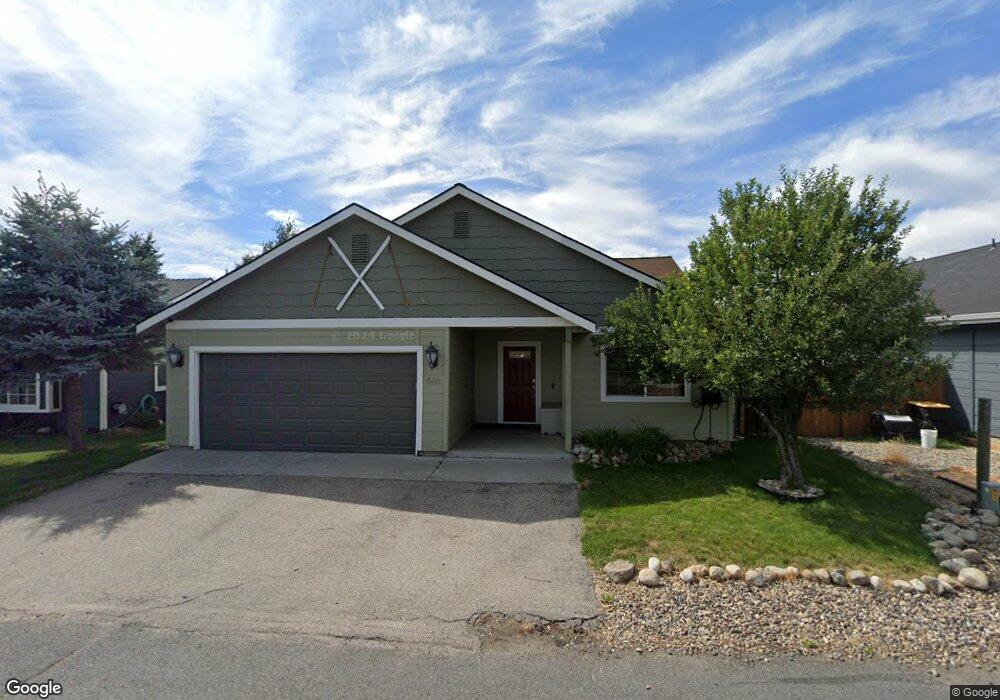
412 Margaret Way McCall, ID 83638
Estimated Value: $395,000 - $676,000
3
Beds
2
Baths
1,217
Sq Ft
$387/Sq Ft
Est. Value
About This Home
This home is located at 412 Margaret Way, McCall, ID 83638 and is currently estimated at $470,442, approximately $386 per square foot. 412 Margaret Way is a home with nearby schools including McCall-Donnelly High School, Mountain Life Education, and The North Fork School.
Ownership History
Date
Name
Owned For
Owner Type
Purchase Details
Closed on
Jan 26, 2021
Sold by
Keller Wesley J
Bought by
Stroud Nathan K and Stroud Morgan A
Current Estimated Value
Home Financials for this Owner
Home Financials are based on the most recent Mortgage that was taken out on this home.
Original Mortgage
$299,250
Outstanding Balance
$267,182
Interest Rate
2.6%
Mortgage Type
New Conventional
Estimated Equity
$203,260
Purchase Details
Closed on
Dec 23, 2005
Sold by
Thompson Kristin N
Bought by
Keller Wesley J
Home Financials for this Owner
Home Financials are based on the most recent Mortgage that was taken out on this home.
Original Mortgage
$157,960
Interest Rate
6.36%
Mortgage Type
New Conventional
Create a Home Valuation Report for This Property
The Home Valuation Report is an in-depth analysis detailing your home's value as well as a comparison with similar homes in the area
Home Values in the Area
Average Home Value in this Area
Purchase History
| Date | Buyer | Sale Price | Title Company |
|---|---|---|---|
| Stroud Nathan K | -- | Amerititle Cascade | |
| Keller Wesley J | -- | -- |
Source: Public Records
Mortgage History
| Date | Status | Borrower | Loan Amount |
|---|---|---|---|
| Open | Stroud Nathan K | $299,250 | |
| Previous Owner | Keller Wesley J | $157,960 |
Source: Public Records
Tax History Compared to Growth
Tax History
| Year | Tax Paid | Tax Assessment Tax Assessment Total Assessment is a certain percentage of the fair market value that is determined by local assessors to be the total taxable value of land and additions on the property. | Land | Improvement |
|---|---|---|---|---|
| 2025 | $1,144 | $380,594 | $104,228 | $276,366 |
| 2023 | $1,144 | $410,395 | $101,193 | $309,202 |
| 2022 | $1,359 | $377,380 | $96,949 | $280,431 |
| 2021 | $2,192 | $277,643 | $31,971 | $245,672 |
| 2020 | $1,401 | $151,804 | $26,110 | $125,694 |
| 2019 | $1,622 | $164,328 | $43,947 | $120,381 |
| 2018 | $1,422 | $132,028 | $33,826 | $98,202 |
| 2017 | $1,654 | $146,212 | $48,073 | $98,139 |
| 2016 | $1,598 | $137,210 | $36,307 | $100,903 |
| 2015 | $1,618 | $134,056 | $0 | $0 |
| 2013 | -- | $114,626 | $0 | $0 |
Source: Public Records
Map
Nearby Homes
- 413 S 3rd St
- Lot A Krahn Ln
- Lot B Krahn Ln
- 503 S Third St
- 293 May Rd
- 571 Krahn Ln
- 304 Mcbride St Unit 307
- 304 Mcbride St Unit 107
- 162 Fox Ln
- TBD Mcbride St
- Lot 19 To Be Determined Unit 19
- Lot 28 To Be Determined Unit 28
- Lot 11 To Be Determined Unit 11
- Lot 18 To Be Determined Unit 18
- Lot 29 To Be Determined Unit 29
- Lot 20 To Be Determined Unit 20
- Lot 8 To Be Determined Unit 8
- TBD Sunbridge Dr
- Lot 33 To Be Determined Unit 33
- Lot 7 To Be Determined Unit 7
- 414 Margaret Way
- 410 Margaret Way
- 413 Virginia Blvd
- 415 Virginia Blvd
- 411 Virginia Blvd
- 416 Margaret Way
- 417 Virginia Blvd
- 408 Margaret Way
- 409 Margaret Way
- 439 Virginia St Unit 18
- 439 Virginia St
- 520 Willey Ln
- 409 Virginia Blvd
- TBD Willie Ln Unit 2
- 414 Virginia Blvd
- 416 Virginia Blvd
- 448 Virginia Blvd
- 418 Virginia Blvd
- 412 Virginia Blvd
- 407 Virginia Blvd