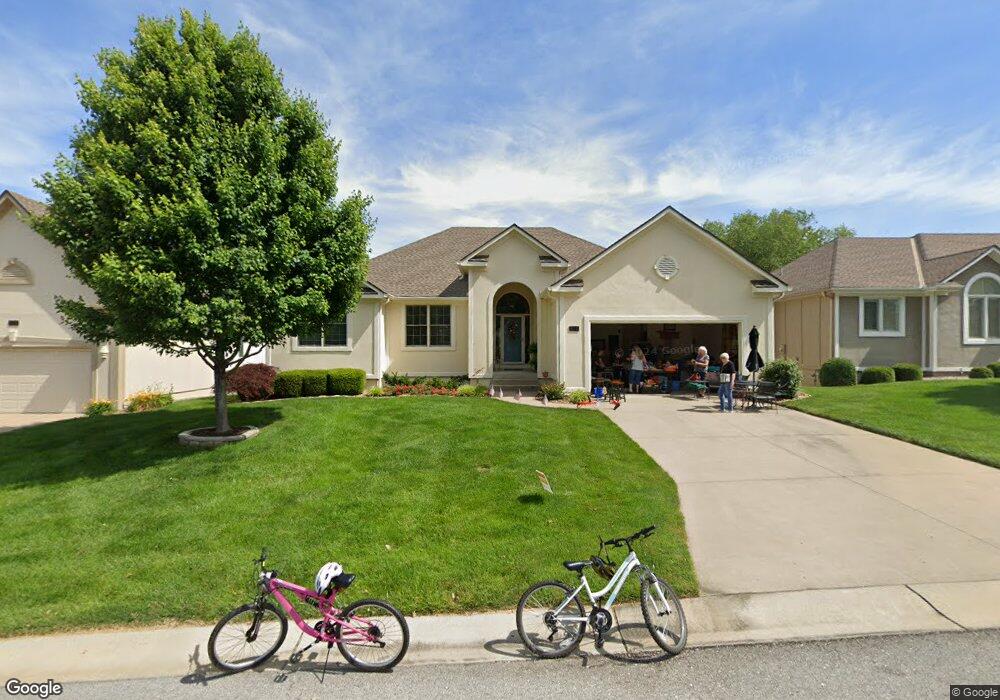
412 NE Thornberry Place Lees Summit, MO 64064
Chapel Ridge NeighborhoodEstimated Value: $398,697 - $457,000
3
Beds
2
Baths
1,940
Sq Ft
$224/Sq Ft
Est. Value
About This Home
This home is located at 412 NE Thornberry Place, Lees Summit, MO 64064 and is currently estimated at $433,924, approximately $223 per square foot. 412 NE Thornberry Place is a home located in Jackson County with nearby schools including Chapel Lakes Elementary School, Delta Woods Middle School, and Blue Springs South High School.
Ownership History
Date
Name
Owned For
Owner Type
Purchase Details
Closed on
Feb 18, 2016
Sold by
Koirtyohann Barbara J
Bought by
Koirtyohann Barbara J and Barbara J Koirtyohann Trust
Current Estimated Value
Purchase Details
Closed on
Aug 21, 1997
Sold by
Lane Development & Building Inc
Bought by
Koirtyohann Louis D and Koirtyohann Barbara J
Home Financials for this Owner
Home Financials are based on the most recent Mortgage that was taken out on this home.
Original Mortgage
$77,900
Interest Rate
7.02%
Mortgage Type
Purchase Money Mortgage
Create a Home Valuation Report for This Property
The Home Valuation Report is an in-depth analysis detailing your home's value as well as a comparison with similar homes in the area
Home Values in the Area
Average Home Value in this Area
Purchase History
| Date | Buyer | Sale Price | Title Company |
|---|---|---|---|
| Koirtyohann Barbara J | -- | None Available | |
| Koirtyohann Louis D | -- | -- |
Source: Public Records
Mortgage History
| Date | Status | Borrower | Loan Amount |
|---|---|---|---|
| Closed | Koirtyohann Louis D | $77,900 |
Source: Public Records
Tax History Compared to Growth
Tax History
| Year | Tax Paid | Tax Assessment Tax Assessment Total Assessment is a certain percentage of the fair market value that is determined by local assessors to be the total taxable value of land and additions on the property. | Land | Improvement |
|---|---|---|---|---|
| 2025 | $5,456 | $72,869 | $8,932 | $63,937 |
| 2024 | $5,358 | $71,250 | $11,052 | $60,198 |
| 2023 | $5,358 | $71,250 | $11,052 | $60,198 |
| 2022 | $4,679 | $55,100 | $5,738 | $49,362 |
| 2021 | $4,675 | $55,100 | $5,738 | $49,362 |
| 2020 | $4,297 | $50,084 | $5,738 | $44,346 |
| 2019 | $4,165 | $50,084 | $5,738 | $44,346 |
| 2018 | $3,933 | $45,885 | $5,397 | $40,488 |
| 2017 | $3,547 | $45,885 | $5,397 | $40,488 |
| 2016 | $3,547 | $41,515 | $6,137 | $35,378 |
| 2014 | $3,293 | $38,297 | $6,131 | $32,166 |
Source: Public Records
Map
Nearby Homes
- 4004 NE Independence Ave
- 4005 NE Channel Dr
- 3723 NE Chapel Dr
- 205 NE Shoreview Dr
- 203 NE Shoreview Dr
- 208 NE Landings Cir
- 214 NE Landings Cir
- 3709 NE Grant St
- 3607 NE Stanton St
- 712 NE Ashmont Place
- 793 NE Algonquin St Unit A
- 222 NE Bayview Dr
- 3743 NE Woodland Ct
- 801 NE Lone Hill Dr
- 824 NE Algonquin St Unit A
- 327 NE Landings Dr
- 4015 NE Sagamore Dr
- 405 NE Grant Ct
- 3524 NE Austin Dr
- 4605 NE Dick Howser Cir
- 416 NE Thornberry Place
- 408 NE Thornberry Place
- 4009 NE Bittersweet Dr
- 420 NE Thornberry Place
- 415 NE Wild Rose Ct
- 417 NE Thornberry Place
- 4013 NE Bittersweet Dr
- 411 NE Wild Rose Ct
- 413 NE Thornberry Place
- 409 NE Thornberry Place
- 424 NE Thornberry Place
- 421 NE Thornberry Place
- 4017 NE Bittersweet Dr
- 405 NE Thornberry Place
- 4004 NE Bittersweet Dr
- 409 NE Wild Rose Ct
- 4008 NE Bittersweet Dr
- 4000 NE Bittersweet Dr
- 417 NE Wild Rose Ct
- 4012 NE Bittersweet Dr