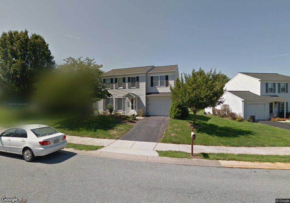
412 Sturbridge Dr Lititz, PA 17543
Estimated Value: $397,478 - $480,000
4
Beds
2
Baths
1,870
Sq Ft
$228/Sq Ft
Est. Value
About This Home
This home is located at 412 Sturbridge Dr, Lititz, PA 17543 and is currently estimated at $426,370, approximately $228 per square foot. 412 Sturbridge Dr is a home located in Lancaster County with nearby schools including Warwick Senior High School, Lititz Christian School, and Linden Hall.
Ownership History
Date
Name
Owned For
Owner Type
Purchase Details
Closed on
Jun 29, 2011
Sold by
Fox George W
Bought by
Fox George W and Fox Koren
Current Estimated Value
Home Financials for this Owner
Home Financials are based on the most recent Mortgage that was taken out on this home.
Original Mortgage
$163,500
Interest Rate
4.58%
Mortgage Type
New Conventional
Create a Home Valuation Report for This Property
The Home Valuation Report is an in-depth analysis detailing your home's value as well as a comparison with similar homes in the area
Home Values in the Area
Average Home Value in this Area
Purchase History
| Date | Buyer | Sale Price | Title Company |
|---|---|---|---|
| Fox George W | -- | None Available |
Source: Public Records
Mortgage History
| Date | Status | Borrower | Loan Amount |
|---|---|---|---|
| Closed | Fox George W | $163,500 |
Source: Public Records
Tax History Compared to Growth
Tax History
| Year | Tax Paid | Tax Assessment Tax Assessment Total Assessment is a certain percentage of the fair market value that is determined by local assessors to be the total taxable value of land and additions on the property. | Land | Improvement |
|---|---|---|---|---|
| 2025 | $4,518 | $199,700 | $54,800 | $144,900 |
| 2024 | $4,518 | $199,700 | $54,800 | $144,900 |
| 2023 | $4,500 | $199,700 | $54,800 | $144,900 |
| 2022 | $4,250 | $199,700 | $54,800 | $144,900 |
| 2021 | $4,250 | $199,700 | $54,800 | $144,900 |
| 2020 | $4,250 | $199,700 | $54,800 | $144,900 |
| 2019 | $4,250 | $199,700 | $54,800 | $144,900 |
| 2018 | $3,155 | $199,700 | $54,800 | $144,900 |
| 2017 | $3,838 | $153,700 | $38,000 | $115,700 |
| 2016 | $3,838 | $141,700 | $38,000 | $103,700 |
| 2015 | $898 | $141,700 | $38,000 | $103,700 |
| 2014 | $2,679 | $141,700 | $38,000 | $103,700 |
Source: Public Records
Map
Nearby Homes
- 411 Danbury Dr
- 28 Cardiff Ct
- 47 W Lincoln Ave
- 34 E Market St
- 343 Coventry Ln
- LOT 14 Thaton Rd
- LOT 12 Thaton Rd
- 7 Brookfield Rd
- 2 Brookfield Rd
- 28 Brookview Dr
- 210 Noble St
- 133 S Spruce St
- 44 E Center St
- 256 Cedar St S
- 501 E New St
- 668 Snyder Hill Rd
- 510 Bluebird Rd
- 671 Snyder Hill Rd
- 601 E Main St
- 213 Barkay Crossing
- 416 Sturbridge Dr
- 408 Sturbridge Dr
- 420 Sturbridge Dr
- 404 Sturbridge Dr
- 111 Arrowhead Dr
- 121 Arrowhead Dr
- 413 Sturbridge Dr
- 417 Springfield Ct
- 101 Arrowhead Dr
- 424 Sturbridge Dr
- 131 Arrowhead Dr
- 415 Danbury Dr
- 457 Sturbridge Dr
- 409 Sturbridge Dr
- 461 Sturbridge Dr
- 432 Springfield Ct
- 405 Sturbridge Dr
- 421 Springfield Ct
- 407 Danbury Dr
- 81 Arrowhead Dr