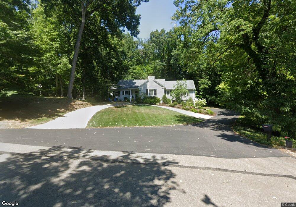
412 Woodhill Dr N Ashland, OH 44805
Estimated Value: $329,397 - $431,000
3
Beds
2
Baths
2,014
Sq Ft
$183/Sq Ft
Est. Value
About This Home
This home is located at 412 Woodhill Dr N, Ashland, OH 44805 and is currently estimated at $368,599, approximately $183 per square foot. 412 Woodhill Dr N is a home located in Ashland County with nearby schools including Ashland High School, Ashland County Community Academy, and St. Edward Elementary School.
Ownership History
Date
Name
Owned For
Owner Type
Purchase Details
Closed on
Jun 23, 2014
Sold by
Keidan Clemy A
Bought by
Strauss Mark A Te and Strauss Kim C Te
Current Estimated Value
Purchase Details
Closed on
Oct 13, 2009
Sold by
Strauss Mark A
Bought by
Strauss Mark A and Strauss Kim C
Purchase Details
Closed on
Sep 15, 2009
Sold by
Strauss Ruth J
Bought by
Keidan Clemy A and Strauss Mark A
Purchase Details
Closed on
Jan 1, 1990
Bought by
Strauss Ruth J
Create a Home Valuation Report for This Property
The Home Valuation Report is an in-depth analysis detailing your home's value as well as a comparison with similar homes in the area
Home Values in the Area
Average Home Value in this Area
Purchase History
| Date | Buyer | Sale Price | Title Company |
|---|---|---|---|
| Strauss Mark A Te | -- | -- | |
| Strauss Mark A | -- | -- | |
| Keidan Clemy A | -- | -- | |
| Strauss Ruth J | -- | -- |
Source: Public Records
Tax History Compared to Growth
Tax History
| Year | Tax Paid | Tax Assessment Tax Assessment Total Assessment is a certain percentage of the fair market value that is determined by local assessors to be the total taxable value of land and additions on the property. | Land | Improvement |
|---|---|---|---|---|
| 2024 | $3,251 | $94,210 | $29,670 | $64,540 |
| 2023 | $3,251 | $94,210 | $29,670 | $64,540 |
| 2022 | $2,930 | $67,290 | $21,190 | $46,100 |
| 2021 | $2,942 | $67,290 | $21,190 | $46,100 |
| 2020 | $2,785 | $67,290 | $21,190 | $46,100 |
| 2019 | $2,772 | $61,990 | $21,430 | $40,560 |
| 2018 | $2,796 | $61,990 | $21,430 | $40,560 |
| 2017 | $2,665 | $61,990 | $21,430 | $40,560 |
| 2016 | $2,665 | $56,350 | $19,480 | $36,870 |
| 2015 | $2,642 | $56,350 | $19,480 | $36,870 |
| 2013 | $2,534 | $53,270 | $19,380 | $33,890 |
Source: Public Records
Map
Nearby Homes
- 426 Woodhill Dr N
- 1701 Woodhill Dr E
- 440 Woodhill Dr N
- 429 Woodhill Dr N
- 340 N Countryside Dr
- 448 Woodhill Dr N
- 439 Woodhill Dr N
- 330 N Countryside Dr
- 1726 Woodhill Dr E
- 458 Woodhill Dr N
- 312 N Countryside Dr
- 457 Woodhill Dr N
- 1738 Woodhill Dr E
- 1727 Woodhill Dr W
- 329 N Countryside Dr
- 1745 Woodhill Dr E
- 1730 Upland Dr
- 464 Woodhill Dr N
- 298 N Countryside Dr
- 434 S Countryside Dr