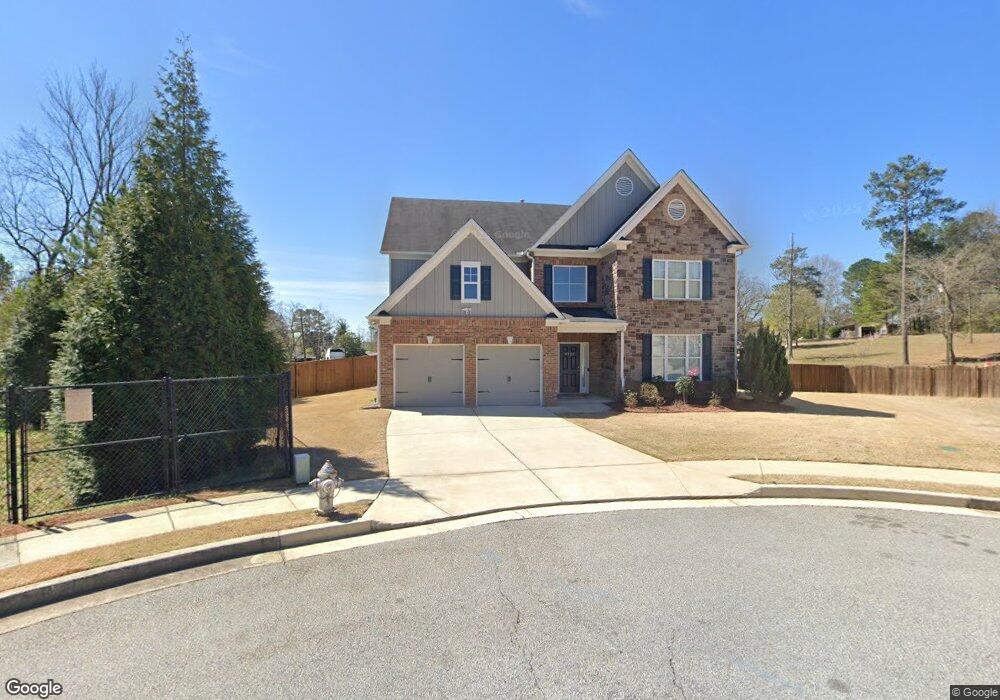
4122 Bunker Dr SW Austell, GA 30106
Estimated Value: $529,000 - $604,073
5
Beds
4
Baths
4,282
Sq Ft
$135/Sq Ft
Est. Value
About This Home
This home is located at 4122 Bunker Dr SW, Austell, GA 30106 and is currently estimated at $576,268, approximately $134 per square foot. 4122 Bunker Dr SW is a home located in Cobb County with nearby schools including Clarkdale Elementary School, Cooper Middle School, and South Cobb High School.
Ownership History
Date
Name
Owned For
Owner Type
Purchase Details
Closed on
Jan 10, 2020
Sold by
Nguyen Tuong M
Bought by
Moultrie Richard M and Moultrie Courtney Da
Current Estimated Value
Home Financials for this Owner
Home Financials are based on the most recent Mortgage that was taken out on this home.
Original Mortgage
$307,264
Outstanding Balance
$271,584
Interest Rate
3.73%
Mortgage Type
New Conventional
Estimated Equity
$304,684
Purchase Details
Closed on
Jun 23, 2016
Sold by
Venture Homes Inc
Bought by
Nguyen Tuong M and Troung Giang Lam
Create a Home Valuation Report for This Property
The Home Valuation Report is an in-depth analysis detailing your home's value as well as a comparison with similar homes in the area
Home Values in the Area
Average Home Value in this Area
Purchase History
| Date | Buyer | Sale Price | Title Company |
|---|---|---|---|
| Moultrie Richard M | $318,000 | -- | |
| Nguyen Tuong M | -- | -- |
Source: Public Records
Mortgage History
| Date | Status | Borrower | Loan Amount |
|---|---|---|---|
| Open | Moultrie Richard M | $307,264 |
Source: Public Records
Tax History Compared to Growth
Tax History
| Year | Tax Paid | Tax Assessment Tax Assessment Total Assessment is a certain percentage of the fair market value that is determined by local assessors to be the total taxable value of land and additions on the property. | Land | Improvement |
|---|---|---|---|---|
| 2025 | $7,178 | $288,716 | $34,000 | $254,716 |
| 2024 | $7,183 | $288,716 | $34,000 | $254,716 |
| 2023 | $4,874 | $207,292 | $20,000 | $187,292 |
| 2022 | $4,443 | $160,992 | $20,000 | $140,992 |
| 2021 | $3,587 | $127,200 | $18,040 | $109,160 |
| 2020 | $4,279 | $140,972 | $20,000 | $120,972 |
| 2019 | $4,068 | $134,024 | $20,000 | $114,024 |
| 2018 | $3,746 | $123,436 | $22,000 | $101,436 |
| 2017 | $3,436 | $119,520 | $24,000 | $95,520 |
| 2016 | $460 | $16,000 | $16,000 | $0 |
Source: Public Records
Map
Nearby Homes
- 4099 Bunker Dr SW
- 4160 Ewing Rd
- 2965 Dr
- 2774 Eloquent Ln
- 2881 Golden Club Bend
- 2473 Greenside Ct
- 3989 Flint Hill Rd
- 2867 Ash St SW
- 2402 Greenside Ct
- 2539 Dogwood Hills Ct
- 2300 Anderson Mill Rd
- 4280 Creek Crest Trail
- 4550 Glory Dr
- 3832 Abbott Ln Unit 1
- 3916 Abbott Way Unit 2
- 4287 Keats Ct
- 3807 Abbott Ln SW Unit 15
- 2373 Buckley Ct
- 3237 Abbott Dr SW Unit 7
- 3235 Abbott Dr Unit 7
- 4122 Bunker Dr SW
- 4267 Ewing Rd
- 4118 Bunker Dr SW
- 4118 Bunker Dr SW
- 4275 Ewing Rd
- 4114 Bunker Dr SW
- 435 Sumac Dr
- 2784 Syble Dr
- 4110 Bunker Dr SW
- 4109 Bunker Dr SW
- 4272 Ewing Rd
- 4274 Ewing Rd
- 4301 Ewing Rd
- 4260 Ewing Rd
- 4103 Bunker Dr SW
- 4060 Broadmoor Ct SW
- 4064 Broadmoor Ct SW
- 2774 Syble Dr
- 4298 Ewing Rd
- 4056 Broadmoor Ct