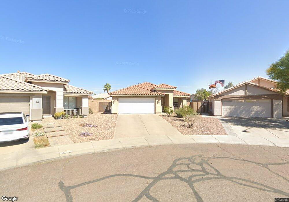
4122 W Bloomfield Rd Phoenix, AZ 85029
North Mountain Village NeighborhoodEstimated Value: $412,336 - $438,000
3
Beds
2
Baths
1,530
Sq Ft
$275/Sq Ft
Est. Value
About This Home
This home is located at 4122 W Bloomfield Rd, Phoenix, AZ 85029 and is currently estimated at $421,084, approximately $275 per square foot. 4122 W Bloomfield Rd is a home located in Maricopa County with nearby schools including Chaparral Elementary School, Desert Foothills Middle School, and Moon Valley High School.
Ownership History
Date
Name
Owned For
Owner Type
Purchase Details
Closed on
Aug 22, 2003
Sold by
Parkinson Gregory J
Bought by
Martin Rhonda L
Current Estimated Value
Home Financials for this Owner
Home Financials are based on the most recent Mortgage that was taken out on this home.
Original Mortgage
$137,750
Outstanding Balance
$59,554
Interest Rate
5.37%
Mortgage Type
New Conventional
Estimated Equity
$361,530
Purchase Details
Closed on
Feb 15, 1996
Sold by
Kaufman & Broad Home Sales Of Az Inc
Bought by
Parkinson Gregory J
Home Financials for this Owner
Home Financials are based on the most recent Mortgage that was taken out on this home.
Original Mortgage
$91,950
Interest Rate
7.68%
Mortgage Type
New Conventional
Create a Home Valuation Report for This Property
The Home Valuation Report is an in-depth analysis detailing your home's value as well as a comparison with similar homes in the area
Home Values in the Area
Average Home Value in this Area
Purchase History
| Date | Buyer | Sale Price | Title Company |
|---|---|---|---|
| Martin Rhonda L | $145,000 | Lawyers Title Insurance Corp | |
| Parkinson Gregory J | $114,967 | First American Title | |
| Kaufman & Broad Home Sales Of Az Inc | -- | First American Title |
Source: Public Records
Mortgage History
| Date | Status | Borrower | Loan Amount |
|---|---|---|---|
| Open | Martin Rhonda L | $137,750 | |
| Previous Owner | Parkinson Gregory J | $91,950 |
Source: Public Records
Tax History
| Year | Tax Paid | Tax Assessment Tax Assessment Total Assessment is a certain percentage of the fair market value that is determined by local assessors to be the total taxable value of land and additions on the property. | Land | Improvement |
|---|---|---|---|---|
| 2025 | $1,976 | $17,723 | -- | -- |
| 2024 | $1,862 | $16,879 | -- | -- |
| 2023 | $1,862 | $31,380 | $6,270 | $25,110 |
| 2022 | $1,796 | $24,260 | $4,850 | $19,410 |
| 2021 | $1,842 | $22,030 | $4,400 | $17,630 |
| 2020 | $1,792 | $20,460 | $4,090 | $16,370 |
| 2019 | $1,760 | $19,880 | $3,970 | $15,910 |
| 2018 | $1,710 | $18,400 | $3,680 | $14,720 |
| 2017 | $1,705 | $15,910 | $3,180 | $12,730 |
| 2016 | $1,675 | $15,680 | $3,130 | $12,550 |
| 2015 | $1,553 | $15,760 | $3,150 | $12,610 |
Source: Public Records
Map
Nearby Homes
- 12618 N 41st Ave
- 4025 W Wethersfield Rd
- 3935 W Charter Oak Rd
- 3920 W Columbine Dr
- 3923 W Aster Dr
- 12619 N 39th Dr
- 4202 W Aster Dr
- 4008 W Laurel Ln
- 4235 W Aster Dr
- 4411 W Windrose Dr
- 3944 W Wood Dr
- 4310 W Dahlia Dr
- 4107 W Poinsettia Dr
- 3724 W Bloomfield Rd
- 4418 W Desert Hills Dr
- 3933 W Pershing Ave
- 4502 W Columbine Dr
- 4434 W Dahlia Dr
- 4002 W Altadena Ave
- 12649 N Rosewood Ave
- 4126 W Bloomfield Rd
- 4119 W Columbine Dr
- 4123 W Columbine Dr
- 4117 W Columbine Dr
- 4130 W Bloomfield Rd
- 4127 W Columbine Dr
- 12428 N 41st Ave
- 12432 N 41st Ave
- 4115 W Columbine Dr
- 12424 N 41st Ave
- 4131 W Columbine Dr
- 12411 N 41st Dr
- 4134 W Bloomfield Rd
- 12420 N 41st Ave
- 4109 W Columbine Dr
- 4135 W Columbine Dr
- 4127 W Bloomfield Rd
- 12407 N 41st Dr
- 12416 N 41st Ave
- 4138 W Bloomfield Rd
Your Personal Tour Guide
Ask me questions while you tour the home.