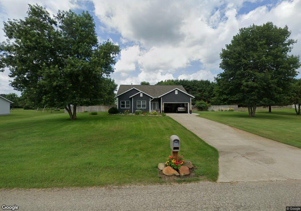
41242 Robin St Mattawan, MI 49071
Estimated Value: $364,000 - $374,000
3
Beds
3
Baths
1,640
Sq Ft
$225/Sq Ft
Est. Value
About This Home
This home is located at 41242 Robin St, Mattawan, MI 49071 and is currently estimated at $369,606, approximately $225 per square foot. 41242 Robin St is a home located in Van Buren County with nearby schools including Paw Paw Early Elementary School, Paw Paw Later Elementary School, and Paw Paw Middle School.
Ownership History
Date
Name
Owned For
Owner Type
Purchase Details
Closed on
Jul 10, 2009
Sold by
Cox Brent H and Cox Vickie S
Bought by
Peterson Erik and Peterson Christy
Current Estimated Value
Home Financials for this Owner
Home Financials are based on the most recent Mortgage that was taken out on this home.
Original Mortgage
$155,750
Outstanding Balance
$101,704
Interest Rate
5.32%
Mortgage Type
Unknown
Estimated Equity
$267,902
Purchase Details
Closed on
Jan 16, 2004
Sold by
Cox Brent H
Bought by
Cox Brent H and Cox Vickie S
Home Financials for this Owner
Home Financials are based on the most recent Mortgage that was taken out on this home.
Original Mortgage
$132,000
Interest Rate
6.12%
Mortgage Type
Stand Alone Refi Refinance Of Original Loan
Purchase Details
Closed on
Oct 30, 1996
Bought by
Cox Brent H
Create a Home Valuation Report for This Property
The Home Valuation Report is an in-depth analysis detailing your home's value as well as a comparison with similar homes in the area
Home Values in the Area
Average Home Value in this Area
Purchase History
| Date | Buyer | Sale Price | Title Company |
|---|---|---|---|
| Peterson Erik | $167,500 | Chicago Title Of Michigan | |
| Cox Brent H | -- | Chicago Title Insurance | |
| Cox Brent H | -- | -- |
Source: Public Records
Mortgage History
| Date | Status | Borrower | Loan Amount |
|---|---|---|---|
| Open | Peterson Erik | $155,750 | |
| Previous Owner | Cox Brent H | $132,000 | |
| Closed | Cox Brent H | $33,000 |
Source: Public Records
Tax History
| Year | Tax Paid | Tax Assessment Tax Assessment Total Assessment is a certain percentage of the fair market value that is determined by local assessors to be the total taxable value of land and additions on the property. | Land | Improvement |
|---|---|---|---|---|
| 2025 | $3,104 | $168,500 | $0 | $0 |
| 2024 | $939 | $161,200 | $0 | $0 |
| 2023 | $894 | $150,800 | $0 | $0 |
| 2022 | $2,815 | $132,400 | $0 | $0 |
| 2021 | $2,756 | $110,900 | $16,000 | $94,900 |
| 2020 | $2,618 | $110,900 | $16,000 | $94,900 |
| 2019 | $2,497 | $101,400 | $101,400 | $0 |
| 2018 | $2,440 | $98,300 | $98,300 | $0 |
| 2017 | $2,392 | $91,900 | $0 | $0 |
| 2016 | $2,377 | $90,000 | $0 | $0 |
| 2015 | $2,113 | $90,000 | $0 | $0 |
| 2014 | $2,074 | $86,800 | $0 | $0 |
| 2013 | -- | $78,200 | $78,200 | $0 |
Source: Public Records
Map
Nearby Homes
- 22185 44th Ave
- 1395 Haven Way
- 1301 Haven Way
- 24271 Thousand Oaks Dr
- 3775 Nia Dr
- 10699 Mystic Heights Trail
- 2109 Toscana St
- 23440 E McGillen Ave Unit Parcel A
- 23440 E McGillen Ave Unit Parcel B
- 58418 Norton St
- 47223 Silver Oaks Blvd
- 22327 Woodhenge Dr
- 0 N 1st St
- 22942 M-43
- 22942 Michigan 43
- 48270 Silver Oaks Blvd
- 48605 Silver Oaks Blvd
- 48405 Silver Oaks W
- 23589 Laurel Glen Ave
- 22889 Red Arrow Hwy
- 41120 Robin St
- 41356 Robin St
- 23093 Canary Ave
- 23092 Blackbird Ave
- 41452 Robin St
- 41008 Robin St
- 41397 Pheasant St
- 23316 Humming Bird Ave
- 23031 Canary Ave
- 23094 Canary Ave
- 23039 Blackbird Ave
- 23030 Blackbird Ave
- 41580 Robin St
- 41525 Pheasant St
- 40930 Robin St
- 23091 Blackbird Ave
- 23032 Canary Ave
- 23390 Humming Bird Ave
- 22979 Canary Ave
- 23029 Blackbird Ave
Your Personal Tour Guide
Ask me questions while you tour the home.