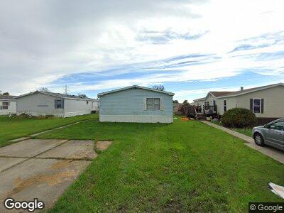
4125 Dove Rd Port Huron, MI 48060
Estimated Value: $98,000
3
Beds
2
Baths
1,904
Sq Ft
$51/Sq Ft
Est. Value
About This Home
This home is located at 4125 Dove Rd, Port Huron, MI 48060 and is currently priced at $98,000, approximately $51 per square foot. 4125 Dove Rd is a home located in St. Clair County with nearby schools including Kimball Elementary School, Central Middle School, and Port Huron High School.
Ownership History
Date
Name
Owned For
Owner Type
Purchase Details
Closed on
Apr 24, 2025
Sold by
Dri Llc
Bought by
Port Of Call Mhp Llc
Current Estimated Value
Home Financials for this Owner
Home Financials are based on the most recent Mortgage that was taken out on this home.
Original Mortgage
$3,276,400
Outstanding Balance
$3,276,400
Interest Rate
6.67%
Mortgage Type
New Conventional
Purchase Details
Closed on
Apr 14, 2010
Sold by
Cali Port Of Call Llc
Bought by
Dri Llc
Home Financials for this Owner
Home Financials are based on the most recent Mortgage that was taken out on this home.
Original Mortgage
$356,250
Interest Rate
5.01%
Mortgage Type
Commercial
Create a Home Valuation Report for This Property
The Home Valuation Report is an in-depth analysis detailing your home's value as well as a comparison with similar homes in the area
Home Values in the Area
Average Home Value in this Area
Purchase History
| Date | Buyer | Sale Price | Title Company |
|---|---|---|---|
| Port Of Call Mhp Llc | -- | None Listed On Document | |
| Dri Llc | -- | Philip R Seaver Title Compan |
Source: Public Records
Mortgage History
| Date | Status | Borrower | Loan Amount |
|---|---|---|---|
| Open | Port Of Call Mhp Llc | $3,276,400 | |
| Previous Owner | Dri Llc | $562,942 | |
| Previous Owner | Dri Llc | $2,590,000 | |
| Previous Owner | Dri Llc | $748,000 | |
| Previous Owner | Dri Llc | $356,250 | |
| Previous Owner | Cali Port Of Call Llc | $3,100,000 | |
| Previous Owner | Visga Dennis | $215,000 |
Source: Public Records
Tax History Compared to Growth
Tax History
| Year | Tax Paid | Tax Assessment Tax Assessment Total Assessment is a certain percentage of the fair market value that is determined by local assessors to be the total taxable value of land and additions on the property. | Land | Improvement |
|---|---|---|---|---|
| 2024 | $16,409 | $651,300 | $0 | $0 |
| 2023 | $15,383 | $619,600 | $0 | $0 |
| 2022 | $22,656 | $615,000 | $0 | $0 |
| 2021 | $21,220 | $632,900 | $0 | $0 |
| 2020 | $21,220 | $574,600 | $55,900 | $518,700 |
| 2019 | $20,892 | $396,900 | $0 | $0 |
| 2018 | $20,478 | $396,900 | $0 | $0 |
| 2017 | $20,108 | $385,900 | $0 | $0 |
| 2016 | $12,820 | $385,900 | $0 | $0 |
| 2015 | -- | $368,100 | $44,200 | $323,900 |
| 2014 | -- | $353,300 | $44,200 | $309,100 |
| 2013 | -- | $406,000 | $0 | $0 |
Source: Public Records
Map
Nearby Homes
- 158 Southbrook Ct
- 203 Oldbrook Ln
- 00 Range Rd
- 42 Liberty Ave
- 10 Acres Michigan Rd
- 80 Capitol Dr
- 92 Michigan Ave
- 40 Capitol Dr
- 0 Dove Rd Unit G31368528
- 3257 Moak St
- vl Range
- 230 Michigan Ave
- 193 Oregon Ave
- 0000 Ravenswood Rd
- 4637 Griswold Rd
- 243 Oregon Ave
- 233 Oregon Ave
- 3333 Ravenswood Rd Unit 147
- 3333 Ravenswood Rd
- 3104 South Blvd
- 4125 Dove Rd Unit 112
- 4125 Dove Rd Unit 78
- 4125 Dove Rd Unit 64
- 4125 Dove Rd Unit 1
- 4125 Dove Rd
- 1441 Minnesota Rd
- 1484 Michigan Rd
- 1490 Michigan Rd
- 1488 Michigan Rd
- 1431 Minnesota Rd
- 4266 Dove Rd
- 1417 Minnesota Rd
- 1486 Michigan Rd
- 1411 Minnesota Rd Unit Bldg-Unit
- 1411 Minnesota Rd
- 1405 Minnesota Rd
- 4280 Dove Rd
- 1399 Minnesota Rd
- 1391 Minnesota Rd
- 1361 Minnesota Rd