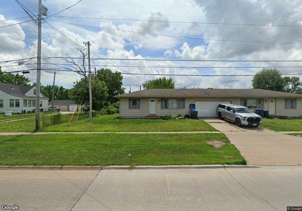
4125 W Locust St Davenport, IA 52804
Northwest Davenport NeighborhoodEstimated Value: $150,000 - $174,000
4
Beds
2
Baths
1,544
Sq Ft
$102/Sq Ft
Est. Value
About This Home
This home is located at 4125 W Locust St, Davenport, IA 52804 and is currently estimated at $157,949, approximately $102 per square foot. 4125 W Locust St is a home located in Scott County with nearby schools including Walnut Hill Elementary School, South Christian Elementary School, and Frank L. Smart Intermediate School.
Ownership History
Date
Name
Owned For
Owner Type
Purchase Details
Closed on
Oct 26, 2020
Sold by
Jepp Llc
Bought by
Boldt Janelle
Current Estimated Value
Home Financials for this Owner
Home Financials are based on the most recent Mortgage that was taken out on this home.
Original Mortgage
$98,000
Outstanding Balance
$87,007
Interest Rate
2.8%
Mortgage Type
New Conventional
Estimated Equity
$70,942
Purchase Details
Closed on
Oct 6, 2015
Sold by
Arp Vicky L Schroeder
Bought by
Jepp Llc
Home Financials for this Owner
Home Financials are based on the most recent Mortgage that was taken out on this home.
Original Mortgage
$102,000
Interest Rate
3.84%
Mortgage Type
Future Advance Clause Open End Mortgage
Purchase Details
Closed on
Jan 29, 2009
Sold by
Arp Vicky L Schroeder and Arp Gregory A
Bought by
Arp Vicky L Schroeder
Create a Home Valuation Report for This Property
The Home Valuation Report is an in-depth analysis detailing your home's value as well as a comparison with similar homes in the area
Home Values in the Area
Average Home Value in this Area
Purchase History
| Date | Buyer | Sale Price | Title Company |
|---|---|---|---|
| Boldt Janelle | $118,000 | None Available | |
| Jepp Llc | $102,000 | Attorney | |
| Arp Vicky L Schroeder | -- | None Available |
Source: Public Records
Mortgage History
| Date | Status | Borrower | Loan Amount |
|---|---|---|---|
| Open | Boldt Janelle | $98,000 | |
| Previous Owner | Jepp Llc | $102,000 |
Source: Public Records
Tax History Compared to Growth
Tax History
| Year | Tax Paid | Tax Assessment Tax Assessment Total Assessment is a certain percentage of the fair market value that is determined by local assessors to be the total taxable value of land and additions on the property. | Land | Improvement |
|---|---|---|---|---|
| 2025 | $2,400 | $137,030 | $31,440 | $105,590 |
| 2024 | $2,342 | $134,290 | $31,440 | $102,850 |
| 2023 | $2,348 | $134,290 | $31,440 | $102,850 |
| 2022 | $2,553 | $109,930 | $26,730 | $83,200 |
| 2021 | $2,326 | $108,410 | $26,730 | $81,680 |
| 2020 | $2,473 | $99,250 | $26,730 | $72,520 |
| 2019 | $2,561 | $88,090 | $26,730 | $61,360 |
| 2018 | $470 | $88,090 | $26,730 | $61,360 |
| 2017 | $472 | $84,860 | $26,730 | $58,130 |
| 2016 | $2,209 | $90,140 | $0 | $0 |
| 2015 | $1,974 | $94,760 | $0 | $0 |
| 2014 | $2,104 | $94,760 | $0 | $0 |
| 2013 | $2,068 | $0 | $0 | $0 |
| 2012 | -- | $95,300 | $28,060 | $67,240 |
Source: Public Records
Map
Nearby Homes
- 2025 Emerald Dr
- 2218 Emerald Dr
- 0 W Locust St Unit Utah
- 0 W Locust St Unit 23235762
- 0 W Locust St Unit NOC6326699
- 2230 Emerald Dr
- 1310 Calvin St
- 4017 W 13th St
- 1312 Emerald Dr
- 3920 W 13th St
- 1215 Calvin St
- 1139 Calvin St
- 1925 N Michigan Ave
- 3430 W Locust St
- 2232 N Nevada Ave
- Lot 12 Hidden Valley Cir
- 2334 N Fairmount St
- 4836 W Pleasant St
- 4703 W 13th St
- 1215 Waverly Rd
- 4125 W Locust St Unit 4127 W Locust
- 1833 Calvin St
- 4111 W Locust St
- 1827 Calvin St
- 4132 W Locust St
- 1821 Calvin St
- 4103 W Locust St
- 1815 Calvin St
- 1809 Calvin St
- 4209 W Locust St
- 1803 Calvin St
- 4207 Laurel Ct
- 4205 Laurel Ct
- 4205 Laurel Ct Unit 8
- 4209 Laurel Ct
- 1733 Calvin St
- 4211 Laurel Ct
- 4203 Laurel Ct Unit 9
- 4203 Laurel Ct
- 4201 Laurel Ct Unit 10