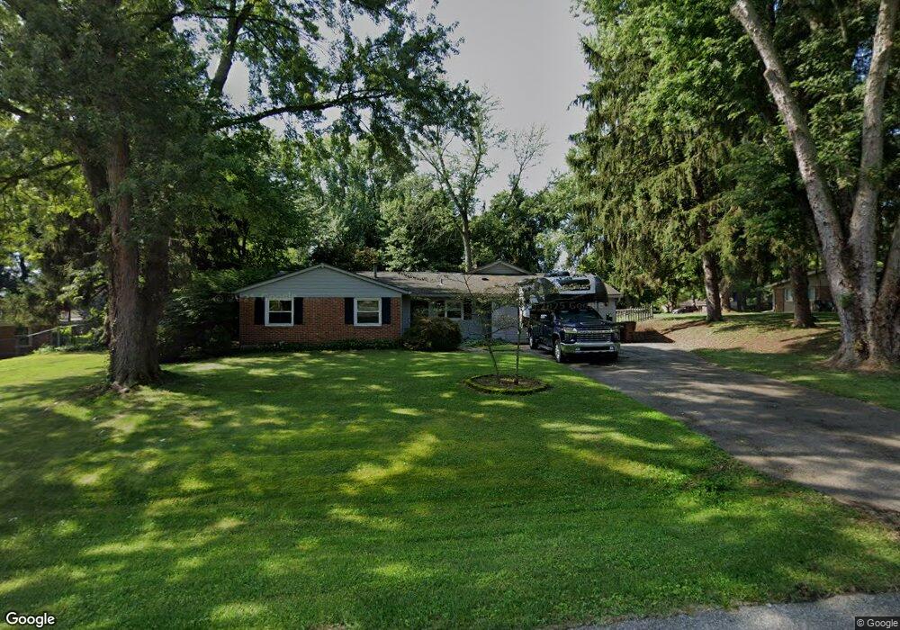
4127 Caudell Dr Bellbrook, OH 45305
Estimated Value: $305,273 - $369,000
3
Beds
2
Baths
1,916
Sq Ft
$175/Sq Ft
Est. Value
About This Home
This home is located at 4127 Caudell Dr, Bellbrook, OH 45305 and is currently estimated at $335,568, approximately $175 per square foot. 4127 Caudell Dr is a home located in Greene County with nearby schools including Stephen Bell Elementary School, Bell Creek Intermediate School, and Bellbrook Middle School.
Ownership History
Date
Name
Owned For
Owner Type
Purchase Details
Closed on
Oct 19, 2017
Sold by
Mcgovern Sott A and Mcgovern Wendy Kim
Bought by
Topsoglou John H
Current Estimated Value
Home Financials for this Owner
Home Financials are based on the most recent Mortgage that was taken out on this home.
Original Mortgage
$168,581
Outstanding Balance
$140,850
Interest Rate
3.83%
Mortgage Type
VA
Estimated Equity
$194,718
Purchase Details
Closed on
Dec 16, 2009
Sold by
Mcgovern James A and Mcgovern Janiece W
Bought by
Mcgovern Scott A
Home Financials for this Owner
Home Financials are based on the most recent Mortgage that was taken out on this home.
Original Mortgage
$153,225
Interest Rate
4.9%
Mortgage Type
VA
Create a Home Valuation Report for This Property
The Home Valuation Report is an in-depth analysis detailing your home's value as well as a comparison with similar homes in the area
Home Values in the Area
Average Home Value in this Area
Purchase History
| Date | Buyer | Sale Price | Title Company |
|---|---|---|---|
| Topsoglou John H | $191,500 | -- | |
| Mcgovern Scott A | $150,000 | Stewart Title Box |
Source: Public Records
Mortgage History
| Date | Status | Borrower | Loan Amount |
|---|---|---|---|
| Open | Topsoglou John H | $168,581 | |
| Previous Owner | Mcgovern Scott A | $153,225 |
Source: Public Records
Tax History
| Year | Tax Paid | Tax Assessment Tax Assessment Total Assessment is a certain percentage of the fair market value that is determined by local assessors to be the total taxable value of land and additions on the property. | Land | Improvement |
|---|---|---|---|---|
| 2024 | $4,226 | $82,530 | $16,710 | $65,820 |
| 2023 | $4,086 | $82,530 | $16,710 | $65,820 |
| 2022 | $3,753 | $63,250 | $14,530 | $48,720 |
| 2021 | $3,792 | $63,250 | $14,530 | $48,720 |
| 2020 | $3,543 | $63,250 | $14,530 | $48,720 |
| 2019 | $3,340 | $55,420 | $8,890 | $46,530 |
| 2018 | $3,440 | $55,420 | $8,890 | $46,530 |
| 2017 | $3,874 | $55,420 | $8,890 | $46,530 |
| 2016 | $3,779 | $51,010 | $8,890 | $42,120 |
| 2015 | $3,791 | $51,010 | $8,890 | $42,120 |
| 2014 | $3,521 | $51,010 | $8,890 | $42,120 |
Source: Public Records
Map
Nearby Homes
- 1478 Kensington Dr
- 4196 N Golden Clove Bend Unit 56-104
- 4206 N Golden Clove Bend Unit 56-303
- 4208 N Golden Clove Bend Unit 56-103
- 4214 N Golden Clove Bend Unit 56-102
- 4216 N Golden Clove Bend Unit 56-302
- 4218 N Golden Clove Bend Unit 56-300
- 4222 N Golden Clove Bend Unit 56-201
- 4220 N Golden Clove Bend Unit 56-301
- 4228 Apple Branch Dr Unit 55-204
- 4230 Apple Branch Dr Unit 55-304
- 4232 Apple Branch Dr Unit 55-305
- 4234 Apple Branch Dr Unit 55-303
- 4236 Apple Branch Dr Unit 55-103
- 4242 Apple Branch Dr Unit 55-102
- 4244 Apple Branch Dr Unit 55-302
- 4246 Apple Branch Dr Unit 55-300
- 4250 Apple Branch Dr Unit 55-301
- 4252 Apple Branch Dr Unit 55-201
- 4254 Apple Branch Dr Unit 55-101
- 4117 Caudell Dr
- 4141 Caudell Dr
- 1542 Kensington Dr
- 1539 Gunther Dr
- 1523 Gunther Dr
- 4126 Caudell Dr
- 1554 Kensington Dr
- 1518 Kensington Dr
- 4116 Caudell Dr
- 1525 Kensington Dr
- 1566 Kensington Dr
- 1535 Kensington Dr
- 4104 Caudell Dr
- 1515 Kensington Dr
- 1545 Gunther Dr
- 1545 Kensington Dr
- 1505 Kensington Dr
- 4094 Caudell Dr
- 1578 Kensington Dr
- 1555 Kensington Dr