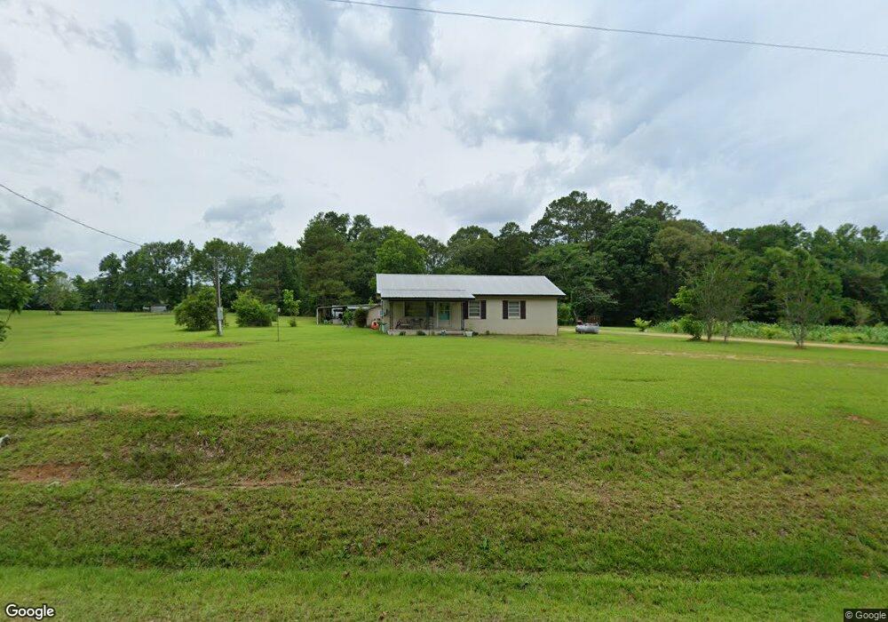
4127 W Topisaw S Summit, MS 39666
Estimated Value: $114,785 - $186,000
Studio
--
Bath
1,517
Sq Ft
$104/Sq Ft
Est. Value
About This Home
This home is located at 4127 W Topisaw S, Summit, MS 39666 and is currently estimated at $158,446, approximately $104 per square foot. 4127 W Topisaw S is a home with nearby schools including North Pike Elementary School, North Pike Middle School, and North Pike Senior High School.
Ownership History
Date
Name
Owned For
Owner Type
Purchase Details
Closed on
Jan 27, 2017
Sold by
Brent Kelby Preston and Duncan Pamela Jo
Bought by
Mccullough William Cody and Mccullough Kelsie Lanie Brent
Current Estimated Value
Home Financials for this Owner
Home Financials are based on the most recent Mortgage that was taken out on this home.
Original Mortgage
$47,340
Interest Rate
4.3%
Mortgage Type
Commercial
Create a Home Valuation Report for This Property
The Home Valuation Report is an in-depth analysis detailing your home's value as well as a comparison with similar homes in the area
Purchase History
| Date | Buyer | Sale Price | Title Company |
|---|---|---|---|
| Mccullough William Cody | -- | None Available |
Source: Public Records
Mortgage History
| Date | Status | Borrower | Loan Amount |
|---|---|---|---|
| Closed | Mccullough William Cody | $47,340 |
Source: Public Records
Tax History
| Year | Tax Paid | Tax Assessment Tax Assessment Total Assessment is a certain percentage of the fair market value that is determined by local assessors to be the total taxable value of land and additions on the property. | Land | Improvement |
|---|---|---|---|---|
| 2025 | $601 | $6,348 | $0 | $0 |
| 2024 | $506 | $5,258 | $0 | $0 |
| 2023 | $491 | $5,258 | $0 | $0 |
| 2022 | $481 | $5,258 | $0 | $0 |
| 2021 | $479 | $5,258 | $0 | $0 |
| 2020 | $504 | $5,473 | $0 | $0 |
| 2019 | $447 | $5,024 | $0 | $0 |
| 2018 | $442 | $5,024 | $0 | $0 |
| 2017 | $949 | $7,536 | $0 | $0 |
| 2016 | $838 | $7,536 | $0 | $0 |
| 2015 | $810 | $7,461 | $0 | $0 |
| 2014 | -- | $4,974 | $0 | $0 |
| 2013 | -- | $4,974 | $0 | $0 |
Source: Public Records
Map
Nearby Homes
- 4190 Mississippi 44
- 1073 Hillcrest Farms Ln
- 2094 W Topisaw S
- 6045 Mississippi 44
- TBD Carters Creek Rd
- 8001 W Topisaw S
- 0 Lawrence Reid Rd
- 239 Mississippi 44
- 182 Hwy 44 None
- Leonard Rd
- 0 Matthews Rd
- 5014 Leatherwood Rd
- 72 Lawrence Reid Rd
- 1022 Friendship Cir
- 37 Adron Boyd Rd
- 0 Beartown Rd
- 1168 Clem Nettles Rd
- 0 Lucille Ln
- 7020 Gibson Rd
- Tbd Hwy 570 River Road N and S
- 4109 W Topisaw S
- 4080 W Topisaw S
- 4094 W Topisaw S
- 4160 W Topisaw S
- 4095 W Topisaw Rd S
- Lot 11 W Topisaw S
- 30XX W Topisaw S
- 000 W Topisaw S
- 0000 W Topisaw S
- 6189 W Topisaw S
- 0 W Topisaw S
- xxx W Topisaw S
- unknow W Topisaw S
- unk W Topisaw S
- 00 W Topisaw S
- 7169 S West Topisaw Rd
- 4155 W Topisaw S
- 4023 W Topisaw S
- 4157 W Topisaw S
- 4088 W Topisaw S
Your Personal Tour Guide
Ask me questions while you tour the home.