
4129 Holbrook Rd Randallstown, MD 21133
Estimated payment $1,658/month
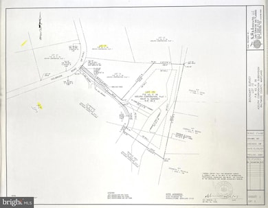
About This Lot
Lovely, wooded 6.41-acre lot, privately located in quiet established community at end of the street with no thru traffic. Lot lines and perc being verified. Excellent distant suburban location in western Randallstown with easy access to Owings Mills and Carroll County. Minutes to Liberty Reservoir and Solders Delight.
Listing Agent
(410) 977-6149 dianekenworthy@northroprealty.com Northrop Realty License #31668 Listed on: 11/13/2025

Property Details
Property Type
- Land
Est. Annual Taxes
- $1,331
Lot Details
- 6.41 Acre Lot
- Property is zoned RC5
Community Details
- No Home Owners Association
Listing and Financial Details
- Tax Lot 15
- Assessor Parcel Number 04021800008295
Map
Home Values in the Area
Average Home Value in this Area
Tax History
| Year | Tax Paid | Tax Assessment Tax Assessment Total Assessment is a certain percentage of the fair market value that is determined by local assessors to be the total taxable value of land and additions on the property. | Land | Improvement |
|---|---|---|---|---|
| 2025 | $1,319 | $113,867 | $113,867 | -- |
| 2024 | $1,319 | $109,800 | $109,800 | $0 |
| 2023 | $1,331 | $109,800 | $109,800 | $0 |
| 2022 | $1,319 | $109,800 | $109,800 | $0 |
| 2021 | $1,331 | $109,800 | $109,800 | $0 |
| 2020 | $1,331 | $109,800 | $109,800 | $0 |
| 2019 | $1,331 | $109,800 | $109,800 | $0 |
| 2018 | $1,331 | $109,800 | $109,800 | $0 |
| 2017 | $1,319 | $109,800 | $0 | $0 |
| 2016 | $1,758 | $109,800 | $0 | $0 |
| 2015 | $1,758 | $109,800 | $0 | $0 |
| 2014 | $1,758 | $109,800 | $0 | $0 |
Property History
| Date | Event | Price | List to Sale | Price per Sq Ft |
|---|---|---|---|---|
| 11/13/2025 11/13/25 | For Sale | $295,000 | -- | -- |
Purchase History
| Date | Type | Sale Price | Title Company |
|---|---|---|---|
| Interfamily Deed Transfer | -- | None Available | |
| Interfamily Deed Transfer | -- | None Available | |
| Deed | $18,000 | -- |
Source: Bright MLS
MLS Number: MDBC2124976
APN: 02-1800008295
Disclaimer: Certain information contained herein is derived from information provided by parties other than Homes.com. All information provided is deemed reliable, but is not guaranteed to be accurate and should be independently verified.
![]() The data relating to real estate for sale on this website appears in part through the BRIGHT Internet Data Exchange program, a voluntary cooperative exchange of property listing data between licensed real estate brokerage firms, and is provided by BRIGHT through a licensing agreement.
The data relating to real estate for sale on this website appears in part through the BRIGHT Internet Data Exchange program, a voluntary cooperative exchange of property listing data between licensed real estate brokerage firms, and is provided by BRIGHT through a licensing agreement.
Listing information is from various brokers who participate in the Bright MLS IDX program and not all listings may be visible on the site.
The property information being provided on or through the website is for the personal, non-commercial use of consumers and such information may not be used for any purpose other than to identify prospective properties consumers may be interested in purchasing.
Some properties which appear for sale on the website may no longer be available because they are for instance, under contract, sold or are no longer being offered for sale.
Property information displayed is deemed reliable but is not guaranteed.
Copyright 2025 Bright MLS, Inc.
- 4133 Holbrook Rd
- 4107 Holbrook Rd
- 10520 Marriottsville Rd
- 10702 Liberty Rd
- 3618 Granite Rd
- 30 Sheraton Rd
- 11120 Liberty Rd
- 3904 Wards Chapel Rd
- 3803 Marriottsville Rd
- 3517 Kings Point Rd
- 4264 Cayuga Rd
- 9931 Tuscarora Rd
- 9 Bannock Ct
- 3827 Rayton Rd
- 9804 Marriottsville Rd
- 3525 Cabot Rd
- 3903 Innerdale Ct
- 9605 Mendoza Rd
- 3538 Corn Stream Rd
- 11 Hunters Forge Ct
- 10141 Liberty Rd Unit 2
- 10141 Liberty Rd Unit 1
- 9998 Tuscarora Rd
- 10001 Paxton Rd
- 9902 Cervidae Ln
- 2 Chinook Ct
- 9851 Branchleigh Rd
- 3507 Corn Stream Rd
- 3901 Noyes Cir
- 3671 Waterwheel Square
- 3511 Orchard Shade Rd
- 9816 Bon Haven Ln
- 4700 Winterset Way
- 3456 Carriage Hill Cir
- 4603 Lathe Rd
- 3000 Hernwood Rd
- 9855 Sherwood Farm Rd
- 9606 Julia Ln
- 4611 Kings Mill Way
- 4733 Buxton Cir