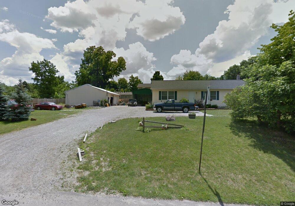
413 Harding Rd Mansfield, OH 44906
Estimated Value: $52,000 - $182,000
Studio
1
Bath
--
Sq Ft
5,750
Sq Ft Lot
About This Home
This home is located at 413 Harding Rd, Mansfield, OH 44906 and is currently estimated at $117,000. 413 Harding Rd is a home located in Richland County with nearby schools including Foundation Academy, Mansfield Elective Academy, and Interactive Media & Construction (IMAC) Academy.
Ownership History
Date
Name
Owned For
Owner Type
Purchase Details
Closed on
Apr 27, 2000
Sold by
Flohr Bonnie K
Bought by
Howard John W and Howard Lisa K
Current Estimated Value
Purchase Details
Closed on
Nov 3, 1997
Sold by
Howard John W
Bought by
Bonnie K Flohr
Home Financials for this Owner
Home Financials are based on the most recent Mortgage that was taken out on this home.
Original Mortgage
$8,190
Interest Rate
7.51%
Mortgage Type
New Conventional
Purchase Details
Closed on
Aug 13, 1993
Sold by
Lambert Archie Ray
Bought by
Howard John William
Purchase Details
Closed on
Apr 1, 1986
Create a Home Valuation Report for This Property
The Home Valuation Report is an in-depth analysis detailing your home's value as well as a comparison with similar homes in the area
Home Values in the Area
Average Home Value in this Area
Purchase History
| Date | Buyer | Sale Price | Title Company |
|---|---|---|---|
| Howard John W | $4,163 | -- | |
| Bonnie K Flohr | $4,693 | -- | |
| Howard John William | $9,000 | -- | |
| -- | $6,000 | -- |
Source: Public Records
Mortgage History
| Date | Status | Borrower | Loan Amount |
|---|---|---|---|
| Previous Owner | Bonnie K Flohr | $8,190 |
Source: Public Records
Tax History
| Year | Tax Paid | Tax Assessment Tax Assessment Total Assessment is a certain percentage of the fair market value that is determined by local assessors to be the total taxable value of land and additions on the property. | Land | Improvement |
|---|---|---|---|---|
| 2024 | $90 | $1,870 | $1,120 | $750 |
| 2023 | $90 | $1,870 | $1,120 | $750 |
| 2022 | $100 | $1,750 | $1,000 | $750 |
| 2021 | $101 | $1,750 | $1,000 | $750 |
| 2020 | $103 | $1,750 | $1,000 | $750 |
| 2019 | $114 | $1,750 | $1,000 | $750 |
| 2018 | $188 | $2,940 | $1,000 | $1,940 |
| 2017 | $189 | $2,940 | $1,000 | $1,940 |
| 2016 | $196 | $3,050 | $950 | $2,100 |
| 2015 | $187 | $3,050 | $950 | $2,100 |
| 2014 | $184 | $3,050 | $950 | $2,100 |
| 2012 | $74 | $3,220 | $1,000 | $2,220 |
Source: Public Records
Map
Nearby Homes
- 640 Hanna Rd
- 891 Springmill Rd
- 739 Armstrong St
- 1501 Bowman St
- 572 France St
- 880 Fairfax Ave
- 516 Burns St
- 878 Fairfax Ave
- 933 Fairfax Ave
- 641 Averill Ave
- 701 Springmill St
- 1101 Lenox Ave
- 492 Stark St
- 1092 N Trimble Rd
- 118 Raymond Ave
- 0 State Route 314 Unit 9069650
- 580 N Mulberry St
- 688 Mcpherson St
- 524 Lida St
- 1005 Truxell Dr
- 413 Harding Rd
- 406 Pomerene Rd
- 412 Pomerene Rd
- 402 Pomerene Rd
- 420 Pomerene Rd
- 422 Pomerene Rd
- 406 Harding Rd
- 382 Pomerene Rd
- 423 Pomerene Rd
- 423 Pomerene Rd
- 397 Pomerene Rd
- 397 Pomerene Rd
- 425 Hanna Rd
- 413 Hanna Rd
- 413 Hanna Rd
- 376 Harding Rd
- 367 Harding Rd
- 372 Pomerene Rd
- 393 Hanna Rd
- 377 Pomerene Rd
Your Personal Tour Guide
Ask me questions while you tour the home.