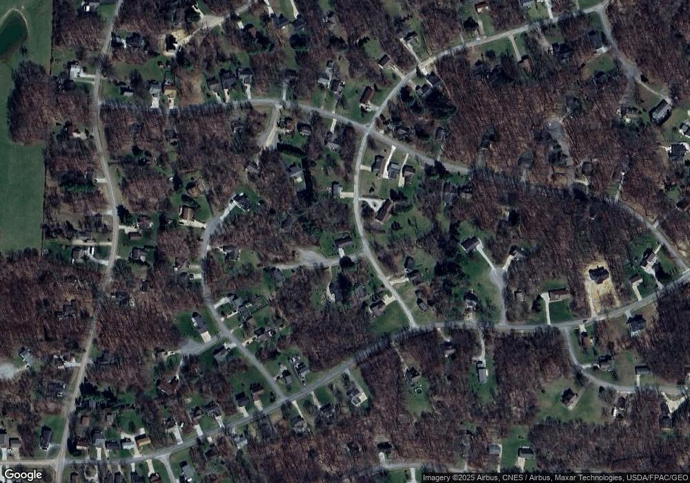
413 Mcintosh Dr Howard, OH 43028
Apple Valley NeighborhoodEstimated Value: $219,544 - $236,000
3
Beds
1
Bath
1,122
Sq Ft
$206/Sq Ft
Est. Value
About This Home
This home is located at 413 Mcintosh Dr, Howard, OH 43028 and is currently estimated at $231,136, approximately $206 per square foot. 413 Mcintosh Dr is a home located in Knox County with nearby schools including East Knox Elementary School and East Knox High School.
Ownership History
Date
Name
Owned For
Owner Type
Purchase Details
Closed on
Aug 2, 2010
Sold by
Miller Brian Y
Bought by
Ruffner Robyn L
Current Estimated Value
Purchase Details
Closed on
Aug 30, 2002
Sold by
Porter Steve A and Porter Peggy J
Bought by
Raver Shirley A
Purchase Details
Closed on
Jan 31, 2002
Sold by
Sayers Trent E and Sayers Rochelle
Bought by
Porter Steve A and Porter Peggy J
Create a Home Valuation Report for This Property
The Home Valuation Report is an in-depth analysis detailing your home's value as well as a comparison with similar homes in the area
Home Values in the Area
Average Home Value in this Area
Purchase History
| Date | Buyer | Sale Price | Title Company |
|---|---|---|---|
| Ruffner Robyn L | $61,875 | None Available | |
| Raver Shirley A | $88,500 | -- | |
| Porter Steve A | $6,500 | -- |
Source: Public Records
Tax History Compared to Growth
Tax History
| Year | Tax Paid | Tax Assessment Tax Assessment Total Assessment is a certain percentage of the fair market value that is determined by local assessors to be the total taxable value of land and additions on the property. | Land | Improvement |
|---|---|---|---|---|
| 2024 | $1,776 | $53,820 | $5,590 | $48,230 |
| 2023 | $1,776 | $53,820 | $5,590 | $48,230 |
| 2022 | $1,338 | $37,110 | $3,850 | $33,260 |
| 2021 | $1,338 | $37,110 | $3,850 | $33,260 |
| 2020 | $1,275 | $37,110 | $3,850 | $33,260 |
| 2019 | $1,193 | $33,090 | $3,780 | $29,310 |
| 2018 | $1,118 | $33,090 | $3,780 | $29,310 |
| 2017 | $1,108 | $33,090 | $3,780 | $29,310 |
| 2016 | $1,013 | $30,640 | $3,500 | $27,140 |
| 2015 | $923 | $30,640 | $3,500 | $27,140 |
| 2014 | $925 | $30,640 | $3,500 | $27,140 |
| 2013 | $1,029 | $31,860 | $4,280 | $27,580 |
Source: Public Records
Map
Nearby Homes
- 0 Northern Spy Dr Unit 226000222
- Lots 392 & 393 Lakeview Heights Dr
- 43 Hawkeye Ct
- 531 Crabapple Dr
- 770 Winesap Cir
- 48 Mcintosh Ct
- 37 Mcintosh Ct
- 0 Mcintosh Ct Unit 20250846
- 0 Mcintosh Ct Unit LOT 321
- 0 Winesap Ct Unit 226001375
- 0 Winesap Ct Unit 20260020
- 318 Crabapple Dr
- 535 Green Acre Cir
- 13496 Monroe Mills
- 13946 Monroe Mills Rd
- 670 Berry Rd
- 2037 Apple Valley Dr Unit 514, 515
- 2100 Apple Valley Dr Unit Lot 63
- 2264 Apple Valley Dr
- 3142 Apple Valley Dr
- 421 Mcintosh Dr
- 0 Ben Davis Ct
- 425 Mcintosh Dr
- 11 Ben Davis Ct
- 401 Mcintosh Dr
- 18 Ben Davis Ct
- 420 Mcintosh Dr
- 408 Mcintosh Dr Unit 423
- 408 McIntosh Dr #423
- 23 Ben Davis Ct
- 46 Hawkeye Ct
- 424 Mcintosh Dr
- 404 Mcintosh Dr
- 177 Northern Spy Dr
- 0 Northern Spy Dr Unit Lot 393 2738142
- 0 Northern Spy Dr Unit Lt50 2657170
- 0 Northern Spy Dr Unit Lt52 2657171
- 0 Northern Spy Dr Unit Lt52 2650026
- 0 Northern Spy Dr Unit Lt50 2650025
- 0 Northern Spy Dr Unit 223008456
