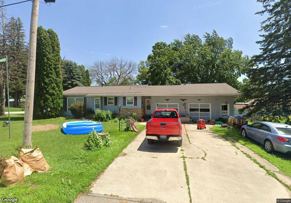
413 N 4th St Thornton, IA 50479
Estimated Value: $119,000 - $198,000
2
Beds
2
Baths
1,238
Sq Ft
$116/Sq Ft
Est. Value
About This Home
This home is located at 413 N 4th St, Thornton, IA 50479 and is currently estimated at $143,755, approximately $116 per square foot. 413 N 4th St is a home located in Cerro Gordo County with nearby schools including West Fork High School.
Ownership History
Date
Name
Owned For
Owner Type
Purchase Details
Closed on
Jul 25, 2011
Sold by
Groh Victor and Groh Ruth
Bought by
Mcdowell Christopher L
Current Estimated Value
Home Financials for this Owner
Home Financials are based on the most recent Mortgage that was taken out on this home.
Original Mortgage
$58,479
Outstanding Balance
$40,105
Interest Rate
4.52%
Mortgage Type
FHA
Estimated Equity
$103,650
Create a Home Valuation Report for This Property
The Home Valuation Report is an in-depth analysis detailing your home's value as well as a comparison with similar homes in the area
Home Values in the Area
Average Home Value in this Area
Purchase History
| Date | Buyer | Sale Price | Title Company |
|---|---|---|---|
| Mcdowell Christopher L | $60,000 | None Availabale | |
| Mcdowell Chrstopher L | -- | None Available |
Source: Public Records
Mortgage History
| Date | Status | Borrower | Loan Amount |
|---|---|---|---|
| Open | Mcdowell Chrstopher L | $58,479 | |
| Closed | Mcdowell Chrstopher L | $58,479 |
Source: Public Records
Tax History Compared to Growth
Tax History
| Year | Tax Paid | Tax Assessment Tax Assessment Total Assessment is a certain percentage of the fair market value that is determined by local assessors to be the total taxable value of land and additions on the property. | Land | Improvement |
|---|---|---|---|---|
| 2025 | $1,314 | $107,670 | $8,250 | $99,420 |
| 2024 | $1,314 | $97,210 | $8,250 | $88,960 |
| 2023 | $1,258 | $97,210 | $8,250 | $88,960 |
| 2022 | $1,122 | $83,740 | $6,600 | $77,140 |
| 2021 | $1,144 | $76,270 | $6,600 | $69,670 |
| 2020 | $1,292 | $74,600 | $6,600 | $68,000 |
| 2019 | $1,196 | $0 | $0 | $0 |
| 2018 | $1,008 | $0 | $0 | $0 |
| 2017 | $984 | $0 | $0 | $0 |
| 2016 | $926 | $0 | $0 | $0 |
| 2015 | $926 | $0 | $0 | $0 |
| 2014 | $996 | $0 | $0 | $0 |
| 2013 | $948 | $0 | $0 | $0 |
Source: Public Records
Map
Nearby Homes
- 400 N 4th St
- 300 S 5th St
- 5950 Jonquil Ave
- 9213 160th St
- 940 250th St
- 627 2nd St
- 190th St
- 12972 120th St
- 602 Claydigger Run
- 421 Brickyard Rd
- 419 Brickyard Rd
- 417 Brickyard Rd
- 109 N Lincoln St
- 410 Brickyard Rd
- 409 Brickyard Rd
- 319 N 6th St
- 319 S Lincoln St
- 601 Gilman St
- 608 Sherman St
- 202 Brickyard Ct