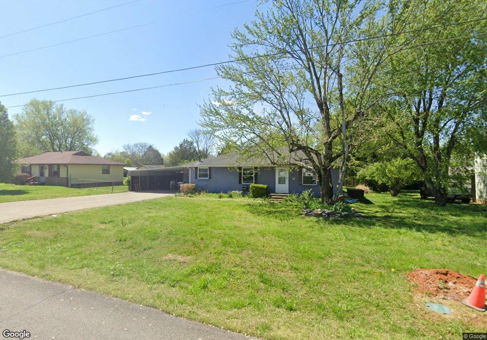
413 Pony Dr Smyrna, TN 37167
Estimated Value: $273,721 - $347,000
--
Bed
2
Baths
1,242
Sq Ft
$249/Sq Ft
Est. Value
About This Home
This home is located at 413 Pony Dr, Smyrna, TN 37167 and is currently estimated at $309,680, approximately $249 per square foot. 413 Pony Dr is a home located in Rutherford County with nearby schools including Stewartsboro Elementary School, Rocky Fork Middle School, and Smyrna High School.
Ownership History
Date
Name
Owned For
Owner Type
Purchase Details
Closed on
Oct 15, 2021
Sold by
Denise Johnson Carole
Bought by
Mangrum Matthew H
Current Estimated Value
Home Financials for this Owner
Home Financials are based on the most recent Mortgage that was taken out on this home.
Original Mortgage
$106,132
Interest Rate
2.8%
Mortgage Type
New Conventional
Purchase Details
Closed on
Apr 7, 2004
Sold by
Johnson Robert E
Bought by
Denise Johnson Carole
Home Financials for this Owner
Home Financials are based on the most recent Mortgage that was taken out on this home.
Original Mortgage
$95,000
Interest Rate
4.5%
Purchase Details
Closed on
Dec 20, 1995
Bought by
Johnson and Denise
Purchase Details
Closed on
Jun 27, 1994
Sold by
Wilson Collins Richard
Bought by
Collins Elouise Kaye M
Create a Home Valuation Report for This Property
The Home Valuation Report is an in-depth analysis detailing your home's value as well as a comparison with similar homes in the area
Home Values in the Area
Average Home Value in this Area
Purchase History
| Date | Buyer | Sale Price | Title Company |
|---|---|---|---|
| Mangrum Matthew H | $111,717 | Horton Ballard & Pemerton Pllc | |
| Denise Johnson Carole | -- | -- | |
| Johnson | $56,900 | -- | |
| Johnson Robert E | $56,900 | -- | |
| Collins Elouise Kaye M | -- | -- |
Source: Public Records
Mortgage History
| Date | Status | Borrower | Loan Amount |
|---|---|---|---|
| Previous Owner | Mangrum Matthew H | $106,132 | |
| Previous Owner | Collins Elouise Kaye M | $95,000 |
Source: Public Records
Tax History Compared to Growth
Tax History
| Year | Tax Paid | Tax Assessment Tax Assessment Total Assessment is a certain percentage of the fair market value that is determined by local assessors to be the total taxable value of land and additions on the property. | Land | Improvement |
|---|---|---|---|---|
| 2025 | $1,439 | $59,900 | $13,750 | $46,150 |
| 2024 | $1,439 | $59,900 | $13,750 | $46,150 |
| 2023 | $1,488 | $61,950 | $13,750 | $48,200 |
| 2022 | $1,327 | $61,950 | $13,750 | $48,200 |
| 2021 | $1,226 | $42,000 | $7,750 | $34,250 |
| 2020 | $1,226 | $42,000 | $7,750 | $34,250 |
| 2019 | $1,226 | $42,000 | $7,750 | $34,250 |
| 2018 | $1,176 | $42,000 | $0 | $0 |
| 2017 | $944 | $26,475 | $0 | $0 |
| 2016 | $944 | $26,475 | $0 | $0 |
| 2015 | $944 | $26,475 | $0 | $0 |
| 2014 | $645 | $26,475 | $0 | $0 |
| 2013 | -- | $21,450 | $0 | $0 |
Source: Public Records
Map
Nearby Homes
- 308 Custer Ct
- 340 Stewarts Landing Cir
- 211 Stewarts Landing Cir
- 213 Stewarts Landing Cir
- 203 Longfellow Ln
- 109 Longfellow Ln
- 101 Longfellow Ln
- 104 Evanmeade Dr
- 121 Crockett Ct
- 1026 Rosemont Terrace
- 303 Davis Park Dr
- 1014 Rosemont Terrace
- 0 Old Nashville Hwy Unit RTC2943706
- 202 Latimer Dr
- 2110 Alteras Dr
- 647 Legacy Dr
- 374 Longhorn Dr
- 1023 Avery Park Dr
- 335 Longhorn Dr
- 321 Longhorn Dr
- 411 Pony Dr
- 415 Pony Dr
- 126 Long Rifle Rd
- 124 Long Rifle Rd
- 429 Stockade Dr
- 409 Pony Dr
- 410 Pony Dr
- 427 Stockade Dr
- 122 Long Rifle Rd
- 407 Pony Dr
- 408 Pony Dr
- 434 Stockade Dr
- 432 Stockade Dr
- 110 Lance Ct
- 425 Stockade Dr
- 120 Long Rifle Rd
- 430 Stockade Dr
- 130 Long Rifle Rd
- 133 Long Rifle Rd
- 131 Long Rifle Rd