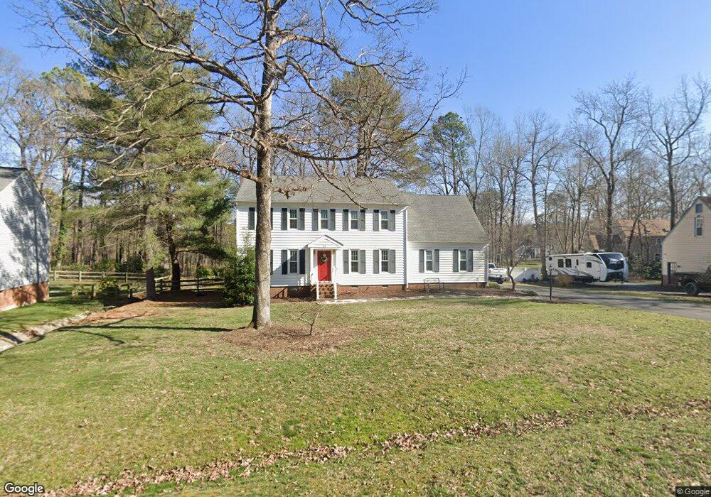
413 Rossmere Dr Midlothian, VA 23114
Estimated Value: $479,000 - $525,000
3
Beds
3
Baths
2,298
Sq Ft
$219/Sq Ft
Est. Value
About This Home
This home is located at 413 Rossmere Dr, Midlothian, VA 23114 and is currently estimated at $503,872, approximately $219 per square foot. 413 Rossmere Dr is a home located in Chesterfield County with nearby schools including J B Watkins Elementary School, Midlothian Middle School, and Midlothian High School.
Ownership History
Date
Name
Owned For
Owner Type
Purchase Details
Closed on
Mar 29, 2004
Sold by
Gadberry Edwin
Bought by
Gorman Samuel
Current Estimated Value
Home Financials for this Owner
Home Financials are based on the most recent Mortgage that was taken out on this home.
Original Mortgage
$192,799
Outstanding Balance
$90,095
Interest Rate
5.56%
Mortgage Type
FHA
Estimated Equity
$413,777
Purchase Details
Closed on
Jul 12, 1999
Sold by
Gadberry Edwin
Bought by
Gadberry Edwin and Gadberry Debra C
Create a Home Valuation Report for This Property
The Home Valuation Report is an in-depth analysis detailing your home's value as well as a comparison with similar homes in the area
Home Values in the Area
Average Home Value in this Area
Purchase History
| Date | Buyer | Sale Price | Title Company |
|---|---|---|---|
| Gorman Samuel | $192,799 | -- | |
| Gadberry Edwin | -- | -- |
Source: Public Records
Mortgage History
| Date | Status | Borrower | Loan Amount |
|---|---|---|---|
| Open | Gorman Samuel | $192,799 |
Source: Public Records
Tax History
| Year | Tax Paid | Tax Assessment Tax Assessment Total Assessment is a certain percentage of the fair market value that is determined by local assessors to be the total taxable value of land and additions on the property. | Land | Improvement |
|---|---|---|---|---|
| 2025 | $4,229 | $472,400 | $105,300 | $367,100 |
| 2024 | $4,229 | $423,400 | $98,800 | $324,600 |
| 2023 | $3,459 | $380,100 | $94,900 | $285,200 |
| 2022 | $3,461 | $376,200 | $88,400 | $287,800 |
| 2021 | $3,238 | $333,900 | $85,800 | $248,100 |
| 2020 | $3,050 | $321,100 | $84,500 | $236,600 |
| 2019 | $3,015 | $317,400 | $84,500 | $232,900 |
| 2018 | $2,916 | $306,900 | $80,600 | $226,300 |
| 2017 | $2,869 | $298,900 | $80,600 | $218,300 |
| 2016 | $2,767 | $288,200 | $78,000 | $210,200 |
| 2015 | $2,719 | $280,600 | $78,000 | $202,600 |
| 2014 | $2,583 | $266,500 | $75,400 | $191,100 |
Source: Public Records
Map
Nearby Homes
- 351 Walton Park Rd
- 12924 Glengate Rd
- 332 Glenpark Ln
- 13101 N Brattice Loop
- 13153 Brattice Loop
- 245 Brattice Dr
- 13141 Brattice Loop
- 241 Brattice Dr
- 13137 Brattice Dr
- 235 Brattice Dr
- 13205 Garland Ln
- 231 Brattice Dr
- The Julianne Plan at Coalfield Station
- 225 Brattice Dr
- 13217 Garland Ln
- 12513 Carnoustie Ln Unit B
- 13121 Brattice Loop
- 13129 Brattice Loop
- 13208 Garland Ln
- 13210 Garland Ln
- 407 Rossmere Dr
- 419 Rossmere Dr
- 412 Rossmere Dr
- 302 Ashtree Place
- 401 Rossmere Dr
- 12836 Ashtree Rd
- 406 Rossmere Dr
- 12900 Ashtree Rd
- 12801 Rossmere Ct
- 12906 Ashtree Rd
- 304 Ashtree Place
- 347 Rossmere Dr
- 12803 Rossmere Ct
- 301 Ashtree Place
- 12912 Ashtree Rd
- 12837 Ashtree Rd
- 12843 Ashtree Rd
- 12805 Rossmere Ct
- 12901 Ashtree Rd
- 303 Ashtree Place
Your Personal Tour Guide
Ask me questions while you tour the home.