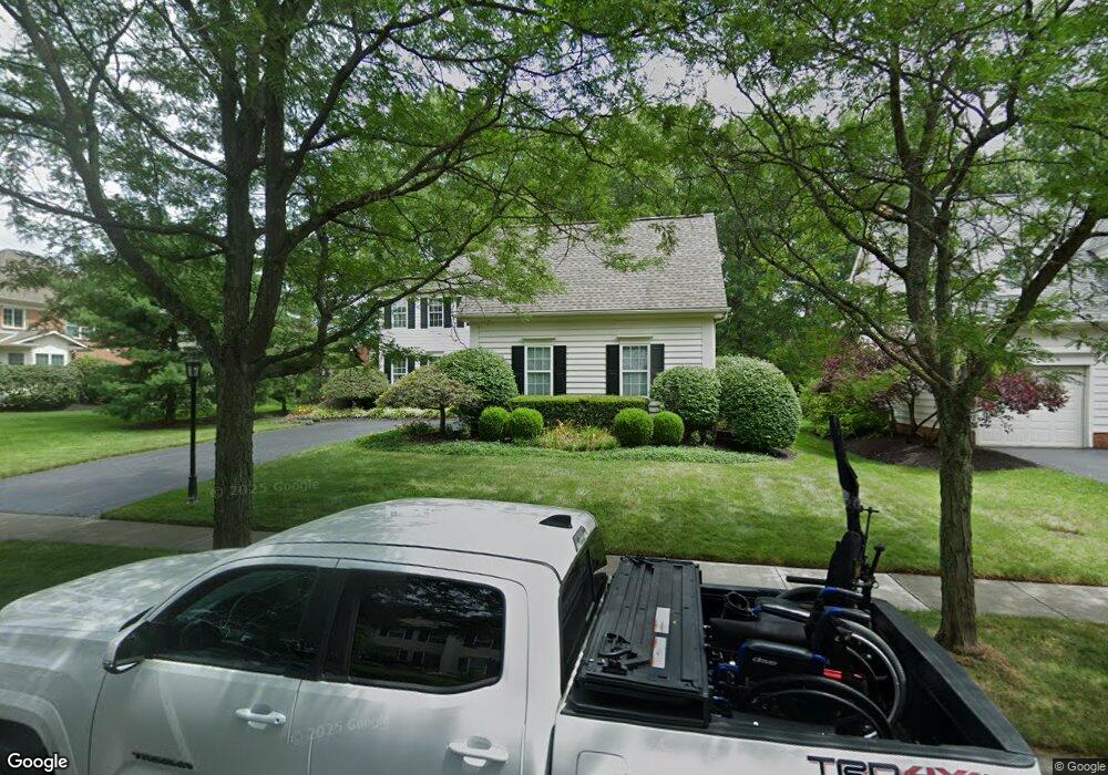
4132 Audley Rd New Albany, OH 43054
Fodor NeighborhoodEstimated Value: $681,000 - $862,000
3
Beds
3
Baths
3,203
Sq Ft
$232/Sq Ft
Est. Value
About This Home
This home is located at 4132 Audley Rd, New Albany, OH 43054 and is currently estimated at $744,123, approximately $232 per square foot. 4132 Audley Rd is a home located in Franklin County with nearby schools including New Albany Primary School, New Albany Intermediate School, and New Albany Middle School.
Ownership History
Date
Name
Owned For
Owner Type
Purchase Details
Closed on
Oct 5, 2000
Sold by
M/I Schottenstein Homes Inc
Bought by
Cline Timothy E and Cline Shonda L
Current Estimated Value
Home Financials for this Owner
Home Financials are based on the most recent Mortgage that was taken out on this home.
Original Mortgage
$288,750
Interest Rate
7.99%
Create a Home Valuation Report for This Property
The Home Valuation Report is an in-depth analysis detailing your home's value as well as a comparison with similar homes in the area
Home Values in the Area
Average Home Value in this Area
Purchase History
| Date | Buyer | Sale Price | Title Company |
|---|---|---|---|
| Cline Timothy E | $339,800 | Transohio Residential Title |
Source: Public Records
Mortgage History
| Date | Status | Borrower | Loan Amount |
|---|---|---|---|
| Closed | Cline Timothy E | $288,750 |
Source: Public Records
Tax History Compared to Growth
Tax History
| Year | Tax Paid | Tax Assessment Tax Assessment Total Assessment is a certain percentage of the fair market value that is determined by local assessors to be the total taxable value of land and additions on the property. | Land | Improvement |
|---|---|---|---|---|
| 2024 | $12,203 | $196,150 | $42,670 | $153,480 |
| 2023 | $11,586 | $196,140 | $42,665 | $153,475 |
| 2022 | $12,952 | $167,370 | $32,130 | $135,240 |
| 2021 | $12,465 | $167,370 | $32,130 | $135,240 |
| 2020 | $12,385 | $167,370 | $32,130 | $135,240 |
| 2019 | $11,358 | $139,620 | $26,780 | $112,840 |
| 2018 | $10,948 | $139,620 | $26,780 | $112,840 |
| 2017 | $11,341 | $139,620 | $26,780 | $112,840 |
| 2016 | $10,652 | $120,680 | $29,820 | $90,860 |
| 2015 | $10,672 | $120,680 | $29,820 | $90,860 |
| 2014 | $10,006 | $120,680 | $29,820 | $90,860 |
| 2013 | $5,148 | $114,905 | $28,385 | $86,520 |
Source: Public Records
Map
Nearby Homes
- 7362 Tottenham Place
- 6813 Ridge Rock Dr Unit 14
- 5556 Falco Dr
- 6923 Rothwell St Unit 46923
- 6931 Rothwell St Unit 36931
- 5600 Apothecary Way
- 5604 Apothecary Way Unit 4
- 5656 Apothecary Way Unit 2
- 109 Keswick Dr
- 115 Keswick Dr
- 105 Keswick Dr
- 4774 Bosk Dr
- 5288 Abby Gate Ave Unit 16
- 5730 Colts Gate Dr Unit 43
- 0 N Hamilton Rd
- 5945 Johnstown Rd
- 6501 Walnut Fork Dr Unit 6501
- 6929 Clivdon Mews
- 6455 Walnut Fork Dr Unit 6455
- 7 Richmond Square
- 4128 Audley Rd
- 7115 Bowermoss Dr
- 7123 Bowermoss Dr
- 7337 Tumblebrook Dr
- 4124 Audley Rd
- 7330 Tumblebrook Dr
- 7101 Bowermoss Dr
- 4133 Audley Rd
- 7131 Bowermoss Dr
- 4129 Audley Rd
- 4120 Audley Rd
- 4125 Audley Rd
- 7345 Tumblebrook Dr
- 7093 Bowermoss Dr
- 7137 Bowermoss Dr
- 5107 Stonhope Rd
- 4121 Audley Rd
- 7108 Bowermoss Dr
- 4116 Audley Rd
- 7355 Tumblebrook Dr