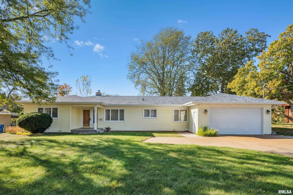
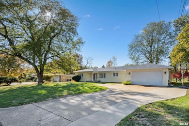
4132 Rodeo Rd Davenport, IA 52806
North Side NeighborhoodEstimated payment $1,988/month
Highlights
- 0.78 Acre Lot
- No HOA
- Forced Air Heating and Cooling System
- Ranch Style House
- 4 Car Attached Garage
- High Speed Internet
About This Home
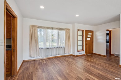
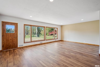
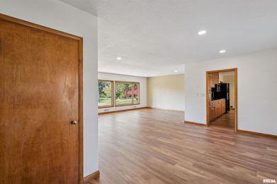
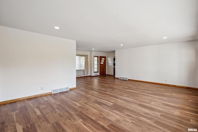
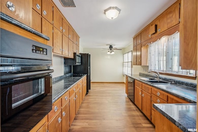
If you're looking for a home that checks all the boxes, here it is. This spacious ranch home features 3 bedrooms, a large living space, a blank canvas in the basement, and not only an oversized 21x50 garage, but an expansive back yard to complete the total package. Throughout the main floor you will notice all new vinyl flooring, fresh paint, ample counter and cabinet space in the kitchen, and newly installed lighting in the living and dining area. Call today to schedule your private showing.
Listing Agent
Mel Foster Co. Davenport Brokerage Phone: 563-271-8407 License #S66162000/475215225 Listed on: 11/05/2025

Home Details
Home Type
- Single Family
Est. Annual Taxes
- $3,724
Year Built
- Built in 1955
Lot Details
- 0.78 Acre Lot
- Lot Dimensions are 100x340
- Level Lot
Parking
- 4 Car Attached Garage
- Parking Pad
- Garage Door Opener
- On-Street Parking
Home Design
- Ranch Style House
- Block Foundation
- Frame Construction
- Shingle Roof
- Vinyl Siding
Interior Spaces
- 1,758 Sq Ft Home
- Gas Log Fireplace
- Window Treatments
- Unfinished Basement
- Basement Fills Entire Space Under The House
Bedrooms and Bathrooms
- 3 Bedrooms
- 1 Full Bathroom
Laundry
- Dryer
- Washer
Schools
- Truman Elementary School
- Davenport North High School
Utilities
- Forced Air Heating and Cooling System
- Heating System Uses Natural Gas
- Gas Water Heater
- High Speed Internet
Community Details
- No Home Owners Association
- Brunsview Park Subdivision
Listing and Financial Details
- Homestead Exemption
- Assessor Parcel Number M1507-18
Map
Home Values in the Area
Average Home Value in this Area
Tax History
| Year | Tax Paid | Tax Assessment Tax Assessment Total Assessment is a certain percentage of the fair market value that is determined by local assessors to be the total taxable value of land and additions on the property. | Land | Improvement |
|---|---|---|---|---|
| 2025 | $3,540 | $223,880 | $42,000 | $181,880 |
| 2024 | $3,452 | $208,350 | $42,000 | $166,350 |
| 2023 | $3,694 | $208,350 | $42,000 | $166,350 |
| 2022 | $3,710 | $181,810 | $36,000 | $145,810 |
| 2021 | $3,710 | $181,810 | $36,000 | $145,810 |
| 2020 | $3,626 | $175,690 | $36,000 | $139,690 |
| 2019 | $3,640 | $170,780 | $36,000 | $134,780 |
| 2018 | $3,290 | $170,780 | $36,000 | $134,780 |
| 2017 | $882 | $158,530 | $36,000 | $122,530 |
| 2016 | $3,280 | $158,530 | $0 | $0 |
| 2015 | $3,280 | $162,990 | $0 | $0 |
| 2014 | $3,426 | $162,990 | $0 | $0 |
| 2013 | $3,362 | $0 | $0 | $0 |
| 2012 | -- | $161,100 | $41,750 | $119,350 |
Property History
| Date | Event | Price | List to Sale | Price per Sq Ft |
|---|---|---|---|---|
| 11/05/2025 11/05/25 | For Sale | $319,900 | -- | $182 / Sq Ft |
Purchase History
| Date | Type | Sale Price | Title Company |
|---|---|---|---|
| Quit Claim Deed | -- | -- |
Source: RMLS Alliance
MLS Number: QC4269119
APN: M1507-18
Disclaimer: Certain information contained herein is derived from information provided by parties other than Homes.com. All information provided is deemed reliable, but is not guaranteed to be accurate and should be independently verified.
![]() IDX information is provided exclusively for personal, non-commercial use, and may not be used for any purpose other than to identify prospective properties consumers may be interested in purchasing. Information is deemed reliable but not guaranteed.
IDX information is provided exclusively for personal, non-commercial use, and may not be used for any purpose other than to identify prospective properties consumers may be interested in purchasing. Information is deemed reliable but not guaranteed.
- 4406 Regency Place
- 1901 W 38th St
- 1453 W 41st St
- 3831 N Sturdevant St
- 1517 W Kimberly Rd
- 3612 Wilkes Ave
- 1617 W 38th St
- 2307 W 38th Place
- 4661 Hitching Post Ct
- 28 W Village Cir
- 4705 N Sturdevant St
- 4618 Fillmore Ln
- 2159 W 35th St
- 1336 W 38th Place
- Lot 29 W 34th St
- 2127 W 51st St
- 3433 Washington St
- 1344 W 37th St
- 2223 W 34th St
- 3812 N Thornwood Ave
- 1905-1935 W 40th St
- 4406 N Division St
- 4323 N Division St
- 1650-1650 W 42nd St
- 1650 W 42nd St Unit 11
- 1646 W 42nd St Unit 12
- 1646 W 42nd St Unit 3
- 1616-1634 W 42nd St
- 2154 W 36th St
- 3575 Marquette St
- 1765 Valley Dr
- 5337 Villa Dr
- 2930 N Lincoln Ave
- 3439 Hillandale Rd
- 3320 W 42nd St
- 4625 Candlelight Dr
- 4811 Candlelight Dr
- 2206 Pacific St
- 605 W 53rd St
- 2133 N Division St