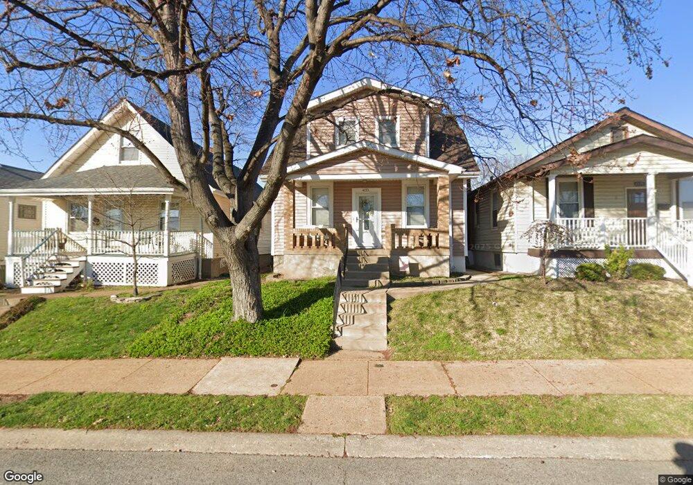
4133 Blow St Saint Louis, MO 63116
Boulevard Heights NeighborhoodEstimated Value: $141,000 - $205,000
--
Bed
1
Bath
1,248
Sq Ft
$131/Sq Ft
Est. Value
About This Home
This home is located at 4133 Blow St, Saint Louis, MO 63116 and is currently estimated at $163,336, approximately $130 per square foot. 4133 Blow St is a home located in St. Louis City with nearby schools including Woerner Elementary School, Long International Middle School, and Roosevelt High School.
Ownership History
Date
Name
Owned For
Owner Type
Purchase Details
Closed on
Feb 26, 2021
Sold by
Wisely Jerry B and Wisely Kathy Sue
Bought by
Fernandez Alexander Joseph
Current Estimated Value
Home Financials for this Owner
Home Financials are based on the most recent Mortgage that was taken out on this home.
Original Mortgage
$88,350
Outstanding Balance
$79,200
Interest Rate
2.7%
Mortgage Type
New Conventional
Estimated Equity
$84,136
Create a Home Valuation Report for This Property
The Home Valuation Report is an in-depth analysis detailing your home's value as well as a comparison with similar homes in the area
Home Values in the Area
Average Home Value in this Area
Purchase History
| Date | Buyer | Sale Price | Title Company |
|---|---|---|---|
| Fernandez Alexander Joseph | $93,000 | Title Partners Agency Llc |
Source: Public Records
Mortgage History
| Date | Status | Borrower | Loan Amount |
|---|---|---|---|
| Open | Fernandez Alexander Joseph | $88,350 |
Source: Public Records
Tax History Compared to Growth
Tax History
| Year | Tax Paid | Tax Assessment Tax Assessment Total Assessment is a certain percentage of the fair market value that is determined by local assessors to be the total taxable value of land and additions on the property. | Land | Improvement |
|---|---|---|---|---|
| 2025 | $1,795 | $23,340 | $2,570 | $20,770 |
| 2024 | $1,708 | $21,110 | $2,570 | $18,540 |
| 2023 | $1,708 | $21,110 | $2,570 | $18,540 |
| 2022 | $1,634 | $19,430 | $2,570 | $16,860 |
| 2021 | $1,632 | $19,430 | $2,570 | $16,860 |
| 2020 | $1,439 | $17,230 | $2,570 | $14,660 |
| 2019 | $1,434 | $17,240 | $2,570 | $14,670 |
| 2018 | $1,416 | $16,490 | $2,280 | $14,210 |
| 2017 | $1,393 | $16,490 | $2,280 | $14,210 |
| 2016 | $1,403 | $16,400 | $2,280 | $14,120 |
| 2015 | $1,273 | $16,400 | $2,280 | $14,120 |
| 2014 | $1,261 | $16,400 | $2,280 | $14,120 |
| 2013 | -- | $16,260 | $2,280 | $13,980 |
Source: Public Records
Map
Nearby Homes
- 4138 Loughborough Ave
- 4153 Loughborough Ave
- 4311 Loughborough Ave
- 4323 Loughborough Ave
- 4102 Upton Ct
- 6815 Parkwood Place
- 6925 Wanda Ct
- 4028 Quincy St
- 6833 Wanda Ave
- 4317 Koeln Ave
- 7401 Morganford Rd
- 4114 Alma Ave
- 4116 Koeln Ave
- 6613 Parkwood Place
- 4317 Alma Ave
- 4329 Alma Ave
- 7316 Sharp Ave
- 6522 Parkwood Place
- 6509 Morganford Rd
- 6432 Wanda Ave