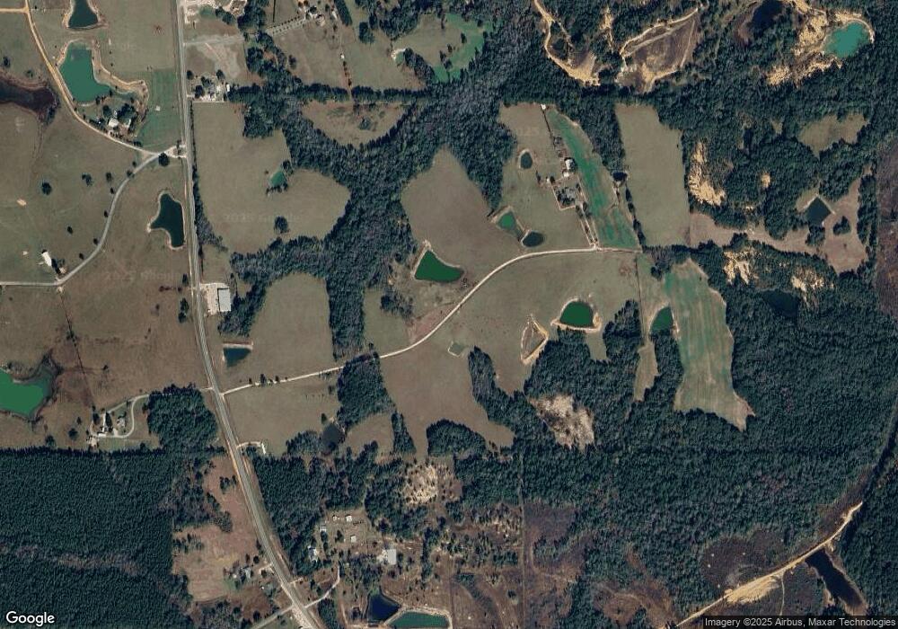
4133 Cuevas Farm Rd Perkinston, MS 39573
Estimated Value: $353,936 - $507,000
3
Beds
1
Bath
2,802
Sq Ft
$148/Sq Ft
Est. Value
About This Home
This home is located at 4133 Cuevas Farm Rd, Perkinston, MS 39573 and is currently estimated at $414,645, approximately $147 per square foot. 4133 Cuevas Farm Rd is a home located in Hancock County with nearby schools including Hancock North Central Elementary School, Hancock Middle School, and Hancock High School.
Ownership History
Date
Name
Owned For
Owner Type
Purchase Details
Closed on
Dec 9, 2022
Sold by
Thibodaux Amy Cuevas
Bought by
Amys Beach Life Llc
Current Estimated Value
Purchase Details
Closed on
Dec 17, 2021
Sold by
Elbert Cuevas Alex and Spiers Darnell
Bought by
Thibodaux Amy Cuevas
Purchase Details
Closed on
Aug 19, 2021
Sold by
Elbert Cuevas Alex and Elbert Darnell S
Bought by
Kirsch Karl
Create a Home Valuation Report for This Property
The Home Valuation Report is an in-depth analysis detailing your home's value as well as a comparison with similar homes in the area
Home Values in the Area
Average Home Value in this Area
Purchase History
| Date | Buyer | Sale Price | Title Company |
|---|---|---|---|
| Amys Beach Life Llc | -- | -- | |
| Amys Beach Life Llc | -- | None Listed On Document | |
| Thibodaux Amy Cuevas | -- | Byrne Julien K | |
| Kirsch Karl | -- | New Title Company Name |
Source: Public Records
Tax History Compared to Growth
Tax History
| Year | Tax Paid | Tax Assessment Tax Assessment Total Assessment is a certain percentage of the fair market value that is determined by local assessors to be the total taxable value of land and additions on the property. | Land | Improvement |
|---|---|---|---|---|
| 2024 | $2,053 | $21,558 | $3,038 | $18,520 |
| 2023 | $2,047 | $21,496 | $3,079 | $18,417 |
| 2022 | $1,337 | $21,536 | $3,119 | $18,417 |
| 2021 | $1,341 | $21,583 | $3,166 | $18,417 |
| 2020 | $1,353 | $21,196 | $3,213 | $17,983 |
| 2019 | $1,801 | $21,248 | $3,265 | $17,983 |
| 2018 | $1,787 | $21,105 | $3,293 | $17,812 |
| 2017 | $1,787 | $21,108 | $3,296 | $17,812 |
| 2016 | $1,724 | $20,996 | $3,184 | $17,812 |
| 2015 | $1,476 | $19,411 | $3,220 | $16,191 |
| 2014 | $1,426 | $19,282 | $3,091 | $16,191 |
| 2013 | $1,359 | $19,223 | $3,032 | $16,191 |
Source: Public Records
Map
Nearby Homes
- 4011 Stewart Ln
- 5677 Highway 53
- 5121 Jordan Rd
- 0 Caesar Necaise Rd
- 100 Marty Ln
- 549 Barth Rd
- 0 Mississippi 603 Unit LotWP001
- 29113 Mississippi 603
- 23156 Tally Shaw Rd
- 27585 V Bar Rd
- 1000 W Bull Creek Dr
- 7060 Sunfish Cove
- 7045 Sunfish Cove
- 0 Sunfish Cove Unit 4115604
- 0 Mississippi 53
- 12 Racoon Cove
- 26004 Bowfin Dr
- 0 Bluegill Point
- 26141 Highway 603
- 26126 Quail Ridge Cir
- 4235 Melvin Shaw Rd
- 4205 Melvin Shaw
- 4205 Melvin Shaw
- 5490 Highway 53
- 5450 Highway 53
- 5564 Highway 53
- 5056 Highway 53
- 5231 Melvin Shaw Rd
- 5558 Highway 53
- 30008 Ash Lake Farm Rd
- 4201 Melvin Shaw Rd
- 5111 Highway 53
- 5231 Highway 53
- 5075 Highway 53
- 4721 Highway 53
- 4692 Highway 53
- 4680 Highway 53
- 5270 Melvin Shaw Rd
- 5023 Highway 53
- 5675 Highway 53
