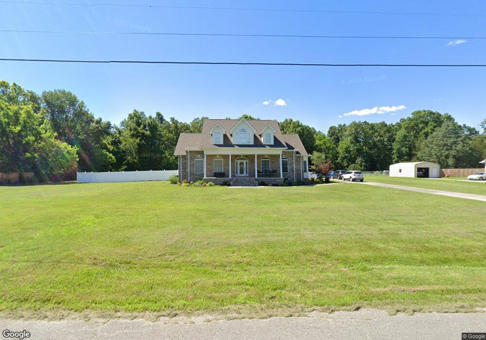
4135 Double S Rd Dayton, TN 37321
Estimated Value: $451,301 - $514,000
Studio
4
Baths
2,811
Sq Ft
$170/Sq Ft
Est. Value
About This Home
This home is located at 4135 Double S Rd, Dayton, TN 37321 and is currently estimated at $478,325, approximately $170 per square foot. 4135 Double S Rd is a home located in Rhea County with nearby schools including Rhea County High School.
Ownership History
Date
Name
Owned For
Owner Type
Purchase Details
Closed on
Apr 1, 2006
Bought by
Keylon Terry E
Current Estimated Value
Purchase Details
Closed on
Oct 1, 2001
Sold by
Warren Stuart
Bought by
Lebron Purser Kenneth
Purchase Details
Closed on
Sep 27, 2001
Bought by
Purser Kenneth Lebron and Purser Rachel
Purchase Details
Closed on
Sep 3, 1999
Sold by
And Stuart Warren
Bought by
Wade Clayton Justin
Home Financials for this Owner
Home Financials are based on the most recent Mortgage that was taken out on this home.
Original Mortgage
$53,104
Interest Rate
7.91%
Purchase Details
Closed on
Oct 15, 1981
Bought by
Stuart Warren and Stuart Cindy
Purchase Details
Closed on
Jan 1, 1981
Purchase Details
Closed on
Feb 14, 1964
Create a Home Valuation Report for This Property
The Home Valuation Report is an in-depth analysis detailing your home's value as well as a comparison with similar homes in the area
Home Values in the Area
Average Home Value in this Area
Purchase History
| Date | Buyer | Sale Price | Title Company |
|---|---|---|---|
| Keylon Terry E | $245,000 | -- | |
| Lebron Purser Kenneth | -- | -- | |
| Purser Kenneth Lebron | $23,000 | -- | |
| Wade Clayton Justin | $12,000 | -- | |
| Stuart Warren | -- | -- | |
| -- | $3,400 | -- | |
| -- | -- | -- |
Source: Public Records
Mortgage History
| Date | Status | Borrower | Loan Amount |
|---|---|---|---|
| Previous Owner | Not Available | $53,104 |
Source: Public Records
Tax History
| Year | Tax Paid | Tax Assessment Tax Assessment Total Assessment is a certain percentage of the fair market value that is determined by local assessors to be the total taxable value of land and additions on the property. | Land | Improvement |
|---|---|---|---|---|
| 2025 | $1,486 | $110,175 | $7,700 | $102,475 |
| 2024 | $1,493 | $110,700 | $7,700 | $103,000 |
| 2023 | $1,527 | $67,700 | $6,925 | $60,775 |
| 2022 | $1,527 | $67,700 | $6,925 | $60,775 |
| 2021 | $1,527 | $67,700 | $6,925 | $60,775 |
| 2020 | $1,527 | $67,700 | $6,925 | $60,775 |
| 2019 | $1,485 | $65,875 | $6,925 | $58,950 |
| 2018 | $1,227 | $55,875 | $6,275 | $49,600 |
| 2017 | $1,227 | $55,875 | $6,275 | $49,600 |
| 2016 | $1,227 | $55,875 | $6,275 | $49,600 |
| 2015 | $1,171 | $55,875 | $6,275 | $49,600 |
| 2014 | $1,171 | $55,875 | $6,275 | $49,600 |
| 2013 | -- | $55,875 | $6,275 | $49,600 |
Source: Public Records
Map
Nearby Homes
- 0 New Bethel Rd Unit RTC3014253
- 0 New Bethel Rd Unit 1522095
- 0 New Bethel Rd Unit 1318405
- 253 Heavenlee Ln
- 66 New Union Rd
- 0 Blue Sky Dr Unit RTC3072107
- 0 Blue Sky Dr Unit 1525966
- 0 Blue Sky Dr Unit 1525965
- 0 Blue Sky Dr Unit 1525963
- 0 Blue Sky Dr Unit RTC3072115
- 1405 Shady Ln
- 148 Peggy Ln
- 3189 Old Washington Hwy
- Lot 32 Overlook Dr
- 32 Overlook Dr
- 387 Overlook Dr
- 451 Overlook Dr
- 345 Overlook Dr
- 375 Overlook Dr
- 4101 Double Rd S
- 4175 Double Rd S
- 4175 Double S Rd
- 4175 Double S Rd
- 4101 Double S Rd
- 4101 Double S Rd
- 4101 Double S Rd
- 4168 Double S Rd
- 4106 Double S Rd
- 1125 New Union Rd
- 4219 Double S Rd
- 4219 Double S Rd
- 4219 Double Rd S
- 114 Paul Lane Dr
- 1194 New Union Rd
- 11 Paul Lane Dr
- 120 Paul Lane Dr
- 1065 New Union Rd
- 124 Paul Lane Dr
- 338 Bishop Rd
Your Personal Tour Guide
Ask me questions while you tour the home.