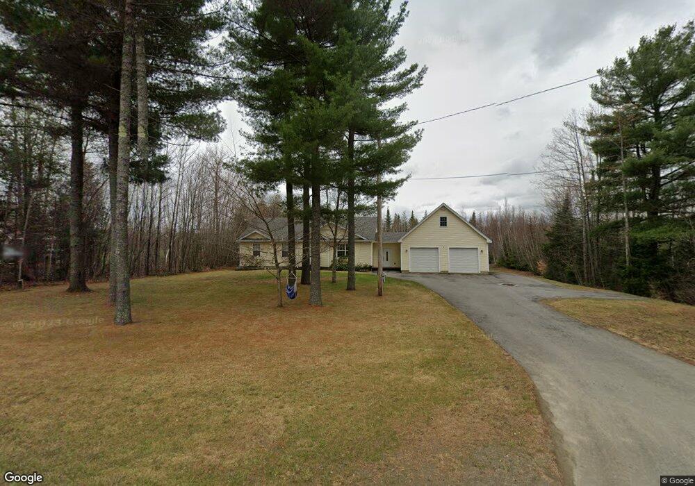
4136 Union St Levant, ME 04456
Estimated Value: $386,000 - $490,000
3
Beds
2
Baths
1,684
Sq Ft
$255/Sq Ft
Est. Value
About This Home
This home is located at 4136 Union St, Levant, ME 04456 and is currently estimated at $428,620, approximately $254 per square foot. 4136 Union St is a home located in Penobscot County with nearby schools including Suzanne M. Smith Elementary School and Caravel Middle School.
Ownership History
Date
Name
Owned For
Owner Type
Purchase Details
Closed on
May 5, 2021
Sold by
Kipler Kevin P and Kipler Melissa J
Bought by
Kipler Melissa J
Current Estimated Value
Home Financials for this Owner
Home Financials are based on the most recent Mortgage that was taken out on this home.
Original Mortgage
$172,400
Outstanding Balance
$155,063
Interest Rate
2.9%
Mortgage Type
Purchase Money Mortgage
Estimated Equity
$273,557
Purchase Details
Closed on
Jul 12, 2006
Sold by
Stlouis Dale T and Stlouis Theresa L
Bought by
Kipler Kevin P and Kipler Melissa J
Create a Home Valuation Report for This Property
The Home Valuation Report is an in-depth analysis detailing your home's value as well as a comparison with similar homes in the area
Home Values in the Area
Average Home Value in this Area
Purchase History
| Date | Buyer | Sale Price | Title Company |
|---|---|---|---|
| Kipler Melissa J | -- | None Available | |
| Kipler Kevin P | -- | -- |
Source: Public Records
Mortgage History
| Date | Status | Borrower | Loan Amount |
|---|---|---|---|
| Open | Kipler Melissa J | $172,400 |
Source: Public Records
Tax History Compared to Growth
Tax History
| Year | Tax Paid | Tax Assessment Tax Assessment Total Assessment is a certain percentage of the fair market value that is determined by local assessors to be the total taxable value of land and additions on the property. | Land | Improvement |
|---|---|---|---|---|
| 2024 | $3,329 | $302,600 | $44,900 | $257,700 |
| 2023 | $3,277 | $278,900 | $44,900 | $234,000 |
| 2022 | $3,315 | $189,400 | $34,600 | $154,800 |
| 2021 | $3,315 | $189,400 | $34,600 | $154,800 |
| 2020 | $3,315 | $189,400 | $34,600 | $154,800 |
| 2019 | $2,841 | $189,400 | $34,600 | $154,800 |
| 2018 | $2,673 | $190,900 | $34,600 | $156,300 |
| 2017 | $2,385 | $176,700 | $34,600 | $142,100 |
| 2016 | $2,209 | $176,700 | $34,600 | $142,100 |
| 2015 | $2,209 | $176,700 | $34,600 | $142,100 |
| 2014 | $2,209 | $176,700 | $34,600 | $142,100 |
Source: Public Records
Map
Nearby Homes
- 3935 Union St
- 189 Stetson Rd E
- 21 Stetson Rd E
- 24 Robichaud Rd
- # S Levant Rd
- 5 Deer Run Ln
- 61 Club House Rd
- 9A Clark Rd
- 21 Maple Dr
- 70 Clark Rd
- 21 Madison Dr
- 40 Doughty Blvd
- 38 Island Farm Rd
- 9 Thibodeau Dr
- 263 Mudgett Rd
- 100 Dill Rd
- 168 Bemis Rd Unit 4
- 35 Birchbrook Ln Unit 35A
- 256 Merrill Rd
- 278 Merrill Rd
- 4128 Union St
- 0 Union St
- 4143 Union St
- 4124 Union St
- 4150 Union St
- TBD Lot 13 Lindsay Dr
- 00 Maple Dr
- 4153 Union St
- 25 Mcintosh Ave
- 27 Upper Ln
- Lot 8 Maple Ln
- Lot 10 Maple Ln
- 12 Staples Ln
- 000 Maple Lane Subdivision French Rd
- Lot 9 Savanna Ln
- 45 Lindsay Dr
- 4165 Union St
- 4170 Union St
- 4160 Union St
- 21 Wagner Rd