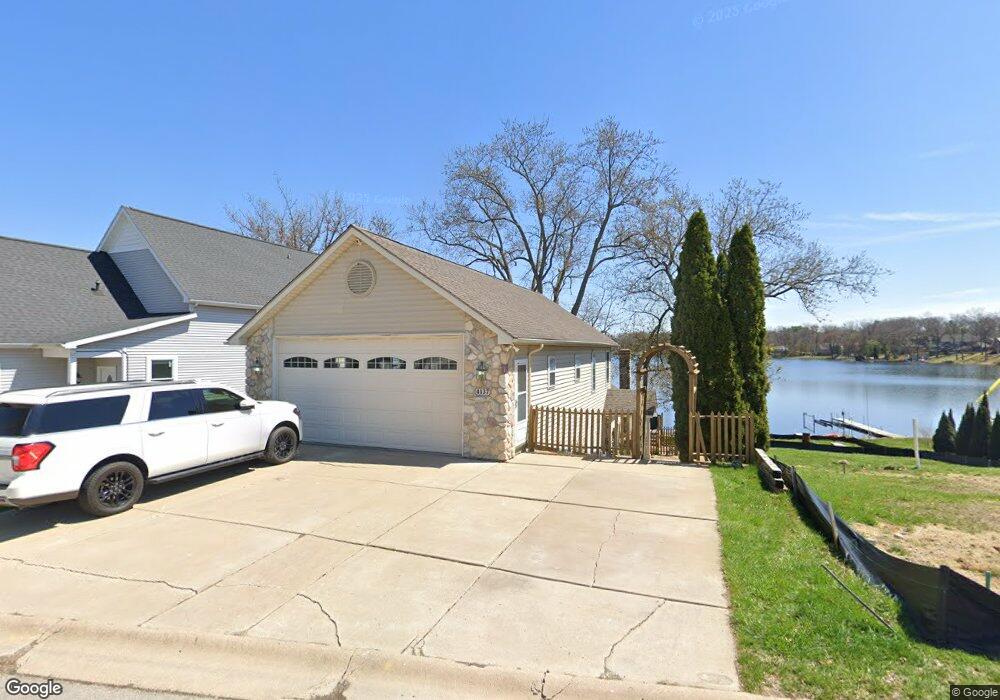
4137 Highcrest Dr Unit Bldg-Unit Brighton, MI 48116
Estimated Value: $500,000 - $560,000
3
Beds
2
Baths
1,750
Sq Ft
$299/Sq Ft
Est. Value
About This Home
This home is located at 4137 Highcrest Dr Unit Bldg-Unit, Brighton, MI 48116 and is currently estimated at $523,166, approximately $298 per square foot. 4137 Highcrest Dr Unit Bldg-Unit is a home located in Livingston County with nearby schools including Hornung Elementary School, Scranton Middle School, and Brighton High School.
Ownership History
Date
Name
Owned For
Owner Type
Purchase Details
Closed on
Jul 13, 2021
Sold by
Lister Deanne
Bought by
Gorham Katie and Gorham Cody
Current Estimated Value
Home Financials for this Owner
Home Financials are based on the most recent Mortgage that was taken out on this home.
Original Mortgage
$372,500
Outstanding Balance
$338,141
Interest Rate
2.93%
Mortgage Type
VA
Estimated Equity
$185,025
Purchase Details
Closed on
Feb 24, 2016
Sold by
Dalton Richard J and Dalton Martina L
Bought by
Lister Deanne
Create a Home Valuation Report for This Property
The Home Valuation Report is an in-depth analysis detailing your home's value as well as a comparison with similar homes in the area
Home Values in the Area
Average Home Value in this Area
Purchase History
| Date | Buyer | Sale Price | Title Company |
|---|---|---|---|
| Gorham Katie | $372,500 | Select Title Company | |
| Lister Deanne | $268,295 | Select Title Company |
Source: Public Records
Mortgage History
| Date | Status | Borrower | Loan Amount |
|---|---|---|---|
| Open | Gorham Katie | $372,500 |
Source: Public Records
Tax History Compared to Growth
Tax History
| Year | Tax Paid | Tax Assessment Tax Assessment Total Assessment is a certain percentage of the fair market value that is determined by local assessors to be the total taxable value of land and additions on the property. | Land | Improvement |
|---|---|---|---|---|
| 2025 | $5,641 | $250,300 | $0 | $0 |
| 2024 | $2,562 | $208,900 | $0 | $0 |
| 2023 | $2,449 | $186,800 | $0 | $0 |
| 2022 | $4,300 | $159,600 | $0 | $0 |
| 2021 | $6,700 | $161,900 | $0 | $0 |
| 2020 | $6,792 | $163,000 | $0 | $0 |
| 2019 | $6,679 | $159,600 | $0 | $0 |
| 2018 | $6,391 | $148,800 | $0 | $0 |
| 2017 | $6,387 | $148,800 | $0 | $0 |
| 2016 | $2,695 | $137,500 | $0 | $0 |
| 2014 | $2,198 | $129,400 | $0 | $0 |
| 2012 | $2,198 | $122,400 | $0 | $0 |
Source: Public Records
Map
Nearby Homes
- 4075 Highcrest Dr
- 4510 Filbert Dr
- 3836 Highcrest Dr
- 4663 Huntington Dr Unit 20
- 4227 Colonial Ct
- 4441 Glen Eagles Ct Unit 87
- 4868 Pine Eagles Ct Unit 1
- 4580 Stillmeadow Dr
- 4955 Crooked Stick Ct
- 3186 Aspen Ridge Ct
- 5089 Northfield Dr Unit 10
- 2895 Spring Hill Dr
- 2861 Spring Hill Dr
- 5150 Old Hickory Dr
- 3480 E Coon Lake Rd
- 1047 Weatherstone Ln
- 5728 Eggert Place
- Parcel 2 E Coon Lake Rd
- Parcel 1 E Coon Lake Rd
- 3535 Westphal Rd
- 4137 Highcrest Dr
- 4143 Highcrest Dr
- 4133 Highcrest Dr
- 4129 Highcrest Dr
- 4149 Highcrest Dr
- 4117 Highcrest Dr
- 4159 Highcrest Dr
- 4130 Highcrest Dr
- 4105 Highcrest Dr
- 4165 Highcrest Dr
- 4136 Highcrest Dr
- 4142 Highcrest Dr
- 4150 Highcrest Dr
- 4122 Highcrest Dr
- 4097 Highcrest Dr
- 4177 Highcrest Dr
- 4118 Highcrest Dr
- 4158 Highcrest Dr
- 4114 Highcrest Dr
- 4091 Highcrest Dr