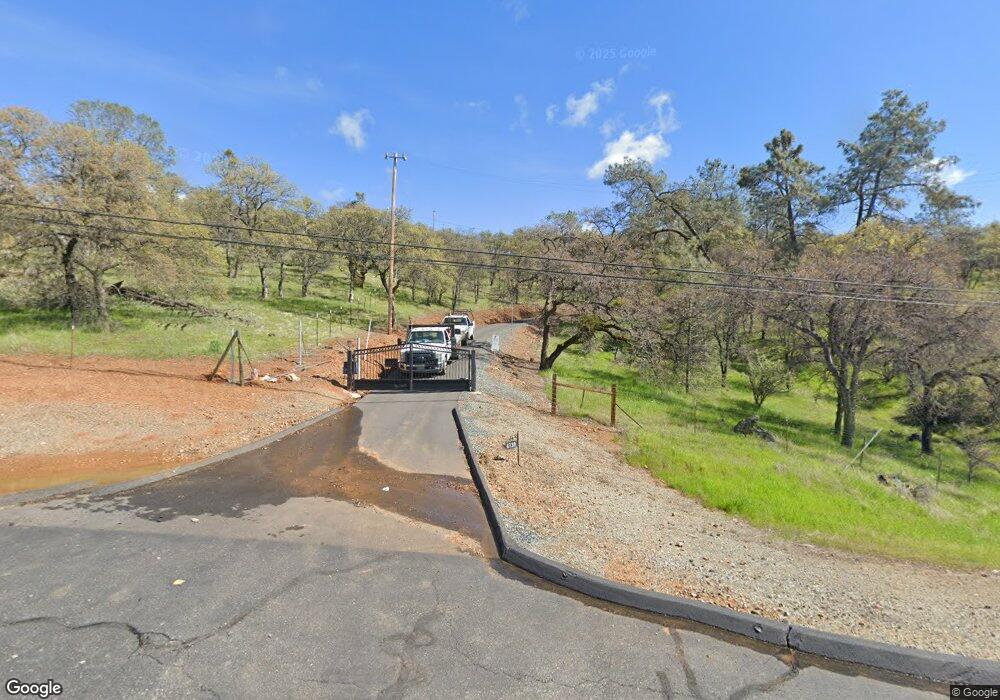
4139 State Highway 132 La Grange, CA 95329
Estimated Value: $466,000 - $597,000
3
Beds
3
Baths
2,485
Sq Ft
$213/Sq Ft
Est. Value
About This Home
This home is located at 4139 State Highway 132, La Grange, CA 95329 and is currently estimated at $530,387, approximately $213 per square foot. 4139 State Highway 132 is a home.
Ownership History
Date
Name
Owned For
Owner Type
Purchase Details
Closed on
May 5, 2015
Sold by
Mullins Todd and Mullins Lisa
Bought by
Todd L Mullins & Lisa A Mullins Family T
Current Estimated Value
Purchase Details
Closed on
Feb 26, 2013
Sold by
Carroll John and Carroll Debra
Bought by
The Bank Of New York Mellon
Purchase Details
Closed on
Jan 31, 2013
Sold by
Carroll John and Carroll Debra
Bought by
The Bank Of New Mellon
Purchase Details
Closed on
May 16, 2007
Sold by
Carroll John and Carroll Debra
Bought by
Carroll John and Carroll Debra
Home Financials for this Owner
Home Financials are based on the most recent Mortgage that was taken out on this home.
Original Mortgage
$500,000
Interest Rate
6.18%
Mortgage Type
Stand Alone Refi Refinance Of Original Loan
Create a Home Valuation Report for This Property
The Home Valuation Report is an in-depth analysis detailing your home's value as well as a comparison with similar homes in the area
Home Values in the Area
Average Home Value in this Area
Purchase History
| Date | Buyer | Sale Price | Title Company |
|---|---|---|---|
| Todd L Mullins & Lisa A Mullins Family T | -- | None Available | |
| The Bank Of New York Mellon | $285,750 | None Available | |
| The Bank Of New Mellon | $285,750 | None Available | |
| Carroll John | -- | Stewart Title Of Ca Inc |
Source: Public Records
Mortgage History
| Date | Status | Borrower | Loan Amount |
|---|---|---|---|
| Previous Owner | Carroll John | $500,000 |
Source: Public Records
Tax History Compared to Growth
Tax History
| Year | Tax Paid | Tax Assessment Tax Assessment Total Assessment is a certain percentage of the fair market value that is determined by local assessors to be the total taxable value of land and additions on the property. | Land | Improvement |
|---|---|---|---|---|
| 2025 | $4,043 | $399,092 | $118,210 | $280,882 |
| 2024 | $4,043 | $391,268 | $115,893 | $275,375 |
| 2023 | $4,043 | $383,597 | $113,621 | $269,976 |
| 2022 | $3,902 | $376,077 | $111,394 | $264,683 |
| 2021 | $3,938 | $368,704 | $109,210 | $259,494 |
| 2020 | $3,899 | $364,925 | $108,091 | $256,834 |
| 2019 | $3,781 | $357,771 | $105,972 | $251,799 |
| 2018 | $3,728 | $350,757 | $103,895 | $246,862 |
| 2017 | $3,641 | $343,880 | $101,858 | $242,022 |
| 2016 | $3,451 | $337,138 | $99,861 | $237,277 |
| 2015 | $3,401 | $332,074 | $98,361 | $233,713 |
| 2014 | -- | $325,570 | $96,435 | $229,135 |
Source: Public Records
Map
Nearby Homes
- 4577 Madreselva St
- 837 Castillo Way
- 13695 Barro Ct
- 13651 Barro Ct
- 10324 Gusanillo Way
- 3601 Ladera Way
- 3357 Maravilla Dr
- 0 Castillo Way Unit 225043107
- 0 Castillo Way Unit 225125624
- 0 Arbolada Dr Unit 224065324
- 0 Arbolada Dr Unit 41114682
- 0 Hoyito Cir
- 10090 Arbolada Dr
- 00000 Arbolada Dr
- 3196 Granite Springs Rd
- 10502 Enramada Dr
- 3261 Granite Springs Rd
- 0 Salinas St Unit 225032962
- 0 Ladera Way Unit 41082157
- 10427 Violeta Way
- 4139 State Highway 132
- 4139 State Highway 132
- 4139 State Highway 132
- 14280 Amber Ridge Dr
- 4115 Arbolada Dr
- 4333 Abeto St
- 4363 Abeto St
- 3444 State Highway 132
- 4110 Arbolada Dr
- 4077 Arbolada Dr
- 4363 Enebro Way
- 4130 Arbolada Dr
- 4244 Abeto St
- 4212 Abeto St
- 3182 State Highway 132
- 4080 Arbolada Dr Unit 845
- 4080 Arbolada Dr
- 4031 Castillo Way
- 4156 Abeto St
- 7600 Enebro Way
