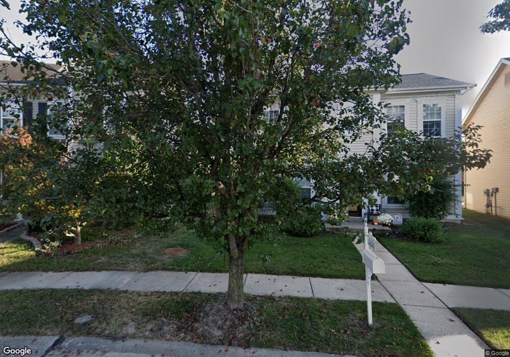
414 Covered Bridge Ln O Fallon, MO 63368
Estimated Value: $361,000 - $382,000
4
Beds
3
Baths
2,584
Sq Ft
$144/Sq Ft
Est. Value
About This Home
This home is located at 414 Covered Bridge Ln, O Fallon, MO 63368 and is currently estimated at $372,182, approximately $144 per square foot. 414 Covered Bridge Ln is a home located in St. Charles County with nearby schools including Twin Chimneys Elementary School, Fort Zumwalt West Middle School, and Fort Zumwalt West High School.
Ownership History
Date
Name
Owned For
Owner Type
Purchase Details
Closed on
Nov 21, 2013
Sold by
Pickrell Larry A and Pickrell Josephine M
Bought by
Maniaci Salvatore
Current Estimated Value
Purchase Details
Closed on
Jan 16, 2004
Sold by
The Jones Co Homes Inc
Bought by
Pickrell Larry A
Home Financials for this Owner
Home Financials are based on the most recent Mortgage that was taken out on this home.
Original Mortgage
$150,328
Interest Rate
4.87%
Mortgage Type
Purchase Money Mortgage
Create a Home Valuation Report for This Property
The Home Valuation Report is an in-depth analysis detailing your home's value as well as a comparison with similar homes in the area
Home Values in the Area
Average Home Value in this Area
Purchase History
| Date | Buyer | Sale Price | Title Company |
|---|---|---|---|
| Maniaci Salvatore | $163,211 | None Available | |
| Pickrell Larry A | -- | Ust |
Source: Public Records
Mortgage History
| Date | Status | Borrower | Loan Amount |
|---|---|---|---|
| Previous Owner | Pickrell Larry A | $150,328 | |
| Closed | Pickrell Larry A | $28,186 |
Source: Public Records
Tax History
| Year | Tax Paid | Tax Assessment Tax Assessment Total Assessment is a certain percentage of the fair market value that is determined by local assessors to be the total taxable value of land and additions on the property. | Land | Improvement |
|---|---|---|---|---|
| 2025 | $3,863 | $62,829 | -- | -- |
| 2023 | $3,867 | $60,074 | $0 | $0 |
| 2022 | $3,503 | $50,752 | $0 | $0 |
| 2021 | $3,512 | $50,752 | $0 | $0 |
| 2020 | $3,345 | $46,045 | $0 | $0 |
| 2019 | $3,358 | $46,045 | $0 | $0 |
| 2018 | $2,888 | $37,781 | $0 | $0 |
| 2017 | $2,863 | $37,781 | $0 | $0 |
| 2016 | $2,553 | $32,455 | $0 | $0 |
| 2015 | $2,353 | $32,455 | $0 | $0 |
| 2014 | $2,339 | $33,199 | $0 | $0 |
Source: Public Records
Map
Nearby Homes
- 572 Misty Mountain Dr
- 653 Covered Bridge Ln
- 102 Riparian Dr
- 101 Haven Ridge Ct Unit LOT 47
- 2671 Whitetail Ln
- 7247 Gadwall Way
- 149 Haven Ridge Ct
- Promenade B Plan at The Courtyards at BaratHaven
- Portico Plan at The Courtyards at BaratHaven
- Palazzo B Bonus Plan at The Courtyards at BaratHaven
- 756 Thunder Hill Dr
- 47 Landyn Ct
- 2613 Tysons Pkwy
- 321 Hawks View Dr
- 711 Red Hawk Place
- New Build Savannah "E" at Dragonstone
- New Build Glacier "E" at Dragonstone
- 7 Dragonstone Ct
- 20 White Chapel Ct
- 3 Dragonstone Ct
- 416 Covered Bridge Ln
- 412 Covered Bridge Ln
- 418 Covered Bridge Ln
- 410 Covered Bridge Ln
- 420 Covered Bridge Ln
- 408 Covered Bridge Ln
- 406 Covered Bridge Ln
- 424 Covered Bridge Ln
- 419 Covered Bridge Ln
- 417 Covered Bridge Ln
- 404 Covered Bridge Ln
- 423 Covered Bridge Ln
- 415 Covered Bridge Ln
- 426 Covered Bridge Ln
- 425 Covered Bridge Ln
- 411 Covered Bridge Ln
- 428 Covered Bridge Ln
- 409 Covered Bridge Ln
- 429 Covered Bridge Ln
- 407 Covered Bridge Ln
Your Personal Tour Guide
Ask me questions while you tour the home.