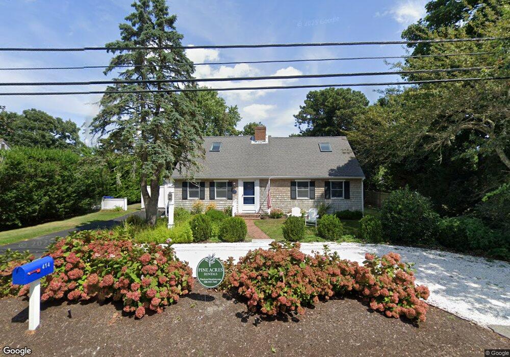
414 Crowell Rd North Chatham, MA 2650
North Chatham NeighborhoodEstimated Value: $805,000 - $1,302,000
4
Beds
2
Baths
1,671
Sq Ft
$586/Sq Ft
Est. Value
About This Home
This home is located at 414 Crowell Rd, North Chatham, MA 2650 and is currently estimated at $979,780, approximately $586 per square foot. 414 Crowell Rd is a home located in Barnstable County with nearby schools including Chatham Elementary School, Harwich Elementary School, and Monomoy Regional Middle School.
Ownership History
Date
Name
Owned For
Owner Type
Purchase Details
Closed on
Dec 2, 2014
Sold by
Terrio Peter A and Terrio Jennifer
Bought by
Kane William F and Kane Catherine
Current Estimated Value
Home Financials for this Owner
Home Financials are based on the most recent Mortgage that was taken out on this home.
Original Mortgage
$266,000
Outstanding Balance
$207,479
Interest Rate
4%
Mortgage Type
New Conventional
Estimated Equity
$772,301
Purchase Details
Closed on
Apr 5, 1996
Sold by
Matheson Robert S and Matheson Ellen W
Bought by
Terrio Peter A and Terrio Caroline
Create a Home Valuation Report for This Property
The Home Valuation Report is an in-depth analysis detailing your home's value as well as a comparison with similar homes in the area
Home Values in the Area
Average Home Value in this Area
Purchase History
| Date | Buyer | Sale Price | Title Company |
|---|---|---|---|
| Kane William F | $332,500 | -- | |
| Terrio Peter A | $145,000 | -- |
Source: Public Records
Mortgage History
| Date | Status | Borrower | Loan Amount |
|---|---|---|---|
| Open | Kane William F | $266,000 | |
| Previous Owner | Terrio Peter A | $30,000 | |
| Previous Owner | Terrio Peter A | $139,300 | |
| Previous Owner | Terrio Peter A | $130,000 | |
| Previous Owner | Terrio Peter A | $113,500 |
Source: Public Records
Tax History Compared to Growth
Tax History
| Year | Tax Paid | Tax Assessment Tax Assessment Total Assessment is a certain percentage of the fair market value that is determined by local assessors to be the total taxable value of land and additions on the property. | Land | Improvement |
|---|---|---|---|---|
| 2025 | $2,645 | $762,200 | $285,700 | $476,500 |
| 2024 | $2,588 | $724,900 | $269,500 | $455,400 |
| 2023 | $2,290 | $590,300 | $190,900 | $399,400 |
| 2022 | $2,182 | $472,300 | $190,900 | $281,400 |
| 2021 | $2,140 | $429,700 | $173,500 | $256,200 |
| 2020 | $2,039 | $423,000 | $163,300 | $259,700 |
| 2019 | $1,795 | $370,000 | $162,200 | $207,800 |
| 2018 | $1,674 | $343,700 | $152,700 | $191,000 |
| 2017 | $1,679 | $333,800 | $148,200 | $185,600 |
| 2016 | $1,698 | $338,300 | $145,300 | $193,000 |
| 2015 | $1,620 | $324,700 | $141,200 | $183,500 |
| 2014 | $1,546 | $304,400 | $123,600 | $180,800 |
Source: Public Records
Map
Nearby Homes
- 39 Meadow Brook Rd
- 109 Misty Meadow Ln Unit 2
- 109 Misty Meadow Ln Unit 4
- 111 Enterprise Dr
- 231 Crowell Rd
- 98 Horizon Dr
- 55 Winterset Dr
- 27 Martha Kendrick Dr
- 207 Horizon Dr
- 597 Orleans Rd
- 56 Skyline Dr
- 912 Main St Unit 304
- 230 Barcliff Ave
- 44 Emery Ln
- 93 Orleans Rd
- 24 Hillcrest Rd
- 92 Barcliff Ave
- 785 Old Harbor Rd
- 414 Crowell Rd
- 424 Crowell Rd
- 404 Crowell Rd
- 404 Crowell Rd
- 39 Meadowbrook Rd
- 49 Meadowbrook Rd
- 49 Meadow Brook Rd
- 23 Meadowbrook Rd
- 436 Crowell Rd
- 436 Crowell Rd
- 8 Meadowbrook Rd
- 46 Meadowbrook Rd
- 8 Meadow Brook Rd
- 61 Meadowbrook Rd
- 34 Meadow Brook Rd
- 34 Meadowbrook Rd
- 61 Meadow Brook Rd
- 46 Meadow Brook Rd
- 444 Crowell Rd
- 444 Crowell Rd