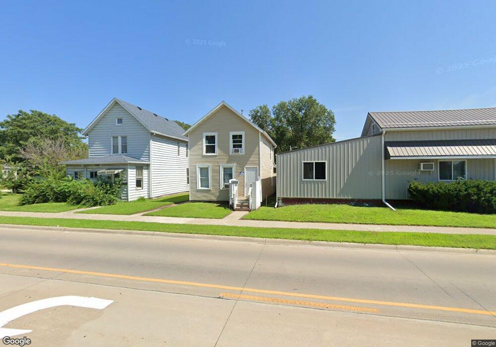
414 Grandview Ave Muscatine, IA 52761
Estimated Value: $67,000 - $95,000
2
Beds
1
Bath
1,360
Sq Ft
$60/Sq Ft
Est. Value
About This Home
This home is located at 414 Grandview Ave, Muscatine, IA 52761 and is currently estimated at $81,000, approximately $59 per square foot. 414 Grandview Ave is a home located in Muscatine County with nearby schools including Franklin Elementary School, Susan Clark Junior High School, and Muscatine High School.
Ownership History
Date
Name
Owned For
Owner Type
Purchase Details
Closed on
Jan 26, 2012
Sold by
Mcmanus Barry and Mcmanus Terri
Bought by
Mcmanus Dallas and Mcmanus Kerri
Current Estimated Value
Purchase Details
Closed on
Feb 11, 2011
Sold by
Terry Ronald H and Terry Robyn Ranae
Bought by
Mcmanus Dallas R and Mcmanus Kerri L
Home Financials for this Owner
Home Financials are based on the most recent Mortgage that was taken out on this home.
Original Mortgage
$65,000
Outstanding Balance
$44,541
Interest Rate
4.81%
Mortgage Type
Future Advance Clause Open End Mortgage
Estimated Equity
$36,459
Create a Home Valuation Report for This Property
The Home Valuation Report is an in-depth analysis detailing your home's value as well as a comparison with similar homes in the area
Home Values in the Area
Average Home Value in this Area
Purchase History
| Date | Buyer | Sale Price | Title Company |
|---|---|---|---|
| Mcmanus Dallas | -- | None Available | |
| Mcmanus Dallas R | $78,000 | None Available |
Source: Public Records
Mortgage History
| Date | Status | Borrower | Loan Amount |
|---|---|---|---|
| Open | Mcmanus Dallas R | $65,000 |
Source: Public Records
Tax History Compared to Growth
Tax History
| Year | Tax Paid | Tax Assessment Tax Assessment Total Assessment is a certain percentage of the fair market value that is determined by local assessors to be the total taxable value of land and additions on the property. | Land | Improvement |
|---|---|---|---|---|
| 2025 | $994 | $58,650 | $7,470 | $51,180 |
| 2024 | $994 | $54,880 | $7,470 | $47,410 |
| 2023 | $940 | $53,954 | $7,473 | $46,481 |
| 2022 | $826 | $45,190 | $7,050 | $38,140 |
| 2021 | $826 | $40,490 | $7,050 | $33,440 |
| 2020 | $798 | $37,970 | $7,050 | $30,920 |
| 2019 | $676 | $30,610 | $0 | $0 |
| 2018 | $948 | $30,610 | $0 | $0 |
| 2017 | $650 | $28,800 | $0 | $0 |
| 2016 | $652 | $28,800 | $0 | $0 |
| 2015 | $652 | $29,610 | $0 | $0 |
| 2014 | $674 | $29,610 | $0 | $0 |
Source: Public Records
Map
Nearby Homes
- LOTS 30-34 Evans St
- 1827 Hershey Ave
- 1903 Hershey Ave
- 2108 Breese Ave
- 111 Gilbert St
- 900 W 3rd St
- 0 Parcel 1302108019 (Busch St)
- 0 Towhead Island Unit 23-716
- 701 W Mississippi Dr
- 2216 New Hampshire St
- 1603 Lucas St
- 1708 Schley Ave
- 613 W 5th St
- 506 W 2nd St
- LOT 17 Briman Prairie
- LOT 5 Pine Ridge
- LOT 4 Pine Ridge
- LOT 6 Pine Ridge
- 410 Spruce St
- 836 Newell Ave
- 418 Grandview Ave
- 412 Grandview Ave
- 404 Grandview Ave
- 400 Grandview Ave
- 415 Grandview Ave
- 502 Grandview Ave
- 501 Grandview Ave
- 401 Grandview Ave
- 507 Grandview Ave
- 500 Liberty St
- 202 Reed St
- 504 Liberty St
- 317 Grandview Ave
- 204 Reed St
- 508 Liberty St
- 206 Reed St
- 512 Liberty St
- 419 Liberty St
- 305 Grandview Ave
- 409 Liberty St