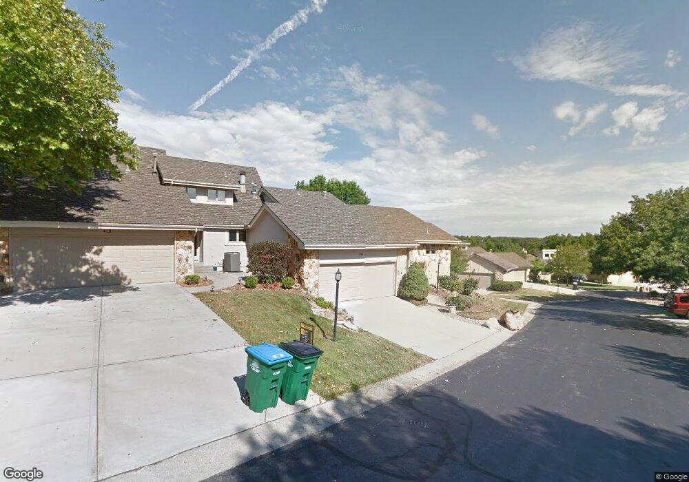
414 NE Point Dr Lees Summit, MO 64064
Chapel Ridge NeighborhoodEstimated Value: $323,103 - $355,000
3
Beds
2
Baths
1,499
Sq Ft
$225/Sq Ft
Est. Value
About This Home
This home is located at 414 NE Point Dr, Lees Summit, MO 64064 and is currently estimated at $336,776, approximately $224 per square foot. 414 NE Point Dr is a home located in Jackson County with nearby schools including Chapel Lakes Elementary School, Delta Woods Middle School, and Blue Springs South High School.
Ownership History
Date
Name
Owned For
Owner Type
Purchase Details
Closed on
Dec 21, 2023
Sold by
Johnson Sharon E and Johnson Christopher A
Bought by
Gvii-Rs Ownerco Llc
Current Estimated Value
Purchase Details
Closed on
Dec 20, 2023
Sold by
Cook Karen Sue
Bought by
G5partner Llc
Purchase Details
Closed on
Dec 13, 2023
Sold by
Gawatz Robert L and Gawatz Doris D
Bought by
Luszcak Meggan
Purchase Details
Closed on
Jul 26, 2019
Sold by
Mcglumphy Thomas H and Mcglumphy Carole T
Bought by
Johnson Sharon E
Create a Home Valuation Report for This Property
The Home Valuation Report is an in-depth analysis detailing your home's value as well as a comparison with similar homes in the area
Home Values in the Area
Average Home Value in this Area
Purchase History
| Date | Buyer | Sale Price | Title Company |
|---|---|---|---|
| Gvii-Rs Ownerco Llc | -- | Lakeside Title | |
| G5partner Llc | -- | Coffelt Land Title | |
| Luszcak Meggan | -- | None Listed On Document | |
| Johnson Sharon E | -- | None Available |
Source: Public Records
Tax History
| Year | Tax Paid | Tax Assessment Tax Assessment Total Assessment is a certain percentage of the fair market value that is determined by local assessors to be the total taxable value of land and additions on the property. | Land | Improvement |
|---|---|---|---|---|
| 2025 | $4,334 | $50,255 | $18,255 | $32,000 |
| 2024 | $4,334 | $56,590 | $7,501 | $49,089 |
| 2023 | $4,256 | $56,589 | $7,706 | $48,883 |
| 2022 | $3,227 | $38,000 | $4,389 | $33,611 |
| 2021 | $3,224 | $38,000 | $4,389 | $33,611 |
| 2020 | $2,863 | $33,377 | $4,389 | $28,988 |
| 2019 | $2,775 | $33,377 | $4,389 | $28,988 |
| 2018 | $2,703 | $31,532 | $3,074 | $28,458 |
| 2017 | $2,627 | $31,532 | $3,074 | $28,458 |
| 2016 | $2,627 | $30,742 | $2,869 | $27,873 |
| 2014 | $2,652 | $30,847 | $2,679 | $28,168 |
Source: Public Records
Map
Nearby Homes
- 448 NE Point Dr
- 311 NE Wicklow Ct
- 102 NW Hackberry St
- 232 NE Bayview Dr
- 210 NE Bayview Dr
- 202 NW Ironbark St
- 46 NE Shoreview Dr
- 282 NE Bayview Dr
- 201 NW Hackberry St
- 210 NW Cypress St
- 128 NW Lakewood Blvd
- 4910 NE Pebble Beach St
- 717 NE Silverleaf Place
- 704 NE Ashmont Place
- 611 NE La Costa St
- 709 NE Lake Pointe Dr
- 708 NE Lake Pointe Dr
- 224 NW Locust St
- 3907 NE Clearbrook Dr
- 607 NE Pinehurst St
- 412 NE Point Dr
- 410 NE Point Dr
- 444 NE Point Dr
- 446 NE Point Dr
- 408 NE Point Dr
- 450 NE Point Dr
- 418 NE Point Dr
- 420 NE Point Dr
- 420 NE Landings Dr
- 422 NE Point Dr
- 422 NE Point Dr
- 406 NE Landings Dr
- 460 NE Point Cir
- 406 NE Point Dr
- 432 NE Point Dr
- 430 NE Point Dr
- 404 NE Point Dr
- 434 NE Point Dr
- 428 NE Point Dr
- 404 NE Landings Dr
Your Personal Tour Guide
Ask me questions while you tour the home.