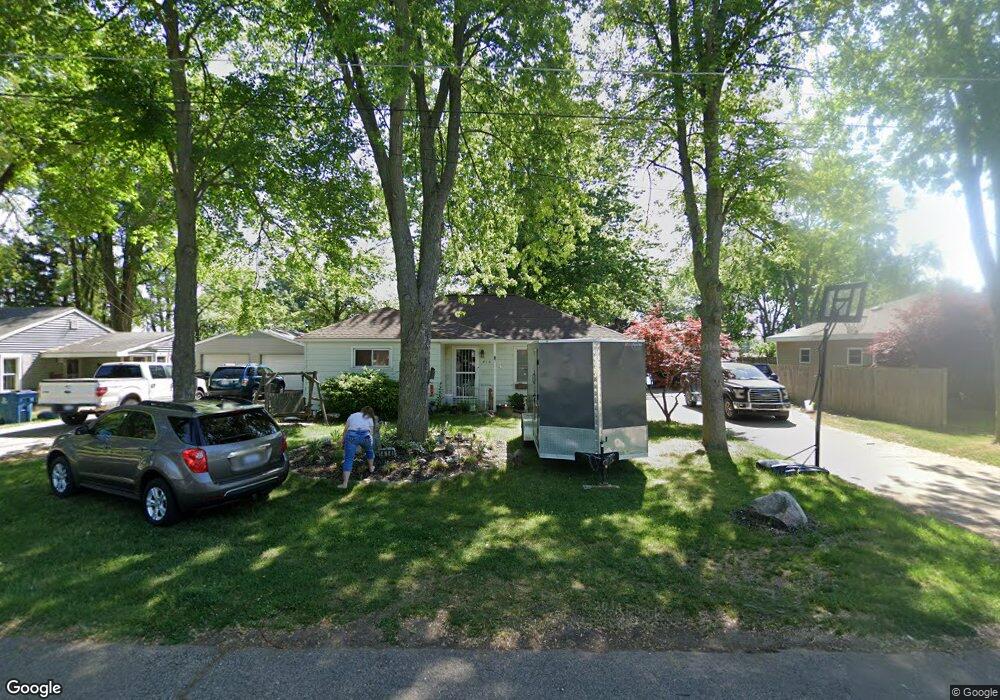
414 Sherman St Bronson, MI 49028
Estimated Value: $109,000 - $187,000
--
Bed
--
Bath
--
Sq Ft
9,148
Sq Ft Lot
About This Home
This home is located at 414 Sherman St, Bronson, MI 49028 and is currently estimated at $140,378. 414 Sherman St is a home located in Branch County with nearby schools including Anderson Elementary School, Ryan Elementary School, and Bronson Junior/Senior High School.
Ownership History
Date
Name
Owned For
Owner Type
Purchase Details
Closed on
Sep 28, 2005
Sold by
Ferguson Israel and Ferguson Donna
Bought by
Ferguson Israel and Ferguson Donna
Current Estimated Value
Home Financials for this Owner
Home Financials are based on the most recent Mortgage that was taken out on this home.
Original Mortgage
$75,000
Outstanding Balance
$40,320
Interest Rate
5.83%
Mortgage Type
Fannie Mae Freddie Mac
Estimated Equity
$100,058
Purchase Details
Closed on
Sep 10, 2004
Sold by
Schaefer Janet F
Bought by
Ferguson Israel and Ferguson Donna
Purchase Details
Closed on
Aug 7, 2002
Sold by
Holtz Janean
Bought by
Schaefer Janet F
Create a Home Valuation Report for This Property
The Home Valuation Report is an in-depth analysis detailing your home's value as well as a comparison with similar homes in the area
Home Values in the Area
Average Home Value in this Area
Purchase History
| Date | Buyer | Sale Price | Title Company |
|---|---|---|---|
| Ferguson Israel | -- | Chicago Title | |
| Ferguson Israel | $79,000 | Chicago Title | |
| Ferguson Israel | -- | -- | |
| Schaefer Janet F | $59,400 | -- |
Source: Public Records
Mortgage History
| Date | Status | Borrower | Loan Amount |
|---|---|---|---|
| Open | Ferguson Israel | $75,000 |
Source: Public Records
Tax History Compared to Growth
Tax History
| Year | Tax Paid | Tax Assessment Tax Assessment Total Assessment is a certain percentage of the fair market value that is determined by local assessors to be the total taxable value of land and additions on the property. | Land | Improvement |
|---|---|---|---|---|
| 2025 | $1,500 | $68,500 | $0 | $0 |
| 2024 | $941 | $65,400 | $0 | $0 |
| 2023 | $876 | $56,100 | $0 | $0 |
| 2022 | $1,385 | $52,300 | $0 | $0 |
| 2021 | -- | $44,600 | $0 | $0 |
| 2020 | -- | $37,900 | $0 | $0 |
| 2019 | -- | $37,300 | $0 | $0 |
| 2018 | -- | $35,800 | $0 | $0 |
| 2017 | -- | $33,500 | $0 | $0 |
| 2016 | -- | $32,000 | $0 | $0 |
| 2015 | -- | $29,200 | $0 | $0 |
| 2014 | -- | $28,200 | $0 | $0 |
| 2013 | -- | $28,400 | $0 | $0 |
Source: Public Records
Map
Nearby Homes
- 325 N Lincoln St
- 150 Washington St
- 544 E Chicago St
- 313 N Matteson St
- 337 N Walker St
- 151 E Corey St
- 227 York St
- 410 Franklin St
- 230 Compton St
- 688 W Chicago Rd
- 505 W Chicago St
- 644 S Matteson St
- 926 Weaver Rd
- 769 Kosmerick Rd
- 389 Prairie River Rd
- 130 Osborn Rd
- 0 Bawden Rd
- 1052 Carpenter Rd
- 141 S Snow Prairie Rd
- 1015 Brink Rd
- 422 Sherman St
- 406 Sherman St
- 411 Sherman St
- 409 Matilda St
- 421 Sherman St
- 531 E Railroad St
- 602 E Railroad St
- 431 Matilda St
- 441 Sherman St
- 341 Sherman St
- 320 Sherman St
- 511 E Railroad St
- 511 E Railroad St
- 446 Sherman St
- 325 Sherman St
- 418 N Lincoln St
- 412 N Lincoln St
- 445 Sherman St
- 316 Sherman St
- 316 Sherman St