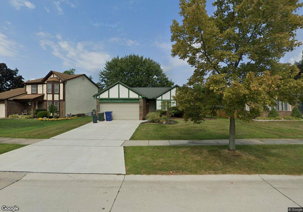
41486 SiMcOe Dr Canton, MI 48188
Estimated Value: $345,035 - $374,000
Studio
3
Baths
1,352
Sq Ft
$264/Sq Ft
Est. Value
About This Home
This home is located at 41486 SiMcOe Dr, Canton, MI 48188 and is currently estimated at $357,509, approximately $264 per square foot. 41486 SiMcOe Dr is a home located in Wayne County with nearby schools including Canton High School, Salem High School, and Plymouth High School.
Ownership History
Date
Name
Owned For
Owner Type
Purchase Details
Closed on
May 11, 2022
Sold by
Doman and Joseph
Bought by
Doman Joseph
Current Estimated Value
Home Financials for this Owner
Home Financials are based on the most recent Mortgage that was taken out on this home.
Original Mortgage
$196,000
Outstanding Balance
$185,772
Interest Rate
5%
Mortgage Type
New Conventional
Estimated Equity
$171,737
Purchase Details
Closed on
Aug 30, 2018
Sold by
Martin Patricia E and Martin Lowell B
Bought by
Doman Joe and Doman Rachel
Home Financials for this Owner
Home Financials are based on the most recent Mortgage that was taken out on this home.
Original Mortgage
$171,000
Interest Rate
4.52%
Purchase Details
Closed on
Sep 28, 2007
Sold by
Martin Lowell B and Martin Patricia E
Bought by
Periard James P
Create a Home Valuation Report for This Property
The Home Valuation Report is an in-depth analysis detailing your home's value as well as a comparison with similar homes in the area
Home Values in the Area
Average Home Value in this Area
Purchase History
| Date | Buyer | Sale Price | Title Company |
|---|---|---|---|
| Doman Joseph | -- | None Listed On Document | |
| Doman Joe | $180,000 | -- | |
| Periard James P | -- | None Available |
Source: Public Records
Mortgage History
| Date | Status | Borrower | Loan Amount |
|---|---|---|---|
| Open | Doman Joseph | $196,000 | |
| Previous Owner | Doman Joe | $171,000 | |
| Previous Owner | Doman Joe | -- |
Source: Public Records
Tax History
| Year | Tax Paid | Tax Assessment Tax Assessment Total Assessment is a certain percentage of the fair market value that is determined by local assessors to be the total taxable value of land and additions on the property. | Land | Improvement |
|---|---|---|---|---|
| 2025 | $5,241 | $187,300 | $0 | $0 |
| 2024 | $5,087 | $162,900 | $0 | $0 |
| 2023 | $4,848 | $155,600 | $0 | $0 |
| 2022 | $7,707 | $134,300 | $0 | $0 |
| 2021 | $5,242 | $130,100 | $0 | $0 |
| 2020 | $5,185 | $122,400 | $0 | $0 |
| 2019 | $5,102 | $119,360 | $0 | $0 |
| 2018 | $2,975 | $108,880 | $0 | $0 |
| 2017 | $3,673 | $106,600 | $0 | $0 |
| 2016 | $4,722 | $107,600 | $0 | $0 |
| 2015 | $8,044 | $92,420 | $0 | $0 |
| 2013 | $7,793 | $81,230 | $0 | $0 |
| 2010 | -- | $84,200 | $40,042 | $44,158 |
Source: Public Records
Map
Nearby Homes
- 41512 Pheasant Creek Dr
- 41587 Pheasant Creek Dr
- 41226 Southwind Dr Unit 138
- 41060 Northwind Dr
- 41777 Princess Dr
- 42264 Chase Dr
- 1381 Hampshire Dr
- 1402 Heritage Dr
- 1878 Otter Pond Ln
- 352 Cherry Hill Pointe Dr Unit 33
- 0 Cherry Hill Unit 16924
- 1530 Fairfax Dr
- 42714 Lilley Pointe Dr Unit 213
- 42216 Metaline Dr
- 1803 Pinecroft Dr Unit 171
- 42739 Lilley Pointe Dr Unit 119
- 41260 Maplewood Dr Unit 5
- 2393 Arcadia Dr
- 2006 S Lilley Rd
- 709 Foothill Dr
- 41500 SiMcOe Dr
- 41474 SiMcOe Dr
- 733 Stonehenge Dr
- 41512 SiMcOe Dr
- 741 Stonehenge Dr Unit Bldg-Unit
- 741 Stonehenge Dr
- 41462 SiMcOe Dr
- 749 Stonehenge Dr
- 725 Stonehenge Dr
- 41483 SiMcOe Dr
- 41495 SiMcOe Dr
- 41522 SiMcOe Dr
- 41450 SiMcOe Dr
- 41471 SiMcOe Dr
- 41507 SiMcOe Dr
- 755 Stonehenge Dr
- 41459 SiMcOe Dr
- 41519 SiMcOe Dr
- 41532 SiMcOe Dr
- 717 Stonehenge Dr
Your Personal Tour Guide
Ask me questions while you tour the home.