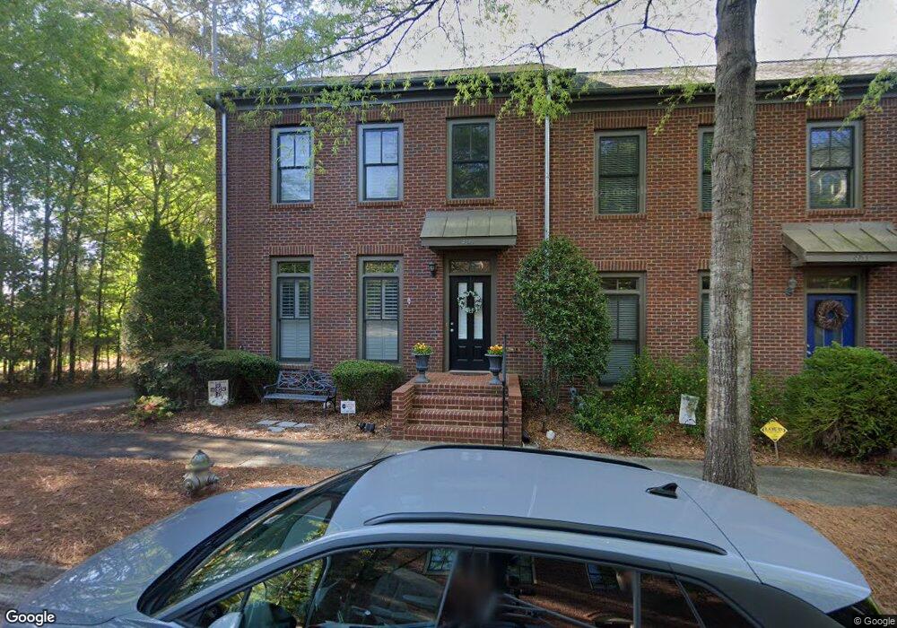
4149 Raphael St SW Unit 4-F Covington, GA 30014
Estimated Value: $274,884 - $456,000
3
Beds
3
Baths
1,728
Sq Ft
$205/Sq Ft
Est. Value
About This Home
This home is located at 4149 Raphael St SW Unit 4-F, Covington, GA 30014 and is currently estimated at $353,971, approximately $204 per square foot. 4149 Raphael St SW Unit 4-F is a home located in Newton County with nearby schools including Porterdale Elementary School, Clements Middle School, and Eastside High School.
Ownership History
Date
Name
Owned For
Owner Type
Purchase Details
Closed on
Jun 27, 2016
Sold by
Stubbs Brenda B
Bought by
Malone Mary Stephens
Current Estimated Value
Purchase Details
Closed on
Jan 15, 2014
Sold by
Bruzzano Shelby Jean
Bought by
Stubbs Brenda B
Home Financials for this Owner
Home Financials are based on the most recent Mortgage that was taken out on this home.
Original Mortgage
$136,000
Interest Rate
4.48%
Mortgage Type
New Conventional
Create a Home Valuation Report for This Property
The Home Valuation Report is an in-depth analysis detailing your home's value as well as a comparison with similar homes in the area
Home Values in the Area
Average Home Value in this Area
Purchase History
| Date | Buyer | Sale Price | Title Company |
|---|---|---|---|
| Malone Mary Stephens | $192,500 | -- | |
| Stubbs Brenda B | $170,000 | -- |
Source: Public Records
Mortgage History
| Date | Status | Borrower | Loan Amount |
|---|---|---|---|
| Previous Owner | Stubbs Brenda B | $136,000 |
Source: Public Records
Tax History Compared to Growth
Tax History
| Year | Tax Paid | Tax Assessment Tax Assessment Total Assessment is a certain percentage of the fair market value that is determined by local assessors to be the total taxable value of land and additions on the property. | Land | Improvement |
|---|---|---|---|---|
| 2024 | $2,932 | $102,240 | $14,000 | $88,240 |
| 2023 | $3,420 | $110,400 | $14,000 | $96,400 |
| 2022 | $2,916 | $92,960 | $14,000 | $78,960 |
| 2021 | $3,114 | $89,000 | $14,000 | $75,000 |
| 2020 | $3,244 | $84,600 | $14,000 | $70,600 |
| 2019 | $2,903 | $74,720 | $14,000 | $60,720 |
| 2018 | $1,417 | $72,200 | $14,000 | $58,200 |
| 2017 | $2,809 | $71,600 | $14,000 | $57,600 |
| 2016 | $1,786 | $67,880 | $15,200 | $52,680 |
| 2015 | $1,753 | $67,080 | $15,200 | $51,880 |
| 2014 | $2,759 | $67,080 | $0 | $0 |
Source: Public Records
Map
Nearby Homes
- 5102 Park St SW
- 4124 Hunt St SW
- 5125 Swann St SW
- 4105 Washington St SW
- 5168 Pratt St SW
- 5135 Arnold St
- 3107 Hendrix Cir SW
- 0 S Highway 81 Unit 10621341
- 2220 Lee St SW
- 2222 Lee St SW
- 3132 Lunsford Cir SW
- 163 Kingfisher Walk
- 13806 Homer Ln
- 0 Old Covered Bridge Rd Unit 10618938
- 13709 Whitman Ln
- 7205 Lakeview Dr SW
- 4689 Sunrise Ridge
- 4561 Sunrise Ridge
- 4457 Sunrise Ridge
- 4149 Raphael St SW
- 4149 Raphael St SW Unit F
- 4149 Raphael St SW Unit 4149
- 4153 Raphael St SW
- 4157 Raphael St SW Unit 4157
- 4157 Raphael St SW
- 4157 Raphael St SW Unit 2
- 4121 Summers St SW Unit 10
- 4121 Summers St SW
- 4161 Raphael St SW
- 4113 Summers St SW
- 4169 Raphael St SW
- 4165 Raphael St SW
- 4173 Raphael St SW
- 0 Raphael St
- 4129 Summers St SW Unit 9
- 4129 Summers St SW Unit 1
- 4129 Summers St SW
- 4171 Raphael St SW
- 4105 Summers St SW