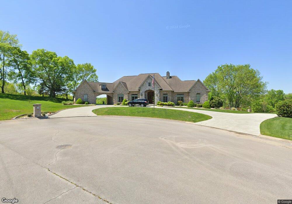
415 Cartel Ct Lebanon, TN 37087
Estimated Value: $804,000 - $862,970
--
Bed
4
Baths
3,971
Sq Ft
$212/Sq Ft
Est. Value
About This Home
This home is located at 415 Cartel Ct, Lebanon, TN 37087 and is currently estimated at $842,493, approximately $212 per square foot. 415 Cartel Ct is a home located in Wilson County with nearby schools including Castle Heights Elementary School, Winfree Bryant Middle School, and Lebanon High School.
Ownership History
Date
Name
Owned For
Owner Type
Purchase Details
Closed on
Jun 7, 2007
Sold by
Tracey Parks C
Bought by
Hoppel Michael E
Current Estimated Value
Purchase Details
Closed on
Nov 24, 2003
Sold by
Craighead Philip E
Bought by
Dodson William D
Purchase Details
Closed on
Sep 10, 2003
Sold by
Bradshaw James C
Bought by
Harry Hewitt
Purchase Details
Closed on
Dec 31, 2000
Bought by
Dodson William D and Dodson Carol L
Purchase Details
Closed on
Jun 18, 1990
Bought by
Watson Anthony
Create a Home Valuation Report for This Property
The Home Valuation Report is an in-depth analysis detailing your home's value as well as a comparison with similar homes in the area
Home Values in the Area
Average Home Value in this Area
Purchase History
| Date | Buyer | Sale Price | Title Company |
|---|---|---|---|
| Hoppel Michael E | $334,000 | -- | |
| Dodson William D | $775 | -- | |
| Harry Hewitt | $39,000 | -- | |
| Dodson William D | $40,000 | -- | |
| Watson Anthony | -- | -- |
Source: Public Records
Tax History Compared to Growth
Tax History
| Year | Tax Paid | Tax Assessment Tax Assessment Total Assessment is a certain percentage of the fair market value that is determined by local assessors to be the total taxable value of land and additions on the property. | Land | Improvement |
|---|---|---|---|---|
| 2024 | $4,060 | $184,050 | $20,000 | $164,050 |
| 2022 | $5,322 | $184,050 | $20,000 | $164,050 |
| 2021 | $5,322 | $184,050 | $20,000 | $164,050 |
| 2020 | $6,126 | $184,050 | $20,000 | $164,050 |
| 2019 | $1,397 | $162,950 | $16,250 | $146,700 |
| 2018 | $5,719 | $162,950 | $16,250 | $146,700 |
| 2017 | $5,719 | $162,950 | $16,250 | $146,700 |
| 2016 | $5,719 | $162,950 | $16,250 | $146,700 |
| 2015 | $5,912 | $162,950 | $16,250 | $146,700 |
| 2014 | $4,817 | $132,775 | $0 | $0 |
Source: Public Records
Map
Nearby Homes
- 2019 Arlington Rd
- 108 Southfork Dr
- 1930 Arlington Rd
- 523 Medwyk Dr
- 3006 Hedgelawn Dr
- 0 Palmer Rd
- 1063 River Oaks Blvd
- 1925 Vicksburg Ln
- 119 Fister Dr
- 2008 Hedgelawn Dr
- 1920 Hampton Dr
- 1915 Appomattox Dr
- 1107 River Oaks Blvd
- 0 Horn Springs Rd Unit RTC2822257
- 0 Horn Springs Rd Unit RTC2822266
- 0 Horn Springs Rd Unit RTC2780684
- 3 Horn Springs Rd
- 1907 Roanoke Dr
- The McGinnis Plan at Stratford Station
- The Langford Plan at Stratford Station
- 411 Cartel Ct
- 414 Cartel Ct
- 412 Cartel Ct
- 410 Cartel Ct
- 2209 Cartel Dr
- 413 413 Amarillo Dr - Lot 125
- 413 Amarillo Dr Unit 125
- 413 Amarillo Dr
- 415 Amarillo Dr
- 2212 Cartel Dr
- 413 Amarillo Dr
- 2204 Cartel Dr
- 413 Oil Springs Dr
- 2211 Cartel Dr
- 2207 Cartel Dr
- 2213 Cartel Dr
- 2205 Cartel Dr
- 412 Amarillo Dr
- 414 Amarillo Dr
- 416 Amarillo Dr