Estimated Value: $378,161 - $426,000
5
Beds
3
Baths
3,323
Sq Ft
$121/Sq Ft
Est. Value
About This Home
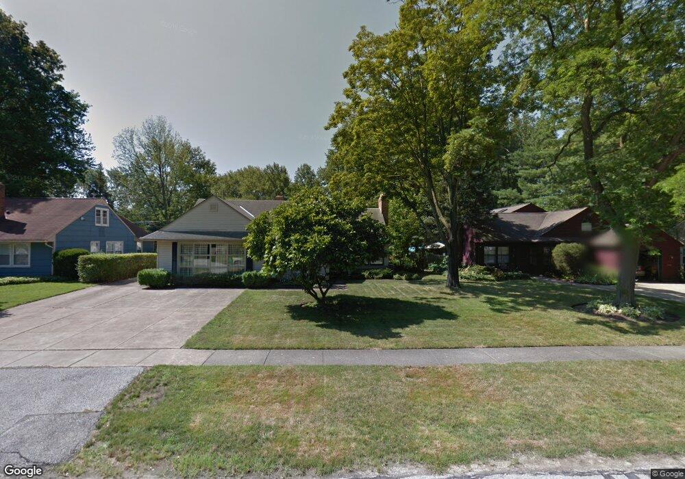
This home is located at 415 Cranston Dr, Berea, OH 44017 and is currently estimated at $403,540, approximately $121 per square foot. 415 Cranston Dr is a home located in Cuyahoga County with nearby schools including Grindstone Elementary School, Berea-Midpark Middle School, and Berea-Midpark High School.
Ownership History
Date
Name
Owned For
Owner Type
Purchase Details
Closed on
Aug 26, 2021
Sold by
Speyer Brian and Speyer Kelli
Bought by
Volpe Arthur M and Volpe Elizabeth T
Current Estimated Value
Home Financials for this Owner
Home Financials are based on the most recent Mortgage that was taken out on this home.
Original Mortgage
$270,400
Outstanding Balance
$245,677
Interest Rate
2.7%
Mortgage Type
New Conventional
Estimated Equity
$157,863
Purchase Details
Closed on
Sep 23, 2020
Sold by
Dick William R and Dick Denise M
Bought by
Speyer Brian and Speyer Kelli
Home Financials for this Owner
Home Financials are based on the most recent Mortgage that was taken out on this home.
Original Mortgage
$219,200
Interest Rate
2.9%
Mortgage Type
New Conventional
Purchase Details
Closed on
Dec 23, 2010
Sold by
Collins Irene M
Bought by
Collins Irene M and Collins Terry
Purchase Details
Closed on
Jun 23, 2010
Sold by
Collins John C and Marcinkevicius Egidijus
Bought by
Collins Irene M
Purchase Details
Closed on
Jan 1, 1975
Bought by
Collins John C and Collins Irene M
Create a Home Valuation Report for This Property
The Home Valuation Report is an in-depth analysis detailing your home's value as well as a comparison with similar homes in the area
Home Values in the Area
Average Home Value in this Area
Purchase History
| Date | Buyer | Sale Price | Title Company |
|---|---|---|---|
| Volpe Arthur M | $338,000 | Chicago Title Insurance C | |
| Speyer Brian | $274,000 | Erieview Title | |
| Collins Irene M | -- | Attorney | |
| Collins Irene M | -- | None Available | |
| Collins John C | -- | -- |
Source: Public Records
Mortgage History
| Date | Status | Borrower | Loan Amount |
|---|---|---|---|
| Open | Volpe Arthur M | $270,400 | |
| Closed | Speyer Brian | $219,200 |
Source: Public Records
Tax History
| Year | Tax Paid | Tax Assessment Tax Assessment Total Assessment is a certain percentage of the fair market value that is determined by local assessors to be the total taxable value of land and additions on the property. | Land | Improvement |
|---|---|---|---|---|
| 2024 | $6,526 | $112,700 | $15,785 | $96,915 |
| 2023 | $6,137 | $88,870 | $14,280 | $74,590 |
| 2022 | $6,099 | $88,865 | $14,280 | $74,585 |
| 2021 | $6,047 | $88,870 | $14,280 | $74,590 |
| 2020 | $5,777 | $75,320 | $12,110 | $63,210 |
| 2019 | $5,623 | $215,200 | $34,600 | $180,600 |
| 2018 | $5,591 | $75,320 | $12,110 | $63,210 |
| 2017 | $5,397 | $67,450 | $10,710 | $56,740 |
| 2016 | $4,675 | $67,450 | $10,710 | $56,740 |
| 2015 | $4,418 | $67,450 | $10,710 | $56,740 |
| 2014 | $4,418 | $67,450 | $10,710 | $56,740 |
Source: Public Records
Map
Nearby Homes
- 550 Race St
- 549 Wyleswood Dr
- 388 Fairwood Cir
- 561 Brigton Dr
- 287 Edgewood Dr
- 300 West St
- 647 Tampico Ct Unit 7
- 23002 Chandlers Ln Unit 223
- 23002 Chandlers Ln Unit 221
- 628 Lindbergh Blvd
- 23155 Wainwright Terrace
- 23411 Grist Mill Ct Unit 2
- 404 Crescent Dr
- 8873 Ashlyn Ct Unit 13A
- 8757 Roberts Ct Unit 25C
- 23004 Chandlers Ln Unit 4-344
- 458 Sprague Rd
- 216 Kraft St
- 160 Marian Ln Unit 6A
- 146 Marian Ln
- 409 Cranston Dr
- 433 Cranston Dr
- 425 Cranston Dr
- 401 Cranston Dr
- 429 Cranston Dr
- 419 Cranston Dr
- 430 Cranston Dr
- 398 Cranston Dr
- 434 Cranston Dr
- 416 Cranston Dr
- 435 Cranston Dr
- 439 Cranston Dr
- 392 Cranston Dr
- 411 Cranston Dr
- 446 Cranston Dr
- 386 Cranston Dr
- 443 Cranston Dr
- 404 Cranston Dr
- 404 Cranston Dr
- 445 Cranston Dr
Your Personal Tour Guide
Ask me questions while you tour the home.