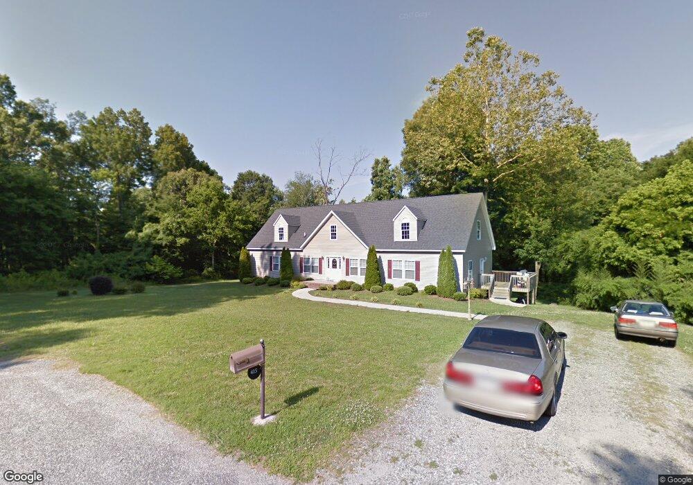
415 Moore St Mebane, NC 27302
Estimated Value: $257,000 - $444,000
3
Beds
4
Baths
2,664
Sq Ft
$132/Sq Ft
Est. Value
About This Home
This home is located at 415 Moore St, Mebane, NC 27302 and is currently estimated at $352,000, approximately $132 per square foot. 415 Moore St is a home located in Alamance County with nearby schools including South Mebane Elementary School, Woodlawn Middle School, and Eastern Alamance High School.
Ownership History
Date
Name
Owned For
Owner Type
Purchase Details
Closed on
Feb 13, 2006
Sold by
Jones Claudine L
Bought by
Bryant Cassandra L
Current Estimated Value
Home Financials for this Owner
Home Financials are based on the most recent Mortgage that was taken out on this home.
Original Mortgage
$50,000
Interest Rate
6.57%
Mortgage Type
New Conventional
Create a Home Valuation Report for This Property
The Home Valuation Report is an in-depth analysis detailing your home's value as well as a comparison with similar homes in the area
Home Values in the Area
Average Home Value in this Area
Purchase History
| Date | Buyer | Sale Price | Title Company |
|---|---|---|---|
| Bryant Cassandra L | $7,000 | -- |
Source: Public Records
Mortgage History
| Date | Status | Borrower | Loan Amount |
|---|---|---|---|
| Previous Owner | Bryant Cassandra L | $50,000 |
Source: Public Records
Tax History Compared to Growth
Tax History
| Year | Tax Paid | Tax Assessment Tax Assessment Total Assessment is a certain percentage of the fair market value that is determined by local assessors to be the total taxable value of land and additions on the property. | Land | Improvement |
|---|---|---|---|---|
| 2025 | $2,451 | $434,634 | $64,048 | $370,586 |
| 2024 | $2,343 | $434,634 | $64,048 | $370,586 |
| 2023 | $2,171 | $434,634 | $64,048 | $370,586 |
| 2022 | $1,539 | $203,821 | $40,545 | $163,276 |
| 2021 | $1,551 | $203,821 | $40,545 | $163,276 |
| 2020 | $1,572 | $203,821 | $40,545 | $163,276 |
| 2019 | $1,580 | $203,821 | $40,545 | $163,276 |
| 2018 | $0 | $203,821 | $40,545 | $163,276 |
| 2017 | $1,396 | $203,821 | $40,545 | $163,276 |
| 2016 | $1,250 | $182,522 | $39,022 | $143,500 |
| 2015 | $1,244 | $182,522 | $39,022 | $143,500 |
| 2014 | $1,153 | $182,522 | $39,022 | $143,500 |
Source: Public Records
Map
Nearby Homes
- 714 W Mckinley St
- 0 Roosevelt St
- 605 Roosevelt St
- 456 Stonewall Dr
- 426 Fitch Dr
- 0 Smith Dr
- 413 Mckinley Place
- 421 W Holt St
- 307 W Austin St
- 308 W Jackson St
- 213 Beauregard Ln
- 1005 Stuart Dr
- 402 W Clay St
- 0 Dyson Dr Unit TBD Dyson 2519207
- 415 S Third St
- 109 Briarwood Dr
- Lot# 2 Highway 70 E
- 0 W Lake Trail Unit 10126145
- 0 W Lake Trail Unit 10127843
- 104 E Wilson St
- 718 Vance St
- 216 North St
- 309 Moore Rd
- 416 Tate Ave
- 308 Moore Rd
- 119 North St
- 530 Tate Ave
- 214 North St
- 426 Tate Ave
- 301 Moore Rd
- 400 Tate Ave
- 212 North St
- 715 Vance St
- 218 North St
- 0 Tate Ave Unit G329127
- 0 Tate Ave Unit 1118051
- 0 Tate Ave Unit 128451
- 0 Tate Ave Unit 2530986
- 0 Tate Ave Unit 38442
- 0 Tate Ave Unit 40280